Eichberg
Located in Niederhollabrunn, Politischer Bezirk Korneuburg Coordinates: 48°29′00″ N 16°18′00″ E
- Elevation
- 241 m
- above sea level
- Local time
- UTC+01:00
- Europe/Vienna · UTC+01:00
- Airports
- VIE Vienna International Airport46 km
- BTS M. R. Štefánik Airport76 km
About Eichberg
Eichberg is a mountain. Location: Niederhollabrunn, Politischer Bezirk Korneuburg. Elevation: 241 m. The best months to visit are May–September. The nearest airport is Vienna International Airport (46 km). Nearby sights include Raingrubenhöhe and Schmalzberg.
Photos of Eichberg
-
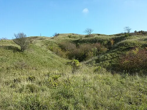
Waschberg Stefan.lefnaer · CC BY-SA 4.0 -
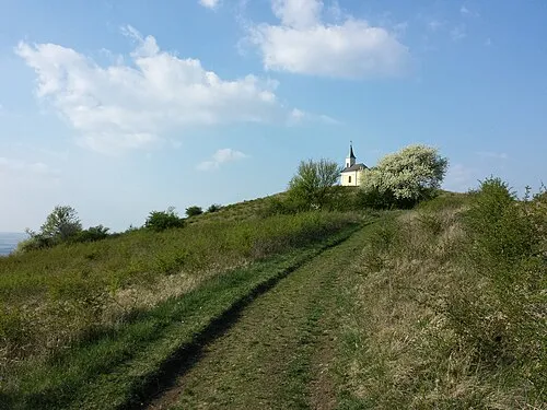
Michelberg Stefan.lefnaer · CC BY-SA 3.0 -
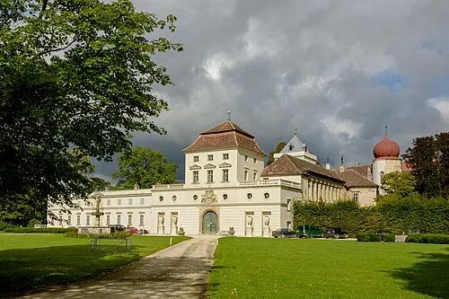
Schloss Ernstbrunn Henry Kellner · CC BY-SA 4.0


Climate of Eichberg
Best months for sightseeingBest months for sightseeing: May–September.
This month · November
A cold month
Day 7° · Night 1° · Rain 43 mm
- Hottest month
- July (day 25°)
- Coldest month
- January (night -4°)
- Wettest month
- July (73 mm)
- Driest month
- January (27 mm)
Bars: average monthly low and high temperature. Below: precipitation. Monthly averages for 1970–2000 at about 18 km resolution, adjusted for elevation. Highlighted months are mild and relatively dry. Source: WorldClim 2.1 (CC BY 4.0).
Show values as a table
| Month | Jan | Feb | Mar | Apr | May | Jun | Jul | Aug | Sep | Oct | Nov | Dec |
|---|---|---|---|---|---|---|---|---|---|---|---|---|
| Average high (°C) | 2° | 4° | 10° | 15° | 20° | 23° | 25° | 25° | 20° | 14° | 7° | 3° |
| Average low (°C) | -4° | -3° | 1° | 5° | 9° | 13° | 14° | 14° | 10° | 6° | 1° | -2° |
| Precipitation (mm) | 27 | 31 | 35 | 43 | 59 | 70 | 73 | 57 | 47 | 35 | 43 | 33 |
Other places to visit in this season: May June July August September
How to get to Eichberg
The nearest airport is Vienna International Airport (VIE), 46 km to the southeast as the crow flies. The nearest large city is Bratislava, 70 km to the southeast.
Airports
- Vienna International Airport (VIE) Vienna 46 kmsoutheast
- M. R. Štefánik Airport (BTS) Bratislava 76 kmsoutheast
- Brno-Tuřany Airport (BRQ) Brno 80 kmnorth
Nearby large cities
- Bratislava Population: 423.7K 70 kmsoutheast
- Brno Population: 404.3K 82 kmnorth
- Győr Population: 129.3K 133 kmsoutheast
- Linz Population: 204.8K 150 kmwest
- Graz Population: 303.3K 170 kmsouth
Straight-line distances; road distances are longer. Airport data: OurAirports.
Day trips from Eichberg
Within 100 km: 530 historic and cultural sites, 1,796 natural sites, 492 lakes, rivers and coasts.
0–25 km494 places
- Waldsee Lake 24 kmSW
- Waldbad Lake 7 kmNE
- Hausberg Mountain 22 kmW
- Altenberg Mountain 17 kmW
25–60 km1,313 places
- Myjava River 51 kmE
- Donauinsel Island 36 kmS
- Vienna Forest Lake Lake 36 kmS
- Steinsee Lake 37 kmS
60–100 km1,011 places
- Gassner Camel Riding School Natural site 80 kmW
- Devínska Kobyla Mountain 61 kmSE
- Záruby Mountain 81 kmE
- Klokoč Mountain 75 kmE
Straight-line distances.
Nearest towns and villages
-
Bruderndorf Village, Niederhollabrunn1.9 km S
-
Niederfellabrunn Village, Niederhollabrunn2.3 km S
-
Maisbirbaum Village, Ernstbrunn1.9 km N
-
Streitdorf Village, Niederhollabrunn3.2 km SW
-
Lachsfeld Village, Ernstbrunn2.5 km E
-
Niederhollabrunn Village, Niederhollabrunn3.8 km S
Nearby attractions & nature
Everything nearby-
Raingrubenhöhe Mountain, Niederhollabrunn<0.1 km N
-
Schmalzberg Mountain, Niederhollabrunn1.2 km W
-
Leeberg Mountain, Niederhollabrunn1.9 km S
-
Zeiselberg Mountain, Ernstbrunn1.9 km N
-
Irrwinkel Mountain, Ernstbrunn2.4 km NW
-
Dornberg Mountain, Ernstbrunn2.4 km NE
-
Braunsberg Mountain, Niederhollabrunn3.1 km SE
-
Mühlberg Mountain, Großmugl3.1 km NW
Sources & licences
Data last updated: