Politischer Bezirk Sankt Pölten
Located in Lower Austria, Austria Coordinates: 48°10′09″ N 15°39′54″ E
- Population
- 130,101
- 130.1K
- Elevation
- 313 m
- above sea level
- Local time
- UTC+01:00
- Europe/Vienna · UTC+01:00
- Places inside
- 45
- listed under Politischer Bezirk Sankt Pölten
About Politischer Bezirk Sankt Pölten
Politischer Bezirk Sankt Pölten is a district. Location: Lower Austria, Austria. Population: 130,101.
In comparison
- 5 sights and natural places within 10 km Kamin der Glanzstoffwerke Sankt Pölten, Schildberg
- Listed here: Municipality: 45
Places in Politischer Bezirk Sankt Pölten
45 places-
Purkersdorf Municipality9.7K
-
Neulengbach Municipality8.3K
-
Herzogenburg Municipality7.7K
-
Pressbaum Municipality7.5K
-
Wilhelmsburg Municipality6.6K
-
Traismauer Municipality6.2K
-
Böheimkirchen Municipality5.1K
-
Gablitz Municipality5K
-
Ober-Grafendorf Municipality4.6K
-
Eichgraben Municipality4.5K
-
Mauerbach Municipality3.7K
-
Pyhra Municipality3.5K
-
Kirchberg an der Pielach Municipality3.2K
-
Maria-Anzbach Municipality3K
-
Altlengbach Municipality2.8K
-
Tullnerbach Municipality2.8K
-
Hofstetten-Grünau Municipality2.6K
-
Wölbling Municipality2.6K
-
Rabenstein an der Pielach Municipality2.5K
-
Obritzberg-Rust Municipality2.3K
-
Asperhofen Municipality2.2K
-
Kirchstetten Municipality2.2K
-
Karlstetten Municipality2.2K
-
Markersdorf-Haindorf Municipality2.1K
-
Frankenfels Municipality2K
-
Nußdorf ob der Traisen Municipality1.7K
-
Wolfsgraben Municipality1.7K
-
Hafnerbach Municipality1.7K
-
Prinzersdorf Municipality1.6K
-
Inzersdorf-Getzersdorf Municipality1.6K
-
Neustift-Innermanzing Municipality1.5K
-
Neidling Municipality1.5K
-
Kasten bei Böheimkirchen Municipality1.4K
-
Kapelln Municipality1.4K
-
Statzendorf Municipality1.4K
-
Weißenkirchen an der Perschling Municipality1.4K
-
Weinburg Municipality1.3K
-
Brand-Laaben Municipality1.2K
-
Haunoldstein Municipality1.1K
-
Sankt Margarethen an der Sierning Municipality1K
-
Gerersdorf Municipality967
-
Michelbach Municipality911
-
Stössing Municipality816
-
Loich Municipality610
-
Schwarzenbach an der Pielach Municipality364
Nature and heritage in Politischer Bezirk Sankt Pölten
-
Unterer Saubichl Mountain, Pressbaum
-
Schwein Berg Mountain, Frankenfels
-
Schnabelstein Mountain, Loich
-
Schindtwald Berg Mountain, Kirchberg an der Pielach
-
Schaflerberg Mountain, Weißenkirchen an der Perschling
-
Reiserberg Mountain, Weißenkirchen an der Perschling
Nearby attractions & nature
Everything nearby-
Kamin der Glanzstoffwerke Sankt Pölten Landmark, St. Pölten5.6 km N
-
Schildberg Mountain, St. Pölten6.6 km NE
-
Haspelwald Natural site, Lower Austria13 km NE
-
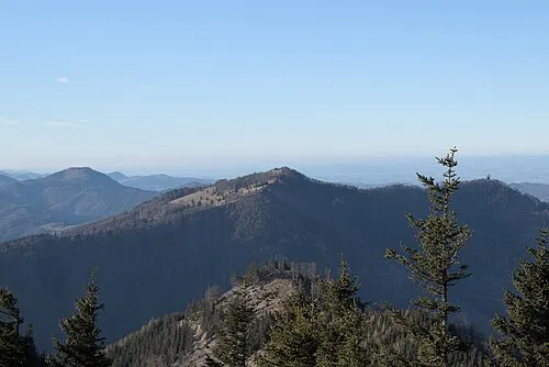 Hinteralpe Mountain, Lilienfeld21 km S
-
Wiesenbach River, Lower Austria13 km S
-
Steinwandleiten Mountain, Sankt Veit an der Gölsen12 km S
Sources & licences
Data last updated: