Schwarzenbach an der Pielach
Located in Politischer Bezirk Sankt Pölten, Lower Austria Coordinates: 47°55′47″ N 15°22′32″ E
- Population
- 364
- 364
- Elevation
- 794 m
- above sea level
- Local time
- UTC+01:00
- Europe/Vienna · UTC+01:00
- Places inside
- 12
- listed under Schwarzenbach an der Pielach
- Airports
- VIE Vienna International Airport91 km
- LNZ Linz-Hörsching Airport95 km
About Schwarzenbach an der Pielach
Schwarzenbach an der Pielach is a municipality. Location: Politischer Bezirk Sankt Pölten, Lower Austria. Population: 364. Elevation: 794 m. The best months to visit are June–September. The nearest airport is Vienna International Airport (91 km). Nearby sights include Kleiner Kögel Berg and Schober Berg.
Photos of Schwarzenbach an der Pielach
-
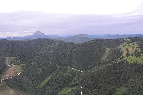
Geißenberg flightlog · CC BY-SA 2.0 -
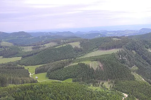
Futterkogel flightlog · CC BY-SA 2.0 -
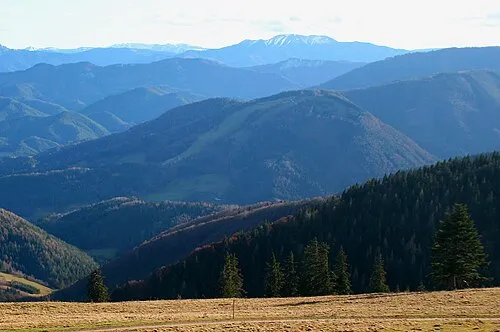
Eibel Berg WA-Wien · CC BY-SA 3.0


Climate of Schwarzenbach an der Pielach
Best months for sightseeingBest months for sightseeing: June–September.
This month · November
A cold month
Day 6° · Night -2° · Rain 68 mm
- Hottest month
- July (day 21°)
- Coldest month
- January (night -5°)
- Wettest month
- July (145 mm)
- Driest month
- February (56 mm)
Bars: average monthly low and high temperature. Below: precipitation. Monthly averages for 1970–2000 at about 18 km resolution, adjusted for elevation. Highlighted months are mild and relatively dry. Source: WorldClim 2.1 (CC BY 4.0).
Show values as a table
| Month | Jan | Feb | Mar | Apr | May | Jun | Jul | Aug | Sep | Oct | Nov | Dec |
|---|---|---|---|---|---|---|---|---|---|---|---|---|
| Average high (°C) | 2° | 3° | 7° | 11° | 17° | 19° | 21° | 21° | 17° | 12° | 6° | 3° |
| Average low (°C) | -5° | -5° | -2° | 1° | 6° | 9° | 11° | 11° | 7° | 3° | -2° | -4° |
| Precipitation (mm) | 57 | 56 | 75 | 76 | 104 | 123 | 145 | 118 | 96 | 66 | 68 | 66 |
Other places to visit in this season: June July August September
How to get to Schwarzenbach an der Pielach
The nearest airport is Vienna International Airport (VIE), 91 km to the east as the crow flies. The nearest large city is Linz, 91 km to the northwest.
Airports
- Vienna International Airport (VIE) Vienna 91 kmeast
- Linz-Hörsching Airport (LNZ) Linz 95 kmwest
- Graz Airport (GRZ) Feldkirchen bei Graz 104 kmsouth
Nearby large cities
- Linz Population: 204.8K 91 kmnorthwest
- Graz Population: 303.3K 96 kmsouth
- Bratislava Population: 423.7K 131 kmeast
- Klagenfurt Population: 100.3K 166 kmsouthwest
- Brno Population: 404.3K 168 kmnortheast
Straight-line distances; road distances are longer. Airport data: OurAirports.
Day trips from Schwarzenbach an der Pielach
Within 100 km: 563 historic and cultural sites, 2,242 natural sites, 623 lakes, rivers and coasts.
0–25 km141 places
- Hubertus see Lake 14 kmS
- Hechten See Lake 19 kmSW
- Erlauf-Stausee Lake 14 kmSW
- Erlaufsee Lake 17 kmSW
25–60 km709 places
- Gassner Camel Riding School Natural site 38 kmN
- Türnsee Lake 34 kmSW
- Teufelssee Lake 46 kmSW
- Sackwiesensee Lake 44 kmSW
60–100 km2,578 places
- Klamm Natural site 92 kmSW
- Gusen I Concentration Camp Historic site 77 kmNW
- Donauinsel Island 87 kmE
- Treffnersee Lake 76 kmSW
Straight-line distances.
Places in Schwarzenbach an der Pielach
12 placesBar: population relative to the most populous place in this list.
Cities & villages3
- Haupttürnitzrotte · Village
- Karntal · Village
- Schwarzenbach an der Pielach · Village
Mountains & nature4
- Eisenstein · Mountain
- Geißenberg · Mountain
- Grohman Berg · Mountain
- Hennesteck · Mountain
Nearby attractions & nature
Everything nearby-
Kleiner Kögel Berg Mountain, Türnitz2.3 km SE
-
Schober Berg Mountain, Türnitz3.4 km SE
-
Schwarzen Berg Mountain, Türnitz4.3 km E
-
Großer Kegel Mountain, Annaberg3.8 km SE
-
Eibel Berg Mountain, Türnitz5.7 km E
-
Schwein Berg Mountain, Frankenfels4.9 km NW
-
Futterkogel Mountain, Puchenstuben5.5 km SW
-
Karlstein Mountain, Annaberg6 km SE
Sources & licences
Data last updated: