Haunoldstein
Located in Politischer Bezirk Sankt Pölten, Lower Austria Coordinates: 48°11′49″ N 15°27′11″ E
- Population
- 1,147
- 1.1K
- Elevation
- 277 m
- above sea level
- Local time
- UTC+01:00
- Europe/Vienna · UTC+01:00
- Places inside
- 3
- listed under Haunoldstein
- Airports
- VIE Vienna International Airport84 km
- LNZ Linz-Hörsching Airport94 km
About Haunoldstein
Haunoldstein is a municipality. Location: Politischer Bezirk Sankt Pölten, Lower Austria. Population: 1,147. Elevation: 277 m. The best months to visit are May–September. The nearest airport is Vienna International Airport (84 km). Nearby sights include Sierning and Hohenegg.
Climate of Haunoldstein
Best months for sightseeingBest months for sightseeing: May–September.
This month · November
A cold month
Day 7° · Night 0° · Rain 48 mm
- Hottest month
- July (day 24°)
- Coldest month
- January (night -4°)
- Wettest month
- July (93 mm)
- Driest month
- January (30 mm)
Bars: average monthly low and high temperature. Below: precipitation. Monthly averages for 1970–2000 at about 18 km resolution, adjusted for elevation. Highlighted months are mild and relatively dry. Source: WorldClim 2.1 (CC BY 4.0).
Show values as a table
| Month | Jan | Feb | Mar | Apr | May | Jun | Jul | Aug | Sep | Oct | Nov | Dec |
|---|---|---|---|---|---|---|---|---|---|---|---|---|
| Average high (°C) | 3° | 5° | 9° | 14° | 20° | 22° | 24° | 24° | 20° | 14° | 7° | 4° |
| Average low (°C) | -4° | -3° | 0° | 3° | 8° | 12° | 13° | 13° | 9° | 5° | 0° | -3° |
| Precipitation (mm) | 30 | 32 | 42 | 52 | 72 | 89 | 93 | 80 | 56 | 40 | 48 | 38 |
Other places to visit in this season: May June July August September
How to get to Haunoldstein
The nearest airport is Vienna International Airport (VIE), 84 km to the east as the crow flies. The nearest large city is Linz, 88 km to the west.
Airports
- Vienna International Airport (VIE) Vienna 84 kmeast
- Linz-Hörsching Airport (LNZ) Linz 94 kmwest
- České Budějovice South Bohemian Airport (JCL) České Budějovice 113 kmnorthwest
Nearby large cities
- Linz Population: 204.8K 88 kmwest
- Bratislava Population: 423.7K 123 kmeast
- Graz Population: 303.3K 126 kmsouth
- Brno Population: 404.3K 140 kmnortheast
- Győr Population: 129.3K 173 kmeast
Straight-line distances; road distances are longer. Airport data: OurAirports.
Day trips from Haunoldstein
Within 100 km: 549 historic and cultural sites, 2,267 natural sites, 566 lakes, rivers and coasts.
0–25 km71 places
- Gassner Camel Riding School Natural site 15 kmNW
- Weitenberg Mountain 25 kmN
- Wachtberg Mountain 22 kmW
- Wachberg Mountain 8 kmW
25–60 km843 places
- Waldsee Lake 47 kmNE
- Vienna Forest Lake Lake 49 kmE
- Obersee Lake 53 kmSW
- Mittersee Lake 50 kmSW
60–100 km2,468 places
- Gusen I Concentration Camp Historic site 74 kmW
- Donauinsel Island 77 kmE
- Steinsee Lake 65 kmE
- Schellensee Lake 64 kmE
Straight-line distances.
Places in Haunoldstein
3 placesBar: population relative to the most populous place in this list.
Nearby attractions & nature
Everything nearby-
Sierning River, Lower Austria0.4 km NW
-
Hohenegg Historic site, Hafnerbach6.3 km N
-
Dunkelsteiner Wald Natural site, Lower Austria6.3 km N
-
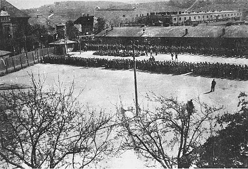 Melk Concentration Camp Historic site, Melk8.3 km NW
-
Wachberg Mountain, Melk7.9 km W
-
Hohenwartberg Mountain, Schönbühel-Aggsbach10 km N
-
Melk Abbey Attraction, Melk9.7 km W
-
Pielach River, Lower Austria9.2 km NW
Sources & licences
Data last updated: