Sieghartskirchen
Located in Politischer Bezirk Tulln, Lower Austria Coordinates: 48°14′51″ N 16°01′17″ E
- Population
- 7,425
- 7.4K
- Elevation
- 217 m
- above sea level
- Local time
- UTC+01:00
- Europe/Vienna · UTC+01:00
- Places inside
- 30
- listed under Sieghartskirchen
- Airports
- VIE Vienna International Airport44 km
- BTS M. R. Štefánik Airport89 km
About Sieghartskirchen
Sieghartskirchen is a municipality. Location: Politischer Bezirk Tulln, Lower Austria. Population: 7,425. Elevation: 217 m. The best months to visit are May–September. The nearest airport is Vienna International Airport (44 km). Nearby sights include Elsbach and Auberg.
Climate of Sieghartskirchen
Best months for sightseeingBest months for sightseeing: May–September.
This month · November
A cold month
Day 8° · Night 2° · Rain 45 mm
- Hottest month
- July (day 25°)
- Coldest month
- January (night -3°)
- Wettest month
- July (76 mm)
- Driest month
- January (28 mm)
Bars: average monthly low and high temperature. Below: precipitation. Monthly averages for 1970–2000 at about 18 km resolution, adjusted for elevation. Highlighted months are mild and relatively dry. Source: WorldClim 2.1 (CC BY 4.0).
Show values as a table
| Month | Jan | Feb | Mar | Apr | May | Jun | Jul | Aug | Sep | Oct | Nov | Dec |
|---|---|---|---|---|---|---|---|---|---|---|---|---|
| Average high (°C) | 3° | 5° | 10° | 15° | 20° | 23° | 25° | 25° | 20° | 14° | 8° | 4° |
| Average low (°C) | -3° | -2° | 1° | 5° | 9° | 13° | 14° | 14° | 10° | 6° | 2° | -2° |
| Precipitation (mm) | 28 | 31 | 38 | 46 | 62 | 75 | 76 | 64 | 50 | 37 | 45 | 35 |
Other places to visit in this season: May June July August September
How to get to Sieghartskirchen
The nearest airport is Vienna International Airport (VIE), 44 km to the east as the crow flies. The nearest large city is Brno, 114 km to the north.
Airports
- Vienna International Airport (VIE) Vienna 44 kmeast
- M. R. Štefánik Airport (BTS) Bratislava 89 kmeast
- Brno-Tuřany Airport (BRQ) Brno 112 kmnortheast
Nearby large cities
- Brno Population: 404.3K 114 kmnorth
- Linz Population: 204.8K 129 kmwest
- Győr Population: 129.3K 136 kmsoutheast
- Graz Population: 303.3K 138 kmsouth
- Székesfehérvár Population: 101.6K 214 kmsoutheast
Straight-line distances; road distances are longer. Airport data: OurAirports.
Places in Sieghartskirchen
30 places- 1 Sieghartskirchen 2K
- 2 Riederberg 846
- 3 Elsbach 578
- 4 Ollern 484
- 5 Rappoltenkirchen 441
- 6 Kogl 436
- 7 Ried am Riederberg 360
- 8 Plankenberg 316
- 9 Dietersdorf 297
- 10 Henzing 202
- 11 Abstetten 201
- 12 Weinzierl am Riederberg 190
- 13 Reichersberg 171
- 14 Kreuth 167
- 15 Röhrenbach 160
- 16 Gollarn 112
- 17 Einsiedl 99
- 18 Ranzelsdorf 87
- 19 Öpping 72
- 20 Gerersdorf 68
- 21 Wagendorf 62
- 22 Flachberg 46
- 23 Penzing 45
- 24 Kracking 19
Bar: population relative to the most populous place in this list.
Nearby attractions & nature
Everything nearby-
Elsbach River, Lower Austria0.5 km NW
-
Auberg Mountain, Judenau-Baumgarten3 km NE
-
Klosterberg Mountain, Tullnerbach4.2 km E
-
Mitterberg Mountain, Michelhausen5.7 km NW
-
Grubhölzer Natural site, Lower Austria6.2 km E
-
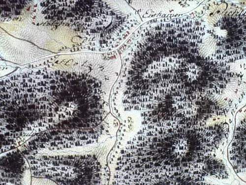 Kaiserbrunnberg Mountain, Pressbaum9.8 km S
-
Oberer Saubichl Mountain, Pressbaum6.6 km SE
-
Kleine Tulln River, Lower Austria4 km N
Sources & licences
Data last updated: