Höpfling
Located in Eggelsberg, Politischer Bezirk Braunau am Inn Coordinates: 48°04′17″ N 12°59′21″ E
- Elevation
- 502 m
- above sea level
- Local time
- UTC+01:00
- Europe/Vienna · UTC+01:00
- Airports
- SZG Salzburg Airport31 km
- LNZ Linz-Hörsching Airport91 km
About Höpfling
Höpfling is a village. Location: Eggelsberg, Politischer Bezirk Braunau am Inn. Elevation: 502 m. The best months to visit are May–September. The nearest airport is Salzburg Airport (31 km). Nearby sights include Gipfelberg and Adenberg.
Climate of Höpfling
Best months for sightseeingBest months for sightseeing: May–September.
This month · November
A cold month
Day 6° · Night 0° · Rain 84 mm
- Hottest month
- July (day 23°)
- Coldest month
- January (night -5°)
- Wettest month
- July (142 mm)
- Driest month
- February (63 mm)
Bars: average monthly low and high temperature. Below: precipitation. Monthly averages for 1970–2000 at about 18 km resolution, adjusted for elevation. Highlighted months are mild and relatively dry. Source: WorldClim 2.1 (CC BY 4.0).
Show values as a table
| Month | Jan | Feb | Mar | Apr | May | Jun | Jul | Aug | Sep | Oct | Nov | Dec |
|---|---|---|---|---|---|---|---|---|---|---|---|---|
| Average high (°C) | 2° | 4° | 9° | 13° | 18° | 21° | 23° | 23° | 18° | 13° | 6° | 3° |
| Average low (°C) | -5° | -4° | -1° | 3° | 7° | 10° | 12° | 12° | 8° | 4° | 0° | -3° |
| Precipitation (mm) | 67 | 63 | 80 | 80 | 103 | 138 | 142 | 132 | 88 | 70 | 84 | 79 |
Other places to visit in this season: May June July August September
How to get to Höpfling
The nearest airport is Salzburg Airport (SZG), 31 km to the south as the crow flies. The nearest large city is Salzburg, 31 km to the south.
Airports
- Salzburg Airport (SZG) Salzburg 31 kmsouth
- Linz-Hörsching Airport (LNZ) Linz 91 kmeast
- Munich Airport (MUC) Munich 95 kmwest
Nearby large cities
- Salzburg Population: 157.2K 31 kmsouth
- Linz Population: 204.8K 100 kmeast
- Munich Population: 1.5M 106 kmwest
- Regensburg Population: 151.4K 124 kmnorthwest
- Ingolstadt Population: 120.7K 139 kmnorthwest
Straight-line distances; road distances are longer. Airport data: OurAirports.
Day trips from Höpfling
Within 100 km: 283 historic and cultural sites, 2,396 natural sites, 871 lakes, rivers and coasts.
0–25 km104 places
- Wallersee Lake 22 kmSE
- Obertrumer See Lake 14 kmSE
- Niedertrumer See Lake 14 kmSE
- Grabensee Lake 13 kmSE
25–60 km887 places
- Frauenchiemsee Island 48 kmSW
- Herreninsel Island 50 kmSW
- Zellersee Lake 30 kmSE
- Wiestalstausee Lake 38 kmS
60–100 km2,559 places
- Hoher Dachstein Mountain 81 kmSE
- Seeriessee Lake 98 kmSE
- Untersee Lake 92 kmSE
- Brandlsee Lake 95 kmS
Straight-line distances.
Nearby attractions & nature
Everything nearby-
Gipfelberg Mountain, Geretsberg4.4 km W
-
Adenberg Mountain, Handenberg8.9 km N
-
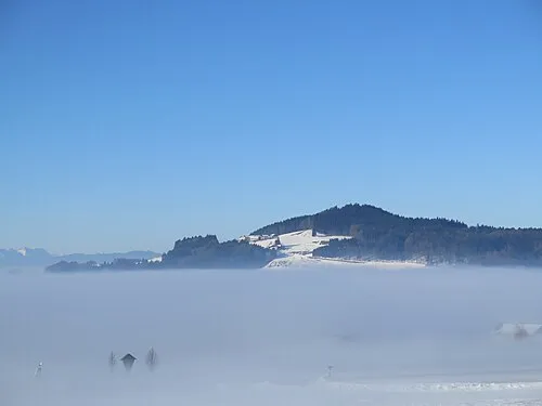 Buchberg Mountain, Mattsee16 km SE
-
Weilhart Forst Natural site, Upper Austria9.7 km W
-
Oberer Weilhart Forst Natural site, Upper Austria9.7 km W
-
Oberholz Natural site, State of Salzburg10 km S
Sources & licences
Data last updated: