Vinska
Located in Republika Srpska, Bosnia and Herzegovina Coordinates: 45°03′46″ N 18°05′41″ E
- Elevation
- 128 m
- above sea level
- Local time
- UTC+01:00
- Europe/Sarajevo · UTC+01:00
- Airports
- BNX Banja Luka International Airport64 km
- OSI Osijek Airport72 km
About Vinska
Vinska is a village. Location: Republika Srpska, Bosnia and Herzegovina. Elevation: 128 m. The best months to visit are May–June, September. The nearest airport is Banja Luka International Airport (64 km). Nearby sights include Vučjak and Petnja.
Climate of Vinska
Best months for sightseeingBest months for sightseeing: May–June, September.
This month · November
A cold month
Day 9° · Night 1° · Rain 81 mm
- Hottest month
- July (day 27°)
- Coldest month
- January (night -4°)
- Wettest month
- June (97 mm)
- Driest month
- March (47 mm)
Bars: average monthly low and high temperature. Below: precipitation. Monthly averages for 1970–2000 at about 18 km resolution, adjusted for elevation. Highlighted months are mild and relatively dry. Source: WorldClim 2.1 (CC BY 4.0).
Show values as a table
| Month | Jan | Feb | Mar | Apr | May | Jun | Jul | Aug | Sep | Oct | Nov | Dec |
|---|---|---|---|---|---|---|---|---|---|---|---|---|
| Average high (°C) | 3° | 6° | 12° | 17° | 22° | 25° | 27° | 27° | 23° | 17° | 9° | 5° |
| Average low (°C) | -4° | -3° | 1° | 5° | 10° | 13° | 14° | 14° | 10° | 5° | 1° | -2° |
| Precipitation (mm) | 50 | 51 | 47 | 57 | 71 | 97 | 68 | 61 | 54 | 72 | 81 | 66 |
How to get to Vinska
The nearest airport is Banja Luka International Airport (BNX), 64 km to the west as the crow flies. The nearest large city is Tuzla, 74 km to the southeast.
Airports
- Banja Luka International Airport (BNX) Mahovljani 64 kmwest
- Osijek Airport (OSI) Osijek(Klisa) 72 kmnortheast
- Tuzla International Airport (TZL) Dubrave Gornje 83 kmsoutheast
Nearby large cities
- Tuzla Population: 142.5K 74 kmsoutheast
- Banja Luka Population: 221.1K 77 kmsouthwest
- Zenica Population: 164.4K 97 kmsouth
- Pécs Population: 145.3K 113 kmnorth
- Sarajevo Population: 696.7K 137 kmsouth
Straight-line distances; road distances are longer. Airport data: OurAirports.
Day trips from Vinska
Within 100 km: 5 historic and cultural sites, 62 natural sites, 84 lakes, rivers and coasts.
0–25 km12 places
- Soline Mountain 17 kmSW
- Jabukovac Mountain 23 kmSW
- Markovac Mountain 18 kmW
- Pjevalovac River 20 kmW
25–60 km39 places
- Krndija Mountain 45 kmN
- Kraljevac Mountain 35 kmW
- Vrbas River 46 kmW
- Orljava River 30 kmW
60–100 km100 places
- Una River 96 kmW
- Zovik Mountain 70 kmSW
- Rajkovac Mountain 86 kmSW
- Ratkovac River 63 kmSW
Straight-line distances.
Nearby attractions & nature
Everything nearby-
Vučjak Mountain, Republika Srpska6.2 km SE
-
 Petnja River, Croatia20 km NW
-
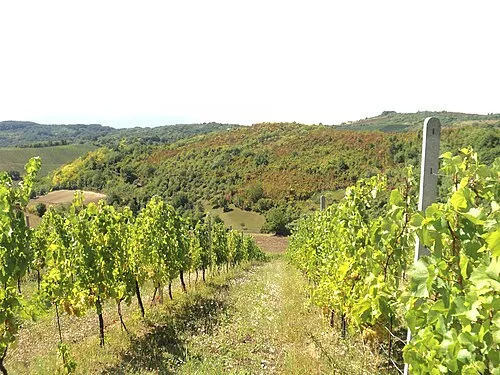 Dilj Planina Mountain, Croatia22 km N
-
 Ukrina River, Republika Srpska13 km W
-
Jezero Petnja Lake, Brod-Posavina County19 km NW
-
Soline Mountain, Republika Srpska17 km SW
Other cities and towns in Republika Srpska
-
 Sijekovac Village, Republika Srpska11 km NW
-
Podnovlje Village, Republika Srpska13 km S
-
Zborište Village, Republika Srpska6.7 km W
-
Žeravac Village, Republika Srpska8 km SW
-
Lužani Bosanski Village, Republika Srpska9.9 km SW
-
Vrela Gornja Village, Republika Srpska4.8 km SE
Sources & licences
Data last updated: