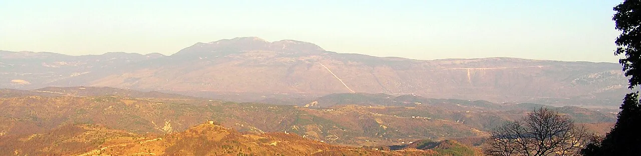
- Elevation
- 1,272 m
- above sea level
- Local time
- UTC+01:00
- Europe/Zagreb · UTC+01:00
- Airports
- RJK Rijeka Airport42 km
- PUY Pula Airport63 km
About Ćićarija
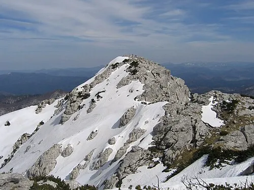
Ćićarija is a mountain. Location: Croatia. Elevation: 1,272 m.
Ćićarija (Slovene: Čičarija; Italian: Cicceria, Monti della Vena; Istro Romanian: Ciceria; German: Tschitschen Boden) is a mountainous plateau in the northern and northeastern part of the Istria peninsula, 45 kilometers (28 mi) long and 10–15 kilometers (6.2–9.3 mi) wide. It mostly lies in Croatia, while its northern part lies in southwestern Slovenia (the traditional region of Inner Carniola). The highest peak is Veliki Planik at 1,272 meters (4,173 ft).
Read more on Wikipedia Text: Wikipedia contributors · CC BY-SA 4.0 · shortened
At a glance
- Length
- 30 km
Source: Wikidata
Climate of Ćićarija
Best months for sightseeingBest months for sightseeing: July–August.
Bars: average monthly low and high temperature. Below: precipitation. Monthly averages for 1970–2000 at about 18 km resolution, adjusted for elevation. Highlighted months are mild and relatively dry. Source: WorldClim 2.1 (CC BY 4.0).
Show values as a table
| Month | Jan | Feb | Mar | Apr | May | Jun | Jul | Aug | Sep | Oct | Nov | Dec |
|---|---|---|---|---|---|---|---|---|---|---|---|---|
| Average high (°C) | 0° | 2° | 4° | 8° | 12° | 17° | 20° | 20° | 16° | 11° | 6° | 2° |
| Average low (°C) | -6° | -6° | -4° | -1° | 4° | 7° | 10° | 10° | 6° | 3° | -1° | -5° |
| Precipitation (mm) | 112 | 92 | 113 | 126 | 114 | 132 | 90 | 113 | 128 | 160 | 178 | 147 |
Airports nearest to Ćićarija
- Rijeka Airport (RJK) Rijeka(Omišalj) 42 km
- Pula Airport (PUY) Pula 63 km
- Trieste Airport (TRS) Ronchi dei Legionari/Trieste 68 km
Straight-line distance; airports with scheduled flights only. Source: OurAirports (public domain).
Nearest towns and villages
More nature in Croatia

Sources & licences
Data last updated: · 2 independent sources