- Population
- 31,209
- 31.2K
- Elevation
- 126 m
- above sea level
- Local time
- UTC+01:00
- Europe/Zagreb · UTC+01:00
- Airports
- ZAG Zagreb Franjo Tuđman International Airport11 km
- MBX Maribor Edvard Rusjan Airport78 km
About Donji Grad
Donji Grad is a district. Location: City of Zagreb, Croatia. Population: 31,209.
Donji grad (pronounced [dôːɲiː grâːd], locally also [ˈdoʎɲi grad], lit. 'Lower Town') is one of the 17 city districts of Zagreb, the capital of Croatia. It is located in the central part of the city and has 37,024 inhabitants (as of 2011). The district is often referred to simply as centar (lit. 'center') by Zagreb residents, a term which also encompasses the southern parts of the Gornji Grad district.
Source: Wikipedia · CC BY-SA 4.0
Photos of Donji Grad
-

Jezero Jarun Suradnik13 · CC BY-SA 3.0 -
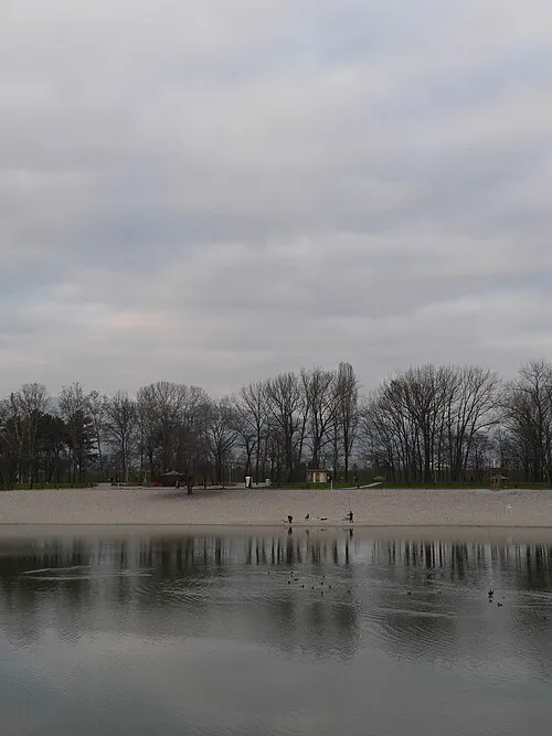
Bundek Daniel Nikolić · CC BY-SA 4.0


Climate of Donji Grad
Best months for sightseeingBest months for sightseeing: May–September.
This month · November
A cold month
Day 9° · Night 2° · Rain 88 mm
- Hottest month
- July (day 26°)
- Coldest month
- January (night -2°)
- Wettest month
- June (96 mm)
- Driest month
- February (48 mm)
Bars: average monthly low and high temperature. Below: precipitation. Monthly averages for 1970–2000 at about 18 km resolution, adjusted for elevation. Highlighted months are mild and relatively dry. Source: WorldClim 2.1 (CC BY 4.0).
Show values as a table
| Month | Jan | Feb | Mar | Apr | May | Jun | Jul | Aug | Sep | Oct | Nov | Dec |
|---|---|---|---|---|---|---|---|---|---|---|---|---|
| Average high (°C) | 4° | 6° | 12° | 16° | 21° | 24° | 26° | 26° | 22° | 16° | 9° | 5° |
| Average low (°C) | -2° | -1° | 2° | 6° | 10° | 14° | 15° | 15° | 11° | 7° | 2° | -1° |
| Precipitation (mm) | 51 | 48 | 60 | 67 | 78 | 96 | 85 | 91 | 89 | 88 | 88 | 65 |
Other places to visit in this season: May June July August September
How to get to Donji Grad
The nearest airport is Zagreb Franjo Tuđman International Airport (ZAG), 11 km to the southeast as the crow flies. The nearest large city is Zagreb, 1 km to the northeast.
Airports
- Zagreb Franjo Tuđman International Airport (ZAG) Velika Gorica 11 kmsoutheast
- Maribor Edvard Rusjan Airport (MBX) Maribor 78 kmnorth
- Ljubljana Jože Pučnik Airport (LJU) Zgornji Brnik 126 kmwest
Nearby large cities
- Zagreb Population: 663.6K 1 kmnortheast
- Ljubljana Population: 272.2K 117 kmwest
- Rijeka Population: 108K 131 kmsouthwest
- Graz Population: 303.3K 146 kmnorth
- Klagenfurt Population: 100.3K 157 kmnorthwest
Straight-line distances; road distances are longer. Airport data: OurAirports.
Day trips from Donji Grad
Within 100 km: 8 historic and cultural sites, 24 natural sites, 69 lakes, rivers and coasts.
0–25 km16 places
- Kašina River 21 kmE
- Krapina River 23 kmNW
- Glavničica River 19 kmE
- Krapina River 12 kmW
25–60 km28 places
- Krka River 30 kmW
- Žumberačka Gora Mountain 50 kmW
- Trdinov Vrh Mountain 51 kmW
- Radulja River 59 kmW
60–100 km57 places
- Ribnica Lake Lake 94 kmNW
- Pohorje Mountain 89 kmNW
- Mala Gora Mountain 96 kmW
- Ledava River 89 kmNE
Straight-line distances.
Nearby attractions & nature
Everything nearby-
Lotrščak tower Landmark, City of Zagreb0.8 km N
-
St. Mark's Church Attraction, City of Zagreb1 km N
-
Zagreb Cathedral Attraction, Croatia1 km NE
-
Zagreb ZOO Attraction, City of Zagreb4.2 km E
-
Bundek Lake, Croatia2.9 km SE
-
Jezero Jarun Lake, City of Zagreb5 km SW
Sources & licences
Data last updated: · 2 independent sources