Municipality of Trpanj
Located in Dubrovnik-Neretva County, Croatia Coordinates: 43°00′28″ N 17°16′15″ E
- Population
- 683
- 683
- Elevation
- 6 m
- above sea level
- Local time
- UTC+01:00
- Europe/Zagreb · UTC+01:00
- Airports
- OMO Mostar International Airport56 km
- BWK Brač Airport57 km
About Municipality of Trpanj
Municipality of Trpanj is a district. Location: Dubrovnik-Neretva County, Croatia. Population: 683. The best months to visit are May, September–October. The nearest airport is Mostar International Airport (56 km). Nearby sights include Otok Badija and Pelješac Bridge.
Climate of Municipality of Trpanj
Best months for sightseeingBest months for sightseeing: May, September–October.
This month · November
A wet month
Day 16° · Night 9° · Rain 114 mm
- Hottest month
- July (day 31°)
- Coldest month
- January (night 5°)
- Wettest month
- November (114 mm)
- Driest month
- July (33 mm)
Bars: average monthly low and high temperature. Below: precipitation. Monthly averages for 1970–2000 at about 18 km resolution, adjusted for elevation. Highlighted months are mild and relatively dry. Source: WorldClim 2.1 (CC BY 4.0).
Show values as a table
| Month | Jan | Feb | Mar | Apr | May | Jun | Jul | Aug | Sep | Oct | Nov | Dec |
|---|---|---|---|---|---|---|---|---|---|---|---|---|
| Average high (°C) | 11° | 12° | 15° | 19° | 24° | 28° | 31° | 31° | 26° | 21° | 16° | 12° |
| Average low (°C) | 5° | 5° | 8° | 11° | 15° | 19° | 21° | 21° | 17° | 14° | 9° | 6° |
| Precipitation (mm) | 87 | 76 | 77 | 72 | 58 | 49 | 33 | 49 | 71 | 99 | 114 | 99 |
How to get to Municipality of Trpanj
The nearest airport is Mostar International Airport (OMO), 56 km to the northeast as the crow flies. The nearest large city is Split, 88 km to the northwest.
Airports
- Mostar International Airport (OMO) Mostar 56 kmnortheast
- Brač Airport (BWK) Gornji Humac 57 kmnorthwest
- Dubrovnik Ruđer Bošković Airport (DBV) Dubrovnik 95 kmsoutheast
Nearby large cities
- Split Population: 149.8K 88 kmnorthwest
- New Belgrade Population: 209.8K 323 kmnortheast
- Zemun Population: 155.6K 324 kmnortheast
- Belgrade Population: 1.3M 325 kmnortheast
- Zagreb Population: 663.6K 328 kmnorth
Straight-line distances; road distances are longer. Airport data: OurAirports.
Day trips from Municipality of Trpanj
Within 100 km: 6 historic and cultural sites, 12 natural sites, 35 lakes, rivers and coasts.
0–25 km5 places
- Pelješac Natural site 16 kmSE
- Otok Badija Island 11 kmSW
- Baćinska Jezera Lake 14 kmNE
- Neretva River 15 kmE
25–60 km21 places
- Mljet Island 37 kmSE
- Lagosta Island Island 43 kmSW
- Česvinica Mountain 42 kmSE
- Skrivena Luka Natural site 45 kmSW
60–100 km27 places
- Brač Island 62 kmNW
- Šolta Island 90 kmNW
- Otok Sveti Klement Island 75 kmW
- Vidova Gora Mountain 61 kmNW
Straight-line distances.
Nearby attractions & nature
Everything nearby-
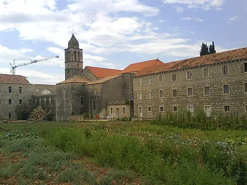 Otok Badija Island, Dubrovnik-Neretva County11 km SW
-
Pelješac Bridge Landmark, Dubrovnik-Neretva County23 km E
-
 Pelješac Natural site, Croatia16 km SE
-
Baćinska Jezera Lake, Dubrovnik-Neretva County14 km NE
-
 Neretva River, Croatia15 km E
Other regions in Dubrovnik-Neretva County
-
 Municipality of Orebić District, Dubrovnik-Neretva County8.7 km W
-
 Town of Korčula District, Dubrovnik-Neretva County13 km SW
-
 Town of Ploče District, Dubrovnik-Neretva County15 km NE
-
 Municipality of Janjina District, Dubrovnik-Neretva County16 km SE
-
Municipality of Lumbarda District, Dubrovnik-Neretva County13 km SW
-
 Municipality of Ston District, Dubrovnik-Neretva County39 km SE
Sources & licences
Data last updated: