Municipality of Vrhovine
Located in Lika-Senj County, Croatia Coordinates: 44°51′05″ N 15°25′22″ E

- Population
- 653
- 653
- Elevation
- 737 m
- above sea level
- Local time
- UTC+01:00
- Europe/Zagreb · UTC+01:00
- Places inside
- 4
- listed under Municipality of Vrhovine
- Airports
- RJK Rijeka Airport78 km
- ZAD Zadar Airport84 km
About Municipality of Vrhovine
Municipality of Vrhovine is a district. Location: Lika-Senj County, Croatia. Population: 653. The best months to visit are June–August. The nearest airport is Rijeka Airport (78 km). Nearby sights include Mala Kapela and Plitvice Lakes National Park.
Climate of Municipality of Vrhovine
Best months for sightseeingBest months for sightseeing: June–August.
This month · November
A wet month
Day 7° · Night 0° · Rain 171 mm
- Hottest month
- July (day 23°)
- Coldest month
- January (night -4°)
- Wettest month
- November (171 mm)
- Driest month
- July (81 mm)
Bars: average monthly low and high temperature. Below: precipitation. Monthly averages for 1970–2000 at about 18 km resolution, adjusted for elevation. Highlighted months are mild and relatively dry. Source: WorldClim 2.1 (CC BY 4.0).
Show values as a table
| Month | Jan | Feb | Mar | Apr | May | Jun | Jul | Aug | Sep | Oct | Nov | Dec |
|---|---|---|---|---|---|---|---|---|---|---|---|---|
| Average high (°C) | 3° | 4° | 8° | 12° | 17° | 21° | 23° | 23° | 19° | 13° | 7° | 3° |
| Average low (°C) | -4° | -4° | -1° | 3° | 7° | 10° | 11° | 11° | 8° | 4° | 0° | -3° |
| Precipitation (mm) | 96 | 100 | 106 | 121 | 109 | 113 | 81 | 98 | 135 | 153 | 171 | 137 |
How to get to Municipality of Vrhovine
The nearest airport is Rijeka Airport (RJK), 78 km to the northwest as the crow flies. The nearest large city is Rijeka, 94 km to the northwest.
Airports
- Rijeka Airport (RJK) Rijeka(Omišalj) 78 kmnorthwest
- Zadar Airport (ZAD) Zadar 84 kmsouth
- Zagreb Franjo Tuđman International Airport (ZAG) Velika Gorica 111 kmnortheast
Nearby large cities
- Rijeka Population: 108K 94 kmnorthwest
- Zagreb Population: 663.6K 116 kmnorth
- Ljubljana Population: 272.2K 151 kmnorthwest
- Split Population: 149.8K 170 kmsoutheast
- Klagenfurt Population: 100.3K 215 kmnorthwest
Straight-line distances; road distances are longer. Airport data: OurAirports.
Day trips from Municipality of Vrhovine
Within 100 km: 5 historic and cultural sites, 30 natural sites, 58 lakes, rivers and coasts.
0–25 km6 places
- Mine Mountain 17 kmNW
- Kotlina Natural site 15 kmW
- Plitvice Lakes National Park Natural site 16 kmE
- Kruščičko Jezero Lake 22 kmSW
25–60 km24 places
- Birovača Mountain 51 kmSE
- Rab Island 52 kmW
- Sveti Ivan Mountain 54 kmSW
- Progon Mountain 27 kmS
60–100 km63 places
- Krk Island 68 kmW
- Lošinj Island 86 kmW
- Uvala Stipanja Natural site 68 kmNW
- Silba Island 78 kmSW
Straight-line distances.
Places in Municipality of Vrhovine
4 placesBar: population relative to the most populous place in this list.
Nearby attractions & nature
Everything nearby-
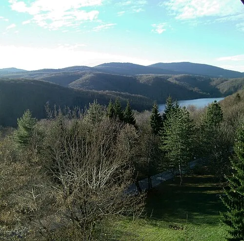 Mala Kapela Mountain, Croatia9.2 km NE
-
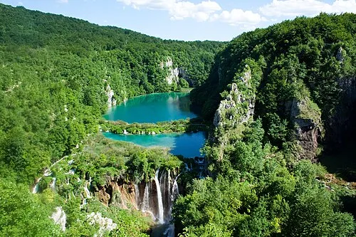 Plitvice Lakes National Park Natural site, Lika-Senj County15 km E
-
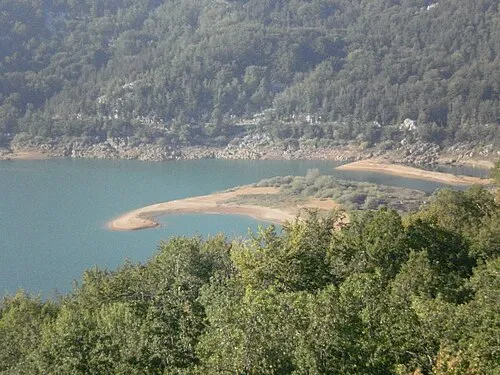 Kruščičko Jezero Lake, Lika-Senj County22 km SW
-
Plitvice Lakes National Park Natural site, Lika-Senj County16 km E
-
Mine Mountain, Lika-Senj County17 km NW
-
Kotlina Natural site, Croatia15 km W
Other regions in Lika-Senj County
-
Town of Otočac District, Lika-Senj County15 km W
-
Town of Gospić District, Lika-Senj County34 km S
-
Municipality of Perušić District, Lika-Senj County23 km S
-
 Town of Senj District, Lika-Senj County44 km W
-
 Municipality of Udbina District, Lika-Senj County45 km SE
-
Municipality of Brinje District, Lika-Senj County28 km NW
Sources & licences
Data last updated: