Moravice
Located in Town of Vrbovsko, Primorje-Gorski Kotar County Coordinates: 45°25′29″ N 15°00′53″ E

- Population
- 509
- 509
- Elevation
- 446 m
- above sea level
- Local time
- UTC+01:00
- Europe/Zagreb · UTC+01:00
- Airports
- RJK Rijeka Airport42 km
- ZAG Zagreb Franjo Tuđman International Airport90 km
About Moravice
Moravice is a village. Location: Town of Vrbovsko, Primorje-Gorski Kotar County. Population: 509. Elevation: 446 m.
Moravice (formerly known as Komorske Moravice until 1919, thereafter as Srpske Moravice until 1991) (Serbian Cyrillic: Моравице) is a settlement in north-western Croatia, situated at the far east of the mountainous region of Gorski kotar in the Primorje-Gorski Kotar County. It is part of the Vrbovsko municipality. The population is 664 (as of the 2011 census).
Source: Wikipedia · CC BY-SA 4.0
At a glance
- Area
- 3.6 km²
Source: Wikidata
Photos of Moravice
-

Andrija12345678 · CC BY-SA 4.0 -

Andrija12345678 · CC BY-SA 4.0 -

Andrija12345678 · CC BY-SA 4.0


Climate of Moravice
Best months for sightseeingBest months for sightseeing: May–September.
This month · November
A wet month
Day 9° · Night 1° · Rain 159 mm
- Hottest month
- July (day 25°)
- Coldest month
- January (night -4°)
- Wettest month
- November (159 mm)
- Driest month
- January (82 mm)
Bars: average monthly low and high temperature. Below: precipitation. Monthly averages for 1970–2000 at about 18 km resolution, adjusted for elevation. Highlighted months are mild and relatively dry. Source: WorldClim 2.1 (CC BY 4.0).
Show values as a table
| Month | Jan | Feb | Mar | Apr | May | Jun | Jul | Aug | Sep | Oct | Nov | Dec |
|---|---|---|---|---|---|---|---|---|---|---|---|---|
| Average high (°C) | 4° | 6° | 9° | 13° | 19° | 22° | 25° | 24° | 20° | 14° | 9° | 4° |
| Average low (°C) | -4° | -3° | 0° | 4° | 8° | 11° | 13° | 12° | 9° | 5° | 1° | -3° |
| Precipitation (mm) | 82 | 88 | 104 | 126 | 113 | 134 | 106 | 116 | 133 | 156 | 159 | 123 |
Other places to visit in this season: May June July August September
How to get to Moravice
The nearest airport is Rijeka Airport (RJK), 42 km to the southwest as the crow flies. The nearest large city is Rijeka, 46 km to the west.
Airports
- Rijeka Airport (RJK) Rijeka(Omišalj) 42 kmsouthwest
- Zagreb Franjo Tuđman International Airport (ZAG) Velika Gorica 90 kmnortheast
- Ljubljana Jože Pučnik Airport (LJU) Zgornji Brnik 99 kmnorthwest
Nearby large cities
- Rijeka Population: 108K 46 kmwest
- Ljubljana Population: 272.2K 80 kmnorthwest
- Zagreb Population: 663.6K 87 kmnortheast
- Klagenfurt Population: 100.3K 144 kmnorth
- Graz Population: 303.3K 186 kmnorth
Straight-line distances; road distances are longer. Airport data: OurAirports.
Day trips from Moravice
Within 100 km: 12 historic and cultural sites, 66 natural sites, 71 lakes, rivers and coasts.
0–25 km5 places
- Kočevski Rog Mountain 25 kmN
- Rinža River 25 kmNW
- Burni bitoraj - Vrh Bitoraj Mountain 23 kmSW
- Velika Kapela Mountain 22 kmS
25–60 km37 places
- Krk Island 50 kmSW
- Uvala Stipanja Natural site 41 kmSW
- Otočić Košljun Island 54 kmSW
- Veliki Snežnik Mountain 46 kmW
60–100 km107 places
- Raša River 98 kmNW
- Šmarna gora Mountain 89 kmNW
- Hrušica Mountain 81 kmNW
- Krim Mountain 70 kmNW
Straight-line distances.
Nearby attractions & nature
Everything nearby-
 Burni bitoraj - Vrh Bitoraj Mountain, Primorje-Gorski Kotar County23 km SW
-
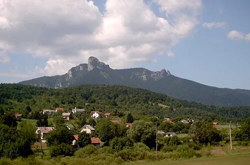 Klek Mountain, Karlovac County21 km SE
-
 Rinža River, Slovenia25 km NW
-
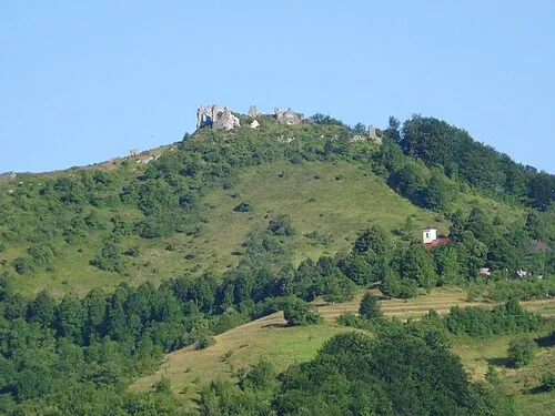 Velika Kapela Mountain, Croatia22 km S
-
Kočevski Rog Mountain, Municipality of Dolenjske Toplice25 km N
Other cities and towns in Town of Vrbovsko
-
 Severin na Kupi Village, Town of Vrbovsko12 km E
-
Močile Village, Town of Vrbovsko12 km E
-
Gomirje Village, Town of Vrbovsko13 km SE
Sources & licences
Data last updated: · 2 independent sources