Mokro Polje
Located in Municipality of Ervenik, Šibenik-Knin County Coordinates: 44°04′19″ N 16°02′20″ E

- Population
- 163
- 163
- Elevation
- 255 m
- above sea level
- Local time
- UTC+01:00
- Europe/Zagreb · UTC+01:00
- Airports
- ZAD Zadar Airport55 km
- SPU Split Saint Jerome Airport63 km
About Mokro Polje
Mokro Polje is a village. Location: Municipality of Ervenik, Šibenik-Knin County. Population: 163. Elevation: 255 m.
Mokro Polje (Serbian Cyrillic: Мокро Поље) is a village in Šibenik-Knin County, Croatia. It is one of the largest villages in the municipality of Ervenik. The river Zrmanja flows through Mokro Polje. The 2021 census listed 163 inhabitants.
Source: Wikipedia · CC BY-SA 4.0
At a glance
- Area
- 55.2 km²
Source: Wikidata
Photos of Mokro Polje
-

Original uploader was Goranirk at sr.wikipedia · CC BY 3.0 rs -

Goranirk at Serbian Wikipedia · Public domain -

Original uploader was Galijatx at sr.wikipedia · CC BY-SA 3.0 -

The original uploader was Goranirk at Serbian Wikipedia · CC BY 3.0 rs -

The original uploader was Goranirk at Serbian Wikipedia · CC BY 3.0 rs


Climate of Mokro Polje
Best months for sightseeingBest months for sightseeing: May–September.
This month · November
A wet month
Day 13° · Night 5° · Rain 117 mm
- Hottest month
- July (day 29°)
- Coldest month
- January (night 1°)
- Wettest month
- November (117 mm)
- Driest month
- July (48 mm)
Bars: average monthly low and high temperature. Below: precipitation. Monthly averages for 1970–2000 at about 18 km resolution, adjusted for elevation. Highlighted months are mild and relatively dry. Source: WorldClim 2.1 (CC BY 4.0).
Show values as a table
| Month | Jan | Feb | Mar | Apr | May | Jun | Jul | Aug | Sep | Oct | Nov | Dec |
|---|---|---|---|---|---|---|---|---|---|---|---|---|
| Average high (°C) | 8° | 9° | 13° | 17° | 22° | 25° | 29° | 28° | 24° | 19° | 13° | 9° |
| Average low (°C) | 1° | 1° | 3° | 7° | 11° | 14° | 16° | 16° | 13° | 9° | 5° | 2° |
| Precipitation (mm) | 76 | 71 | 76 | 84 | 71 | 71 | 48 | 60 | 91 | 101 | 117 | 96 |
Other places to visit in this season: May June July August September
How to get to Mokro Polje
The nearest airport is Zadar Airport (ZAD), 55 km to the west as the crow flies. The nearest large city is Split, 70 km to the southeast.
Airports
- Zadar Airport (ZAD) Zadar 55 kmwest
- Split Saint Jerome Airport (SPU) Split 63 kmsouth
- Brač Airport (BWK) Gornji Humac 102 kmsoutheast
Nearby large cities
- Split Population: 149.8K 70 kmsoutheast
- Banja Luka Population: 221.1K 122 kmnortheast
- Zenica Population: 164.4K 150 kmeast
- Mostar Population: 104.5K 164 kmsoutheast
- Sarajevo Population: 696.7K 188 kmeast
Straight-line distances; road distances are longer. Airport data: OurAirports.
Day trips from Mokro Polje
Within 100 km: 10 historic and cultural sites, 63 natural sites, 80 lakes, rivers and coasts.
0–25 km2 places
- Krka National Park Natural site 23 kmS
- Burnum Historic site 9 kmSW
25–60 km50 places
- Otok Prvić Island 42 kmSW
- Otok Zlarin Island 45 kmS
- Otok Kaprije Island 50 kmSW
- Krapanj Island 45 kmS
60–100 km101 places
- Brač Island 96 kmSE
- Šolta Island 79 kmS
- Otok Mali Drvenik Island 69 kmS
- Otok Sestrunj Island 85 kmW
Straight-line distances.
Nearby attractions & nature
Everything nearby-
 Burnum Historic site, Šibenik-Knin County9.2 km SW
-
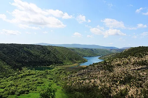 Krka National Park Natural site, Šibenik-Knin County23 km S
Sources & licences
Data last updated: · 2 independent sources