Čavoglave
Located in Municipality of Ružić, Šibenik-Knin County Coordinates: 43°47′01″ N 16°20′14″ E

- Population
- 147
- 147
- Elevation
- 428 m
- above sea level
- Local time
- UTC+01:00
- Europe/Zagreb · UTC+01:00
- Airports
- SPU Split Saint Jerome Airport27 km
- BWK Brač Airport62 km
About Čavoglave
Čavoglave is a village. Location: Municipality of Ružić, Šibenik-Knin County. Population: 147. Elevation: 428 m.
Čavoglave is a village in Dalmatian Hinterland, Croatia with a population of 190. It is part of the Ružić municipality of the Šibenik-Knin County, in the region of Dalmatia. It is located between the mountains Svilaja and Moseć, next to the spring of the Čikola river. The southern edge of the village passes the D56 highway. Although the village is not usually a tourist destination, the village has started to gain popularity due to the famous Croatian nationalist folk rock song "Bojna Čavoglave".
Source: Wikipedia · CC BY-SA 4.0
At a glance
- Area
- 21.7 km²
Source: Wikidata
Photos of Čavoglave
-

Julian Nyča · CC BY-SA 3.0

Climate of Čavoglave
Best months for sightseeingBest months for sightseeing: May–September.
This month · November
A wet month
Day 13° · Night 5° · Rain 119 mm
- Hottest month
- July (day 27°)
- Coldest month
- February (night 1°)
- Wettest month
- November (119 mm)
- Driest month
- July (45 mm)
Bars: average monthly low and high temperature. Below: precipitation. Monthly averages for 1970–2000 at about 18 km resolution, adjusted for elevation. Highlighted months are mild and relatively dry. Source: WorldClim 2.1 (CC BY 4.0).
Show values as a table
| Month | Jan | Feb | Mar | Apr | May | Jun | Jul | Aug | Sep | Oct | Nov | Dec |
|---|---|---|---|---|---|---|---|---|---|---|---|---|
| Average high (°C) | 8° | 8° | 11° | 16° | 21° | 25° | 27° | 27° | 23° | 18° | 13° | 9° |
| Average low (°C) | 1° | 1° | 3° | 7° | 11° | 14° | 16° | 16° | 13° | 9° | 5° | 2° |
| Precipitation (mm) | 75 | 68 | 73 | 80 | 68 | 68 | 45 | 58 | 85 | 102 | 119 | 100 |
Other places to visit in this season: May June July August September
How to get to Čavoglave
The nearest airport is Split Saint Jerome Airport (SPU), 27 km to the south as the crow flies. The nearest large city is Split, 32 km to the south.
Airports
- Split Saint Jerome Airport (SPU) Split 27 kmsouth
- Brač Airport (BWK) Gornji Humac 62 kmsoutheast
- Zadar Airport (ZAD) Zadar 86 kmnorthwest
Nearby large cities
- Split Population: 149.8K 32 kmsouth
- Zagreb Population: 663.6K 227 kmnorth
- Rijeka Population: 108K 228 kmnorthwest
- Ljubljana Population: 272.2K 291 kmnorthwest
- Pécs Population: 145.3K 295 kmnortheast
Straight-line distances; road distances are longer. Airport data: OurAirports.
Day trips from Čavoglave
Within 100 km: 9 historic and cultural sites, 16 natural sites, 49 lakes, rivers and coasts.
0–25 km3 places
- Peruća Lake Lake 17 kmE
- Svilaja Mountain 10 kmNE
- Dinara Nature Park Natural site 20 kmNE
25–60 km35 places
- Brač Island 57 kmSE
- Šolta Island 45 kmS
- Otok Prvić Island 44 kmW
- Otok Zlarin Island 41 kmW
60–100 km36 places
- Birovača Mountain 94 kmN
- Otočić Ošljak Island 96 kmW
- Kornat Island 83 kmW
- Otok Biševo Island 93 kmS
Straight-line distances.
Nearby attractions & nature
Everything nearby-
 Svilaja Mountain, Croatia9.5 km NE
-
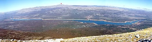 Peruća Lake Lake, Split-Dalmatia County17 km E
-
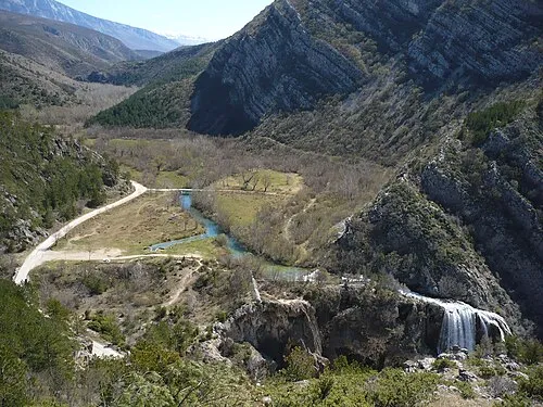 Dinara Nature Park Natural site, Split-Dalmatia County20 km NE
Sources & licences
Data last updated: · 2 independent sources