Municipality of Jasenovac
Local name: Jasenovac
Located in Sisak-Moslavina County, Croatia Coordinates: 45°16′15″ N 16°54′41″ E

- Population
- 1,559
- 1.6K
- Elevation
- 95 m
- above sea level
- Local time
- UTC+01:00
- Europe/Zagreb · UTC+01:00
- Places inside
- 7
- listed under Municipality of Jasenovac
- Airports
- BNX Banja Luka International Airport48 km
- ZAG Zagreb Franjo Tuđman International Airport84 km
About Municipality of Jasenovac
Municipality of Jasenovac is a district. Location: Sisak-Moslavina County, Croatia. Population: 1,559.
Jasenovac (pronounced [jasěnovats]) is a village and a municipality in Croatia, in the southern part of the Sisak-Moslavina County at the confluence of the river Una into Sava. In Croatian "jasen" means ash tree and the name Jasenovac means "ashen, or made of ash tree". Jasenovac attained notoriety during the Holocaust through the Jasenovac concentration camp giving its name to the Ustaše complex of WWII concentration camps in the context of the Genocide of Serbs.
Source: Wikipedia · CC BY-SA 4.0
Photos of Municipality of Jasenovac
-

Wikimedia Commons · Public domain -

Mnalis · CC BY-SA 4.0 -

Mnalis · CC BY-SA 4.0 -

Monument Hunter · CC BY-SA 4.0 -

Petar Milošević · CC BY-SA 4.0


Climate of Municipality of Jasenovac
Best months for sightseeingBest months for sightseeing: May–June, September.
This month · November
A cold month
Day 10° · Night 3° · Rain 90 mm
- Hottest month
- July (day 27°)
- Coldest month
- January (night -3°)
- Wettest month
- June (96 mm)
- Driest month
- February (55 mm)
Bars: average monthly low and high temperature. Below: precipitation. Monthly averages for 1970–2000 at about 18 km resolution, adjusted for elevation. Highlighted months are mild and relatively dry. Source: WorldClim 2.1 (CC BY 4.0).
Show values as a table
| Month | Jan | Feb | Mar | Apr | May | Jun | Jul | Aug | Sep | Oct | Nov | Dec |
|---|---|---|---|---|---|---|---|---|---|---|---|---|
| Average high (°C) | 5° | 7° | 12° | 17° | 22° | 25° | 27° | 27° | 23° | 17° | 10° | 6° |
| Average low (°C) | -3° | -1° | 2° | 6° | 11° | 14° | 15° | 14° | 11° | 7° | 3° | -1° |
| Precipitation (mm) | 60 | 55 | 65 | 79 | 84 | 96 | 86 | 87 | 80 | 85 | 90 | 74 |
How to get to Municipality of Jasenovac
The nearest airport is Banja Luka International Airport (BNX), 48 km to the southeast as the crow flies. The nearest large city is Banja Luka, 59 km to the southeast.
Airports
- Banja Luka International Airport (BNX) Mahovljani 48 kmsoutheast
- Zagreb Franjo Tuđman International Airport (ZAG) Velika Gorica 84 kmnorthwest
- Pécs-Pogány International Airport (PEV) Pécs 131 kmnortheast
Nearby large cities
- Banja Luka Population: 221.1K 59 kmsoutheast
- Zagreb Population: 663.6K 95 kmnorthwest
- Pécs Population: 145.3K 136 kmnortheast
- Zenica Population: 164.4K 142 kmsoutheast
- Tuzla Population: 142.5K 161 kmsoutheast
Straight-line distances; road distances are longer. Airport data: OurAirports.
Day trips from Municipality of Jasenovac
Within 100 km: 7 historic and cultural sites, 66 natural sites, 66 lakes, rivers and coasts.
0–25 km6 places
- Strmac Mountain 24 kmS
- Una River 1 kmSE
- Rakovica River 8 kmS
- Sunja River 12 kmNW
25–60 km36 places
- Čot Mountain 33 kmS
- Tavan Mountain 56 kmSW
- Mačkovac Mountain 51 kmS
- Kapela Mountain 33 kmSW
60–100 km97 places
- Kašina River 82 kmNW
- Krndija Mountain 81 kmE
- Oštrelj Mountain 69 kmS
- Klepalo Mountain 79 kmS
Straight-line distances.
Places in Municipality of Jasenovac
7 placesBar: population relative to the most populous place in this list.
Nearby attractions & nature
Everything nearby-
Sunja River, Sisak-Moslavina County12 km NW
-
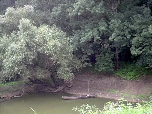 Lonjsko Polje Nature Park Natural site, Croatia15 km NW
-
 Ilova River, Sisak-Moslavina County21 km NW
Other regions in Sisak-Moslavina County
-
 Town of Novska District, Sisak-Moslavina County9.8 km NE
-
 Town of Kutina District, Sisak-Moslavina County28 km NW
-
Municipality of Hrvatska Dubica District, Sisak-Moslavina County13 km SW
-
Municipality of Lipovljani District, Sisak-Moslavina County14 km N
-
 Municipality of Sunja District, Sisak-Moslavina County29 km W
-
City of Sisak District, Sisak-Moslavina County50 km NW
Sources & licences
Data last updated: · 2 independent sources