Town of Kutina
Local name: Kutina
Located in Sisak-Moslavina County, Croatia Coordinates: 45°30′00″ N 16°45′00″ E

- Population
- 19,601
- 19.6K
- Elevation
- 142 m
- above sea level
- Local time
- UTC+01:00
- Europe/Zagreb · UTC+01:00
- Places inside
- 6
- listed under Town of Kutina
- Airports
- ZAG Zagreb Franjo Tuđman International Airport60 km
- BNX Banja Luka International Airport76 km
About Town of Kutina
Town of Kutina is a district. Location: Sisak-Moslavina County, Croatia. Population: 19,601.
Kutina is a town in central Croatia, the largest settlement in the hilly region of Moslavina, in the Sisak-Moslavina County. The town proper has a population of 13,735 (2011), while the total municipal population is 22,760.
Source: Wikipedia · CC BY-SA 4.0
Climate of Town of Kutina
Best months for sightseeingBest months for sightseeing: May–September.
This month · November
A cold month
Day 10° · Night 2° · Rain 89 mm
- Hottest month
- July (day 27°)
- Coldest month
- January (night -3°)
- Wettest month
- June (93 mm)
- Driest month
- February (53 mm)
Bars: average monthly low and high temperature. Below: precipitation. Monthly averages for 1970–2000 at about 18 km resolution, adjusted for elevation. Highlighted months are mild and relatively dry. Source: WorldClim 2.1 (CC BY 4.0).
Show values as a table
| Month | Jan | Feb | Mar | Apr | May | Jun | Jul | Aug | Sep | Oct | Nov | Dec |
|---|---|---|---|---|---|---|---|---|---|---|---|---|
| Average high (°C) | 4° | 7° | 12° | 16° | 22° | 25° | 27° | 27° | 22° | 17° | 10° | 5° |
| Average low (°C) | -3° | -1° | 2° | 6° | 10° | 14° | 15° | 14° | 11° | 7° | 2° | -1° |
| Precipitation (mm) | 57 | 53 | 63 | 76 | 81 | 93 | 83 | 85 | 80 | 83 | 89 | 70 |
Other places to visit in this season: May June July August September
How to get to Town of Kutina
The nearest airport is Zagreb Franjo Tuđman International Airport (ZAG), 60 km to the northwest as the crow flies. The nearest large city is Zagreb, 70 km to the northwest.
Airports
- Zagreb Franjo Tuđman International Airport (ZAG) Velika Gorica 60 kmnorthwest
- Banja Luka International Airport (BNX) Mahovljani 76 kmsoutheast
- Pécs-Pogány International Airport (PEV) Pécs 128 kmnortheast
Nearby large cities
- Zagreb Population: 663.6K 70 kmnorthwest
- Pécs Population: 145.3K 132 kmnortheast
- Rijeka Population: 108K 182 kmwest
- Ljubljana Population: 272.2K 185 kmwest
- Graz Population: 303.3K 201 kmnorthwest
Straight-line distances; road distances are longer. Airport data: OurAirports.
Day trips from Town of Kutina
Within 100 km: 10 historic and cultural sites, 19 natural sites, 45 lakes, rivers and coasts.
0–25 km6 places
- Sunja River 21 kmS
- Gora Moslavačka Mountain 18 kmN
- Lonjsko Polje Nature Park Natural site 15 kmS
- Lonja River 8 kmSW
25–60 km12 places
- Kašina River 55 kmNW
- Golinja River 57 kmW
- Sredska River 33 kmN
- Glavničica River 57 kmNW
60–100 km56 places
- Krndija Mountain 91 kmE
- Krka River 100 kmNW
- Cerje Mountain 79 kmSE
- Sokolovac Mountain 74 kmE
Straight-line distances.
Places in Town of Kutina
6 places- 1 Kutina 12K
- 2 Repušnica 1.6K
- 3 Banova Jaruga 605
- 4 Kutinska Slatina 508
- 5 Međurić 427
- 6 Šartovac 318
Bar: population relative to the most populous place in this list.
Nearby attractions & nature
Everything nearby-
 Ilova River, Sisak-Moslavina County9.3 km S
-
Lonja River, Croatia8.2 km SW
-
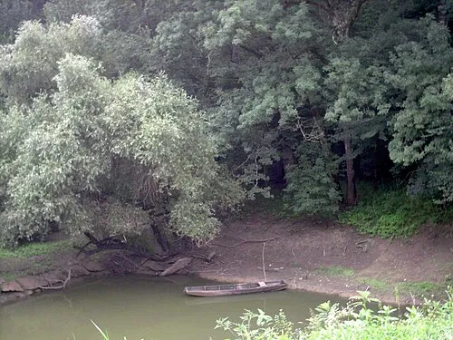 Lonjsko Polje Nature Park Natural site, Croatia15 km S
-
 Česma River, Sisak-Moslavina County22 km W
-
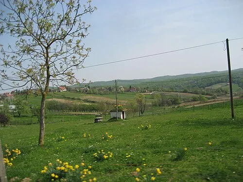 Gora Moslavačka Mountain, Croatia18 km N
-
Sunja River, Sisak-Moslavina County21 km S
Other regions in Sisak-Moslavina County
-
 Municipality of Velika Ludina District, Sisak-Moslavina County18 km NW
-
Town of Popovača District, Sisak-Moslavina County12 km NW
-
 Municipality of Sunja District, Sisak-Moslavina County20 km SW
-
City of Sisak District, Sisak-Moslavina County30 km W
-
 Town of Novska District, Sisak-Moslavina County27 km SE
-
 Municipality of Jasenovac District, Sisak-Moslavina County28 km SE
Sources & licences
Data last updated: · 2 independent sources