Town of Virovitica
Local name: Virovitica
Located in Virovitica-Podravina County, Croatia Coordinates: 45°49′54″ N 17°23′05″ E
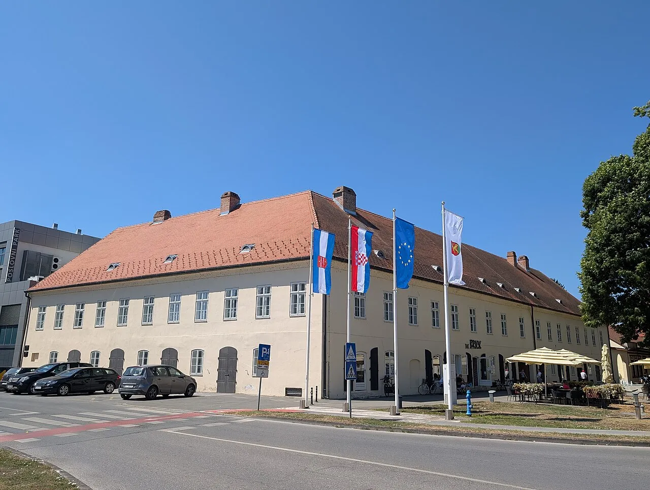
- Population
- 19,302
- 19.3K
- Elevation
- 124 m
- above sea level
- Local time
- UTC+01:00
- Europe/Zagreb · UTC+01:00
- Places inside
- 3
- listed under Town of Virovitica
- Airports
- PEV Pécs-Pogány International Airport69 km
- SOB Hévíz–Balaton Airport97 km
About Town of Virovitica
Town of Virovitica is a district. Location: Virovitica-Podravina County, Croatia. Population: 19,302.
Virovitica (pronounced [ʋirɔʋǐtit͡sa]) is a Croatian city near the Hungarian border. It is situated near the Drava river and belongs to the historic region of Slavonia. Virovitica has a population of 14,688, with 21,291 people in the municipality (census 2011). It is also the capital of Virovitica-Podravina County.
Source: Wikipedia · CC BY-SA 4.0
Twin towns and sister cities of Town of Virovitica
- Barcs· Hungary
Source: Wikidata. Only places with a page on this site are shown.
Population of Town of Virovitica over time
| 2001 | 15,589 | |
|---|---|---|
| 2011 | 21,291 | |
| 2021 | 19,302 |
Censuses and official estimates; source: Wikidata.
Climate of Town of Virovitica
Best months for sightseeingBest months for sightseeing: May–June, September.
This month · November
A cold month
Day 10° · Night 3° · Rain 78 mm
- Hottest month
- July (day 27°)
- Coldest month
- January (night -2°)
- Wettest month
- June (93 mm)
- Driest month
- February (43 mm)
Bars: average monthly low and high temperature. Below: precipitation. Monthly averages for 1970–2000 at about 18 km resolution, adjusted for elevation. Highlighted months are mild and relatively dry. Source: WorldClim 2.1 (CC BY 4.0).
Show values as a table
| Month | Jan | Feb | Mar | Apr | May | Jun | Jul | Aug | Sep | Oct | Nov | Dec |
|---|---|---|---|---|---|---|---|---|---|---|---|---|
| Average high (°C) | 4° | 7° | 12° | 17° | 22° | 25° | 27° | 27° | 22° | 17° | 10° | 5° |
| Average low (°C) | -2° | -1° | 3° | 7° | 12° | 15° | 16° | 16° | 12° | 7° | 3° | -1° |
| Precipitation (mm) | 49 | 43 | 51 | 64 | 76 | 93 | 76 | 82 | 68 | 69 | 78 | 59 |
How to get to Town of Virovitica
The nearest airport is Pécs-Pogány International Airport (PEV), 69 km to the east as the crow flies. The nearest large city is Pécs, 71 km to the northeast.
Airports
- Pécs-Pogány International Airport (PEV) Pécs 69 kmeast
- Hévíz–Balaton Airport (SOB) Sármellék 97 kmnorth
- Banja Luka International Airport (BNX) Mahovljani 99 kmsouth
Nearby large cities
- Pécs Population: 145.3K 71 kmnortheast
- Zagreb Population: 663.6K 109 kmwest
- Székesfehérvár Population: 101.6K 170 kmnortheast
- Graz Population: 303.3K 203 kmnorthwest
- Győr Population: 129.3K 207 kmnorth
Straight-line distances; road distances are longer. Airport data: OurAirports.
Day trips from Town of Virovitica
Within 100 km: 7 historic and cultural sites, 29 natural sites, 31 lakes, rivers and coasts.
0–25 km3 places
- Čađavica River 25 kmE
- Brana River 12 kmNE
- Barcs Ghetto Historic site 16 kmNE
25–60 km11 places
- Krndija Mountain 59 kmSE
- Sredska River 40 kmW
- Kistilos Mountain 57 kmNE
- Kisasszond Mountain 59 kmN
60–100 km53 places
- Kašina River 89 kmW
- Ledava River 93 kmNW
- Cerje Mountain 72 kmS
- Sokolovac Mountain 61 kmS
Straight-line distances.
Places in Town of Virovitica
3 placesBar: population relative to the most populous place in this list.
Nearby attractions & nature
Everything nearby-
Brana River, Croatia12 km NE
-
Barcs Ghetto Historic site, Somogy County16 km NE
-
Čađavica River, Croatia25 km E
Other regions in Virovitica-Podravina County
-
 Municipality of Gradina District, Virovitica-Podravina County10 km E
-
Municipality of Lukač District, Virovitica-Podravina County5.4 km NE
-
Municipality of Suhopolje District, Virovitica-Podravina County9.4 km E
-
Municipality of Špišić Bukovica District, Virovitica-Podravina County7.1 km NW
-
 Town of Slatina District, Virovitica-Podravina County29 km SE
-
Municipality of Pitomača District, Virovitica-Podravina County18 km NW
Sources & licences
Data last updated: · 2 independent sources