Town of Slatina
Local name: Slatina
Located in Virovitica-Podravina County, Croatia Coordinates: 45°42′00″ N 17°42′00″ E

- Population
- 11,503
- 11.5K
- Elevation
- 137 m
- above sea level
- Local time
- UTC+01:00
- Europe/Zagreb · UTC+01:00
- Places inside
- 6
- listed under Town of Slatina
- Airports
- PEV Pécs-Pogány International Airport53 km
- BNX Banja Luka International Airport90 km
About Town of Slatina
Town of Slatina is a district. Location: Virovitica-Podravina County, Croatia. Population: 11,503.
Slatina is a town in the Slavonia region of Croatia. It is located in the Virovitica-Podravina County, at the contact of the Drava valley and the foothills of Papuk mountain, in the central part of the region of Podravina, 29 km (18 mi) southeast of Virovitica; elevation 127 metres (417 feet). It was ruled by Ottoman Empire between 1542 and 1687, when it was captured by Austrian troops.
Source: Wikipedia · CC BY-SA 4.0
Photos of Town of Slatina
-

Krigla · CC BY-SA 4.0 -

Flammard · CC BY-SA 3.0 -

Flammard · CC BY-SA 3.0 -

Frane Lovošević · CC BY-SA 3.0 -

Frane Lovošević · CC BY-SA 3.0


Climate of Town of Slatina
Best months for sightseeingBest months for sightseeing: May–June, September.
This month · November
A cold month
Day 9° · Night 2° · Rain 71 mm
- Hottest month
- July (day 27°)
- Coldest month
- January (night -3°)
- Wettest month
- June (89 mm)
- Driest month
- February (39 mm)
Bars: average monthly low and high temperature. Below: precipitation. Monthly averages for 1970–2000 at about 18 km resolution, adjusted for elevation. Highlighted months are mild and relatively dry. Source: WorldClim 2.1 (CC BY 4.0).
Show values as a table
| Month | Jan | Feb | Mar | Apr | May | Jun | Jul | Aug | Sep | Oct | Nov | Dec |
|---|---|---|---|---|---|---|---|---|---|---|---|---|
| Average high (°C) | 3° | 6° | 11° | 17° | 22° | 25° | 27° | 27° | 22° | 17° | 9° | 4° |
| Average low (°C) | -3° | -2° | 2° | 6° | 11° | 14° | 15° | 15° | 11° | 6° | 2° | -2° |
| Precipitation (mm) | 44 | 39 | 44 | 57 | 70 | 89 | 68 | 71 | 59 | 62 | 71 | 55 |
How to get to Town of Slatina
The nearest airport is Pécs-Pogány International Airport (PEV), 53 km to the northeast as the crow flies. The nearest large city is Pécs, 59 km to the northeast.
Airports
- Pécs-Pogány International Airport (PEV) Pécs 53 kmnortheast
- Banja Luka International Airport (BNX) Mahovljani 90 kmsouth
- Osijek Airport (OSI) Osijek(Klisa) 91 kmeast
Nearby large cities
- Pécs Population: 145.3K 59 kmnortheast
- Zagreb Population: 663.6K 135 kmwest
- Székesfehérvár Population: 101.6K 174 kmnorth
- Szeged Population: 160.8K 199 kmeast
- Kecskemét Population: 109.8K 204 kmnortheast
Straight-line distances; road distances are longer. Airport data: OurAirports.
Day trips from Town of Slatina
Within 100 km: 8 historic and cultural sites, 30 natural sites, 24 lakes, rivers and coasts.
0–25 km4 places
- Papuk Mountain 21 kmS
- Čađavica River 12 kmN
- Brana River 25 kmNW
- Vágsellye Ghetto Historic site 22 kmNE
25–60 km17 places
- Krndija Mountain 33 kmSE
- Cerje Mountain 55 kmS
- Sokolovac Mountain 42 kmS
- Cerovac Mountain 50 kmS
60–100 km41 places
- Sunja River 84 kmSW
- Sredska River 65 kmW
- Karašica River 70 kmE
- Strand Beach 83 kmNE
Straight-line distances.
Places in Town of Slatina
6 placesBar: population relative to the most populous place in this list.
Nearby attractions & nature
Everything nearby-
Čađavica River, Croatia12 km N
-
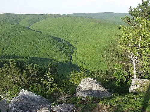 Papuk Mountain, Požega-Slavonia County21 km S
-
Vágsellye Ghetto Historic site, Baranya22 km NE
-
Brana River, Croatia25 km NW
Other regions in Virovitica-Podravina County
-
Municipality of Nova Bukovica District, Virovitica-Podravina County7 km SE
-
Town of Orahovica District, Virovitica-Podravina County24 km SE
-
Municipality of Sopje District, Virovitica-Podravina County12 km N
-
Town of Virovitica District, Virovitica-Podravina County29 km NW
-
 Municipality of Gradina District, Virovitica-Podravina County23 km NW
-
Municipality of Čađavica District, Virovitica-Podravina County13 km E
Sources & licences
Data last updated: · 2 independent sources