Bobota
Located in Municipality of Trpinja, Vukovar-Srijem County Coordinates: 45°25′16″ N 18°51′14″ E

- Population
- 1,202
- 1.2K
- Elevation
- 84 m
- above sea level
- Local time
- UTC+01:00
- Europe/Zagreb · UTC+01:00
- Airports
- OSI Osijek Airport6 km
- PEV Pécs-Pogány International Airport79 km
About Bobota
Bobota is a village. Location: Municipality of Trpinja, Vukovar-Srijem County. Population: 1,202. Elevation: 84 m.
Bobota (Serbian Cyrillic: Бобота) is a village in the municipality of Trpinja in Vukovar-Syrmia County in eastern Croatia. Regional Bobota Canal, the first major water management project in modern-day Croatia in the post-Roman Empire period, was named after the village. According to 2011 Census Bobota, had a population of 1,491 inhabitants. Bobota is centrally located within the municipality and is its largest settlement with its total population just marginally ahead of Trpinja.
Source: Wikipedia · CC BY-SA 4.0
At a glance
- Area
- 34.6 km²
Source: Wikidata
Photos of Bobota
-

MirkoS18 · CC BY-SA 4.0 -

MirkoS18 · CC BY-SA 4.0 -

Bojana Wiki PG · CC BY-SA 4.0


Climate of Bobota
Best months for sightseeingBest months for sightseeing: May, September.
This month · November
A cold month
Day 10° · Night 1° · Rain 60 mm
- Hottest month
- August (day 28°)
- Coldest month
- January (night -3°)
- Wettest month
- June (83 mm)
- Driest month
- February (37 mm)
Bars: average monthly low and high temperature. Below: precipitation. Monthly averages for 1970–2000 at about 18 km resolution, adjusted for elevation. Highlighted months are mild and relatively dry. Source: WorldClim 2.1 (CC BY 4.0).
Show values as a table
| Month | Jan | Feb | Mar | Apr | May | Jun | Jul | Aug | Sep | Oct | Nov | Dec |
|---|---|---|---|---|---|---|---|---|---|---|---|---|
| Average high (°C) | 3° | 6° | 12° | 17° | 23° | 26° | 27° | 28° | 23° | 17° | 10° | 5° |
| Average low (°C) | -3° | -2° | 1° | 6° | 11° | 14° | 15° | 15° | 11° | 6° | 1° | -2° |
| Precipitation (mm) | 42 | 37 | 40 | 52 | 60 | 83 | 66 | 60 | 49 | 52 | 60 | 51 |
How to get to Bobota
The nearest airport is Osijek Airport (OSI), 6 km to the northwest as the crow flies. For international flights: Pécs-Pogány International Airport (PEV) (79 km). The nearest large city is Pécs, 88 km to the northwest.
Airports
- Osijek Airport (OSI) Osijek(Klisa) 6 kmnorthwest
- Pécs-Pogány International Airport (PEV) Pécs 79 kmnorthwest
- Tuzla International Airport (TZL) Dubrave Gornje 107 kmsouth
Nearby large cities
- Pécs Population: 145.3K 88 kmnorthwest
- Tuzla Population: 142.5K 99 kmsouth
- Szeged Population: 160.8K 137 kmnortheast
- Zemun Population: 155.6K 137 kmsoutheast
- New Belgrade Population: 209.8K 141 kmsoutheast
Straight-line distances; road distances are longer. Airport data: OurAirports.
Day trips from Bobota
Within 100 km: 13 historic and cultural sites, 28 natural sites, 37 lakes, rivers and coasts.
0–25 km8 places
- Island of Vukovar Island 16 kmSE
- Živica River 17 kmE
- Manastir Bođani Attraction 20 kmE
- Kopački Rit Nature Park Natural site 19 kmN
25–60 km12 places
- Busača Lake 57 kmSW
- Šarengradska Ada Island 35 kmSE
- Plazović River 42 kmN
- Studva River 54 kmSE
60–100 km58 places
- Krndija Mountain 73 kmW
- Zasavica River 75 kmSE
- Police Custody Camp Šabac Historic site 100 kmSE
- Soline Mountain 88 kmSW
Straight-line distances.
Nearby attractions & nature
Everything nearby-
 Vuka River, Croatia14 km SE
-
 Manastir Bođani Attraction, Opština Bač20 km E
-
 Vučedol Historic site, Vukovar-Srijem County18 km SE
-
Vučica River, Croatia8.9 km SW
-
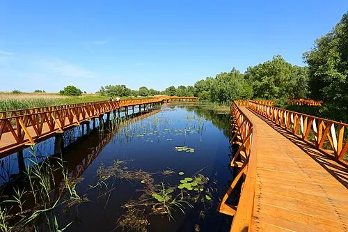 Kopački Rit Nature Park Natural site, County of Osijek-Baranja19 km N
-
 Drava River River, Austria15 km N
Sources & licences
Data last updated: · 2 independent sources