Vučedol
Located in Vukovar-Srijem County, Croatia Coordinates: 45°20′14″ N 19°03′21″ E
- Local time
- UTC+01:00
- Europe/Zagreb · UTC+01:00
- Elevation
- 106 m
- above sea level
- Airports
- OSI Osijek Airport24 km
- PEV Pécs-Pogány International Airport96 km
About Vučedol
Vučedol is a historic site. Location: Vukovar-Srijem County, Croatia.
Vučedol (lit. 'Wolf's Valley') in Croatia, is an archeological site, an elevated ground on the right bank of the River Danube, which also forms the border with Serbia. Vučedol became the eponym of the eneolithic Vučedol culture. It is estimated that the site had once been home to about 3,000 inhabitants, making it one of the largest and most important European centers of its time. Artifacts from the Vučedol site are located in the Archaeological Museum in Zagreb, and the City museum of Vukovar.
Source: Wikipedia · CC BY-SA 4.0
Climate of Vučedol
Best months for sightseeingBest months for sightseeing: May–June, September.
This month · November
A cold month
Day 9° · Night 1° · Rain 58 mm
- Hottest month
- July (day 27°)
- Coldest month
- January (night -3°)
- Wettest month
- June (82 mm)
- Driest month
- February (36 mm)
Bars: average monthly low and high temperature. Below: precipitation. Monthly averages for 1970–2000 at about 18 km resolution, adjusted for elevation. Highlighted months are mild and relatively dry. Source: WorldClim 2.1 (CC BY 4.0).
Show values as a table
| Month | Jan | Feb | Mar | Apr | May | Jun | Jul | Aug | Sep | Oct | Nov | Dec |
|---|---|---|---|---|---|---|---|---|---|---|---|---|
| Average high (°C) | 3° | 6° | 12° | 17° | 22° | 25° | 27° | 27° | 23° | 17° | 9° | 5° |
| Average low (°C) | -3° | -2° | 1° | 6° | 11° | 14° | 15° | 14° | 11° | 6° | 1° | -2° |
| Precipitation (mm) | 40 | 36 | 39 | 52 | 58 | 82 | 66 | 58 | 47 | 50 | 58 | 50 |
How to get to Vučedol
The nearest airport is Osijek Airport (OSI), 24 km to the northwest as the crow flies. For international flights: Pécs-Pogány International Airport (PEV) (96 km). The nearest large city is Pécs, 104 km to the northwest.
Airports
- Osijek Airport (OSI) Osijek(Klisa) 24 kmnorthwest
- Pécs-Pogány International Airport (PEV) Pécs 96 kmnorthwest
- Tuzla International Airport (TZL) Dubrave Gornje 101 kmsouth
Nearby large cities
- Pécs Population: 145.3K 104 kmnorthwest
- Szeged Population: 160.8K 133 kmnortheast
- Timișoara Population: 250.8K 176 kmeast
- Kecskemét Population: 109.8K 181 kmnorth
- Arad Population: 169.1K 199 kmnortheast
Straight-line distances; road distances are longer. Airport data: OurAirports.
Nearby attractions & nature
Everything nearbyNearest towns and villages
-
 Vukovar City, City of Vukovar4.5 km W
-
Sotin Village, City of Vukovar5.3 km SE
-
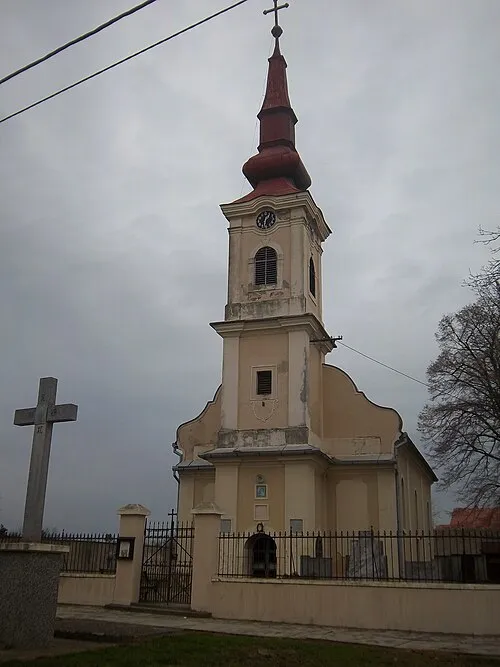 Negoslavci City, Municipality of Negoslavci7.9 km SW
-
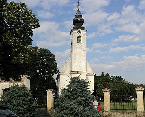 Borovo City, Municipality of Borovo9.8 km NW
Sources & licences
Data last updated: · 2 independent sources