Vlkov pod Oškobrhem
Located in Nymburk District, Central Bohemia Coordinates: 50°09′35″ N 15°13′03″ E
- Elevation
- 219 m
- above sea level
- Local time
- UTC+01:00
- Europe/Prague · UTC+01:00
- Places inside
- 1
- listed under Vlkov pod Oškobrhem
- Airports
- PED Pardubice Airport41 km
- PRG Václav Havel Airport Prague69 km
About Vlkov pod Oškobrhem
Vlkov pod Oškobrhem is a municipality. Location: Nymburk District, Central Bohemia. Elevation: 219 m. The best months to visit are May–September. The nearest airport is Pardubice Airport (41 km). Nearby sights include Oškobrh and Hořánck.
Photos of Vlkov pod Oškobrhem
-
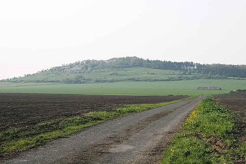
Oškobrh Zp at cs.wikipedia · CC BY-SA 3.0

Climate of Vlkov pod Oškobrhem
Best months for sightseeingBest months for sightseeing: May–September.
This month · November
A cold month
Day 7° · Night 2° · Rain 30 mm
- Hottest month
- August (day 25°)
- Coldest month
- January (night -3°)
- Wettest month
- July (74 mm)
- Driest month
- February (19 mm)
Bars: average monthly low and high temperature. Below: precipitation. Monthly averages for 1970–2000 at about 18 km resolution, adjusted for elevation. Highlighted months are mild and relatively dry. Source: WorldClim 2.1 (CC BY 4.0).
Show values as a table
| Month | Jan | Feb | Mar | Apr | May | Jun | Jul | Aug | Sep | Oct | Nov | Dec |
|---|---|---|---|---|---|---|---|---|---|---|---|---|
| Average high (°C) | 2° | 4° | 9° | 14° | 20° | 22° | 24° | 25° | 19° | 13° | 7° | 3° |
| Average low (°C) | -3° | -3° | 1° | 4° | 9° | 12° | 13° | 13° | 9° | 5° | 2° | -2° |
| Precipitation (mm) | 20 | 19 | 26 | 31 | 60 | 69 | 74 | 62 | 38 | 30 | 30 | 25 |
Other places to visit in this season: May June July August September
How to get to Vlkov pod Oškobrhem
The nearest airport is Pardubice Airport (PED), 41 km to the southeast as the crow flies. The nearest large city is Prague, 58 km to the west.
Airports
- Pardubice Airport (PED) Pardubice 41 kmsoutheast
- Václav Havel Airport Prague (PRG) Prague 69 kmwest
- České Budějovice South Bohemian Airport (JCL) České Budějovice 146 kmsouthwest
Nearby large cities
- Prague Population: 1.2M 58 kmwest
- Dresden Population: 564.9K 144 kmnorthwest
- Brno Population: 404.3K 147 kmsoutheast
- Chemnitz Population: 247.2K 179 kmnorthwest
- Linz Population: 204.8K 217 kmsouth
Straight-line distances; road distances are longer. Airport data: OurAirports.
Day trips from Vlkov pod Oškobrhem
Within 100 km: 53 historic and cultural sites, 594 natural sites, 8 lakes, rivers and coasts.
0–25 km3 places
- Hořánck Mountain 11 kmS
- Horky Mountain 25 kmW
- Oškobrh Mountain 2 kmS
25–60 km40 places
- Lysá Mountain 52 kmNW
- Slovanský ostrov Island 58 kmW
- Dětský ostrov Island 59 kmW
- Veslařský ostrov Island 58 kmW
60–100 km612 places
- Královský vršek Mountain 87 kmS
- Tvarožník Mountain 73 kmN
- Hořidla Mountain 80 kmNW
- Vosí vrch Mountain 100 kmNW
Straight-line distances.
Places in Vlkov pod Oškobrhem
1 placeBar: population relative to the most populous place in this list.
Nearby attractions & nature
Everything nearbySources & licences
Data last updated: