- Population
- 4,220
- 4.2K
- Elevation
- 254 m
- above sea level
- Local time
- UTC+01:00
- Europe/Prague · UTC+01:00
- Airports
- PRG Václav Havel Airport Prague30 km
- PED Pardubice Airport77 km
About Šestajovice
Šestajovice is a village. Location: Šestajovice, Okres Praha-východ. Population: 4,220. Elevation: 254 m. The best months to visit are May–September. The nearest airport is Václav Havel Airport Prague (30 km). Nearby sights include Kinsky Palace and National Museum.
Climate of Šestajovice
Best months for sightseeingBest months for sightseeing: May–September.
This month · November
A cold month
Day 6° · Night 2° · Rain 31 mm
- Hottest month
- August (day 24°)
- Coldest month
- January (night -3°)
- Wettest month
- July (74 mm)
- Driest month
- February (21 mm)
Bars: average monthly low and high temperature. Below: precipitation. Monthly averages for 1970–2000 at about 18 km resolution, adjusted for elevation. Highlighted months are mild and relatively dry. Source: WorldClim 2.1 (CC BY 4.0).
Show values as a table
| Month | Jan | Feb | Mar | Apr | May | Jun | Jul | Aug | Sep | Oct | Nov | Dec |
|---|---|---|---|---|---|---|---|---|---|---|---|---|
| Average high (°C) | 2° | 4° | 9° | 14° | 19° | 22° | 24° | 24° | 19° | 13° | 6° | 3° |
| Average low (°C) | -3° | -2° | 1° | 4° | 9° | 12° | 13° | 13° | 9° | 5° | 2° | -1° |
| Precipitation (mm) | 22 | 21 | 28 | 30 | 64 | 68 | 74 | 65 | 39 | 31 | 31 | 26 |
Other places to visit in this season: May June July August September
How to get to Šestajovice
The nearest airport is Václav Havel Airport Prague (PRG), 30 km to the west as the crow flies. The nearest large city is Prague, 19 km to the west.
Airports
- Václav Havel Airport Prague (PRG) Prague 30 kmwest
- Pardubice Airport (PED) Pardubice 77 kmeast
- Karlovy Vary Airport (KLV) Karlovy Vary 127 kmwest
Nearby large cities
- Prague Population: 1.2M 19 kmwest
- Dresden Population: 564.9K 124 kmnorthwest
- Chemnitz Population: 247.2K 148 kmnorthwest
- Brno Population: 404.3K 172 kmsoutheast
- Linz Population: 204.8K 202 kmsouth
Straight-line distances; road distances are longer. Airport data: OurAirports.
Day trips from Šestajovice
Within 100 km: 41 historic and cultural sites, 488 natural sites, 23 lakes, rivers and coasts.
0–25 km16 places
- Slovanský ostrov Island 19 kmW
- Dětský ostrov Island 20 kmW
- Veslařský ostrov Island 20 kmW
- Horky Mountain 14 kmE
25–60 km58 places
- Lysá Mountain 49 kmN
- Hořidla Mountain 56 kmNW
- Hořice Mountain 43 kmN
- Hořánck Mountain 42 kmE
60–100 km478 places
- Tvarožník Mountain 96 kmNE
- Vosí vrch Mountain 89 kmN
- Svatý Prokop Landmark 96 kmW
- Taubenteich Lake 90 kmNW
Straight-line distances.
Nearby attractions & nature
Everything nearby-
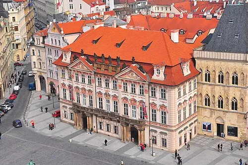 Kinsky Palace Historic site, Praha 119 km W
-
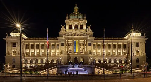 National Museum Museum, Praha 118 km W
-
Charles Bridge Landmark, Praha 119 km W
-
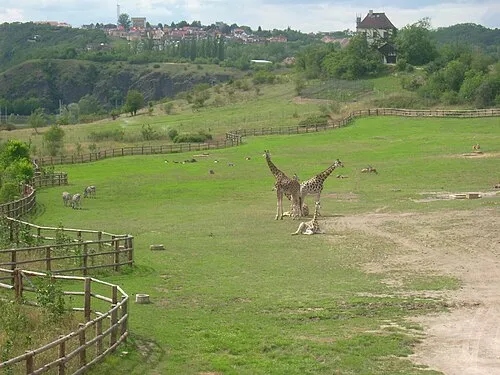 Prague Zoo Attraction, Praha-Troja20 km W
-
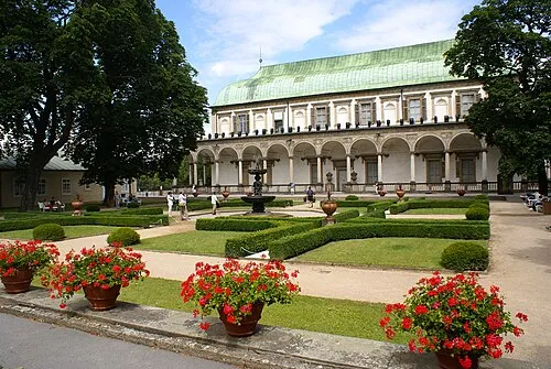 Letohrádek královny Anny Historic site, Praha 120 km W
-
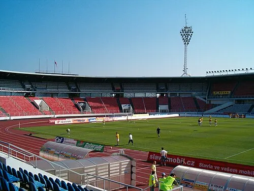 Stadion Evžena Rošického Landmark, Praha 621 km W
Sources & licences
Data last updated: