Sudovo Hlavno
Located in Okres Praha-východ, Central Bohemia Coordinates: 50°16′25″ N 14°41′04″ E
- Elevation
- 209 m
- above sea level
- Local time
- UTC+01:00
- Europe/Prague · UTC+01:00
- Places inside
- 1
- listed under Sudovo Hlavno
- Airports
- PRG Václav Havel Airport Prague36 km
- PED Pardubice Airport81 km
About Sudovo Hlavno
Sudovo Hlavno is a municipality. Location: Okres Praha-východ, Central Bohemia. Elevation: 209 m. The best months to visit are May–September. The nearest airport is Václav Havel Airport Prague (36 km). Nearby sights include Horka and Chotětov [Chotětov].
Photos of Sudovo Hlavno
-
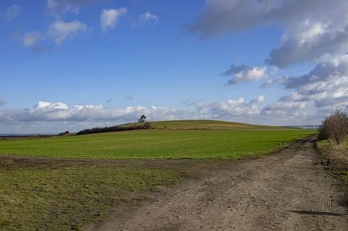
Horka The photonaut · CC BY-SA 4.0

Climate of Sudovo Hlavno
Best months for sightseeingBest months for sightseeing: May–September.
This month · November
A cold month
Day 6° · Night 2° · Rain 32 mm
- Hottest month
- August (day 24°)
- Coldest month
- January (night -3°)
- Wettest month
- July (77 mm)
- Driest month
- February (21 mm)
Bars: average monthly low and high temperature. Below: precipitation. Monthly averages for 1970–2000 at about 18 km resolution, adjusted for elevation. Highlighted months are mild and relatively dry. Source: WorldClim 2.1 (CC BY 4.0).
Show values as a table
| Month | Jan | Feb | Mar | Apr | May | Jun | Jul | Aug | Sep | Oct | Nov | Dec |
|---|---|---|---|---|---|---|---|---|---|---|---|---|
| Average high (°C) | 2° | 4° | 9° | 14° | 20° | 22° | 24° | 24° | 19° | 13° | 6° | 3° |
| Average low (°C) | -3° | -2° | 1° | 4° | 9° | 12° | 13° | 13° | 10° | 6° | 2° | -1° |
| Precipitation (mm) | 23 | 21 | 29 | 30 | 66 | 68 | 77 | 69 | 40 | 33 | 32 | 27 |
Other places to visit in this season: May June July August September
How to get to Sudovo Hlavno
The nearest airport is Václav Havel Airport Prague (PRG), 36 km to the southwest as the crow flies. The nearest large city is Prague, 28 km to the southwest.
Airports
- Václav Havel Airport Prague (PRG) Prague 36 kmsouthwest
- Pardubice Airport (PED) Pardubice 81 kmeast
- Dresden Airport (DRS) Dresden 116 kmnorthwest
Nearby large cities
- Prague Population: 1.2M 28 kmsouthwest
- Dresden Population: 564.9K 109 kmnorthwest
- Chemnitz Population: 247.2K 139 kmnorthwest
- Brno Population: 404.3K 183 kmsoutheast
- Gera Population: 104.7K 196 kmwest
Straight-line distances; road distances are longer. Airport data: OurAirports.
Day trips from Sudovo Hlavno
Within 100 km: 84 historic and cultural sites, 789 natural sites, 54 lakes, rivers and coasts.
0–25 km7 places
- Vrátenská hora [Nosálov-Libovice] Mountain 23 kmN
- Chotětov [Chotětov] Mountain 12 kmNE
- Horky Mountain 21 kmSE
- Horka Mountain 5 kmE
25–60 km108 places
- Lysá Mountain 31 kmN
- Hořidla Mountain 42 kmNW
- Slovanský ostrov Island 29 kmSW
- Dětský ostrov Island 29 kmSW
60–100 km812 places
- Erzgebirge Mountain 93 kmNW
- Pirna-Sonnenstein Mountain 92 kmNW
- Tvarožník Mountain 82 kmNE
- Vosí vrch Mountain 71 kmN
Straight-line distances.
Places in Sudovo Hlavno
1 placeBar: population relative to the most populous place in this list.
Nearby attractions & nature
Everything nearby-
Horka Mountain, Mečeříž4.8 km E
-
Chotětov [Chotětov] Mountain, Chotětov12 km NE
-
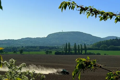 Vrátenská hora [Nosálov-Libovice] Mountain, Liberec Region23 km N
-
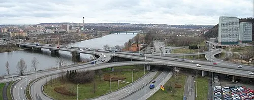 Most Barikádníků Landmark, Praha 725 km SW
-
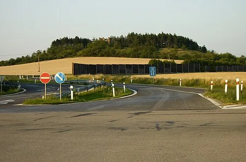 Břístevská hůra u Starého Vestce Mountain, Bříství19 km SE
-
Horky Mountain, Chrást21 km SE
-
Jungfern Breschan Concentration Camp Historic site, Panenské Břežany18 km W
Sources & licences
Data last updated: