Bílčice
Located in Bruntál District, Moravian-Silesian Region Coordinates: 49°52′07″ N 17°33′53″ E
- Elevation
- 570 m
- above sea level
- Local time
- UTC+01:00
- Europe/Prague · UTC+01:00
- Places inside
- 1
- listed under Bílčice
- Airports
- OSR Leoš Janáček Airport Ostrava44 km
- BRQ Brno-Tuřany Airport102 km
About Bílčice
Bílčice is a municipality. Location: Bruntál District, Moravian-Silesian Region. Elevation: 570 m. The best months to visit are June–August. The nearest airport is Leoš Janáček Airport Ostrava (44 km). Nearby sights include Stráž and Kamenec [Lomnice u Rýmařova].
Climate of Bílčice
Best months for sightseeingBest months for sightseeing: June–August.
This month · November
A cold month
Day 4° · Night -1° · Rain 47 mm
- Hottest month
- July (day 21°)
- Coldest month
- January (night -5°)
- Wettest month
- June (102 mm)
- Driest month
- February (33 mm)
Bars: average monthly low and high temperature. Below: precipitation. Monthly averages for 1970–2000 at about 18 km resolution, adjusted for elevation. Highlighted months are mild and relatively dry. Source: WorldClim 2.1 (CC BY 4.0).
Show values as a table
| Month | Jan | Feb | Mar | Apr | May | Jun | Jul | Aug | Sep | Oct | Nov | Dec |
|---|---|---|---|---|---|---|---|---|---|---|---|---|
| Average high (°C) | 0° | 1° | 5° | 10° | 16° | 19° | 21° | 21° | 16° | 11° | 4° | 1° |
| Average low (°C) | -5° | -5° | -2° | 1° | 6° | 9° | 11° | 10° | 7° | 3° | -1° | -4° |
| Precipitation (mm) | 34 | 33 | 34 | 46 | 76 | 102 | 94 | 95 | 64 | 44 | 47 | 45 |
How to get to Bílčice
The nearest airport is Leoš Janáček Airport Ostrava (OSR), 44 km to the southeast as the crow flies. The nearest large city is Brno, 102 km to the southwest.
Airports
- Leoš Janáček Airport Ostrava (OSR) Mošnov 44 kmsoutheast
- Brno-Tuřany Airport (BRQ) Brno 102 kmsouthwest
- Katowice Wojciech Korfanty International Airport (KTW) Katowice 128 kmnortheast
Nearby large cities
- Brno Population: 404.3K 102 kmsouthwest
- Bratislava Population: 423.7K 194 kmsouth
- Prague Population: 1.2M 227 kmwest
- Győr Population: 129.3K 243 kmsouth
- Linz Population: 204.8K 296 kmsouthwest
Straight-line distances; road distances are longer. Airport data: OurAirports.
Day trips from Bílčice
Within 100 km: 15 historic and cultural sites, 499 natural sites, 1 lake, river or coast.
0–25 km14 places
- Kamenná Mountain 14 kmW
- Vinice Mountain 22 kmN
- Tri Lípy Mountain 15 kmW
- Stráž Mountain 7 kmS
25–60 km114 places
- Tylna Kopa Mountain 49 kmN
- Olszak Mountain 48 kmN
- Kowadło Mountain 59 kmNW
- Pasieczna Mountain 59 kmNW
60–100 km387 places
- Korňa River 91 kmSE
- Gírová Mountain 97 kmE
- Strčí Hlava Mountain 86 kmSE
- Sucha Kopa Mountain 62 kmNW
Straight-line distances.
Places in Bílčice
1 placeBar: population relative to the most populous place in this list.
Nearby attractions & nature
Everything nearby-
Stráž Mountain, Dvorce7.1 km S
-
Kamenec [Lomnice u Rýmařova] Mountain, Lomnice8.9 km W
-
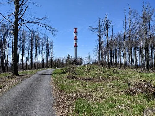 Slunečná Mountain, Dětřichov nad Bystřicí10 km W
-
Kamenná Mountain, Moravian-Silesian Region14 km W
-
Tri Lípy Mountain, Moravian-Silesian Region15 km W
-
Jeseníky Mountain, Moravian-Silesian Region17 km W
-
Rudná Mountain, Široká Niva18 km N
-
Freudenthal Concentration Camp (Bruntál) Historic site, Bruntál15 km NW
Sources & licences
Data last updated: