Cukrová Bouda
Located in Tatenice, Ústí nad Orlicí District Coordinates: 49°53′01″ N 16°43′47″ E
- Elevation
- 605 m
- above sea level
- Local time
- UTC+01:00
- Europe/Prague · UTC+01:00
- Airports
- PED Pardubice Airport73 km
- BRQ Brno-Tuřany Airport82 km
About Cukrová Bouda
Cukrová Bouda is a mountain. Location: Tatenice, Ústí nad Orlicí District. Elevation: 605 m. The best months to visit are June–August. The nearest airport is Pardubice Airport (73 km). Nearby sights include Mírovská and Lazek.
Photos of Cukrová Bouda
-
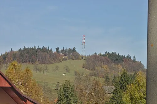
Lazek I would appreciate being notified if you use my work outside Wikimedia. More of my work can be found in my personal gall · CC BY-SA 4.0

Climate of Cukrová Bouda
Best months for sightseeingBest months for sightseeing: June–August.
This month · November
A cold month
Day 4° · Night -1° · Rain 39 mm
- Hottest month
- August (day 21°)
- Coldest month
- January (night -6°)
- Wettest month
- June (92 mm)
- Driest month
- February (26 mm)
Bars: average monthly low and high temperature. Below: precipitation. Monthly averages for 1970–2000 at about 18 km resolution, adjusted for elevation. Highlighted months are mild and relatively dry. Source: WorldClim 2.1 (CC BY 4.0).
Show values as a table
| Month | Jan | Feb | Mar | Apr | May | Jun | Jul | Aug | Sep | Oct | Nov | Dec |
|---|---|---|---|---|---|---|---|---|---|---|---|---|
| Average high (°C) | -1° | 1° | 5° | 11° | 16° | 19° | 21° | 21° | 16° | 11° | 4° | 0° |
| Average low (°C) | -6° | -6° | -2° | 1° | 6° | 9° | 10° | 10° | 7° | 3° | -1° | -5° |
| Precipitation (mm) | 27 | 26 | 30 | 38 | 64 | 92 | 85 | 75 | 51 | 38 | 39 | 34 |
How to get to Cukrová Bouda
The nearest airport is Pardubice Airport (PED), 73 km to the west as the crow flies. The nearest large city is Brno, 77 km to the south.
Airports
- Pardubice Airport (PED) Pardubice 73 kmwest
- Brno-Tuřany Airport (BRQ) Brno 82 kmsouth
- Leoš Janáček Airport Ostrava (OSR) Mošnov 102 kmeast
Nearby large cities
- Brno Population: 404.3K 77 kmsouth
- Prague Population: 1.2M 167 kmwest
- Bratislava Population: 423.7K 195 kmsouth
- Dresden Population: 564.9K 249 kmnorthwest
- Linz Population: 204.8K 250 kmsouthwest
Straight-line distances; road distances are longer. Airport data: OurAirports.
Day trips from Cukrová Bouda
Within 100 km: 36 historic and cultural sites, 609 natural sites.
0–25 km43 places
- Vysoký Kámen Mountain 22 kmN
- Trlina Mountain 16 kmE
- Skalka Mountain 11 kmSE
- Roh Mountain 21 kmSW
25–60 km248 places
- Sucha Kopa Mountain 44 kmN
- Úsobrnka Natural site 34 kmS
- Goworek Mountain 34 kmN
- Kłobuk Mountain 53 kmN
60–100 km354 places
- Královský vršek Mountain 98 kmSW
- Ptak Mountain 70 kmNW
- Leszek Mountain 71 kmN
- Klimek Mountain 71 kmN
Straight-line distances.
Nearest towns and villages
Nearby attractions & nature
Everything nearby-
Mírovská Mountain, Hynčina3.8 km SE
-
Lazek Mountain, Cotkytle5 km N
-
Vrchy Mountain, Hynčina7.7 km SE
-
Háječek Mountain, Zborov9.7 km NE
-
Kalvárie Mountain, Jestřebí9.8 km SE
-
Pustina [Horní Studénky] outlook p. Mountain, Horní Studénky11 km NE
-
Skalka Mountain, Jestřebí11 km SE
-
Buková hora Mountain, Čenkovice14 km N
Sources & licences
Data last updated: · 2 independent sources