Záblatíčko
Located in Dříteň, České Budějovice District Coordinates: 49°07′48″ N 14°16′11″ E

- Population
- 253
- 253
- Elevation
- 411 m
- above sea level
- Local time
- UTC+01:00
- Europe/Prague · UTC+01:00
- Airports
- JCL České Budějovice South Bohemian Airport23 km
- LNZ Linz-Hörsching Airport100 km
About Záblatíčko
Záblatíčko is a village. Location: Dříteň, České Budějovice District. Population: 253. Elevation: 411 m. The best months to visit are May–September. The nearest airport is České Budějovice South Bohemian Airport (23 km). Nearby sights include Číčenice [Číčenice] and Mužský.
At a glance
- Area
- 2.6 km²
Source: Wikidata
Photos of Záblatíčko
-

JAn Dudík · CC BY-SA 4.0 -

Richenza · CC BY-SA 3.0 -

Czeva · CC BY-SA 3.0


Population of Záblatíčko over time
| 1900 | 215 | |
|---|---|---|
| 1910 | 253 | |
| 1921 | 249 | |
| 1930 | 234 | |
| 1950 | 181 | |
| 1961 | 173 | |
| 1970 | 140 | |
| 1980 | 112 | |
| 1991 | 107 | |
| 2001 | 80 | |
| 2011 | 71 | |
| 2021 | 68 |
Censuses and official estimates; source: Wikidata.
Climate of Záblatíčko
Best months for sightseeingBest months for sightseeing: May–September.
This month · November
A cold month
Day 6° · Night 0° · Rain 53 mm
- Hottest month
- July (day 24°)
- Coldest month
- January (night -4°)
- Wettest month
- July (93 mm)
- Driest month
- February (43 mm)
Bars: average monthly low and high temperature. Below: precipitation. Monthly averages for 1970–2000 at about 18 km resolution, adjusted for elevation. Highlighted months are mild and relatively dry. Source: WorldClim 2.1 (CC BY 4.0).
Show values as a table
| Month | Jan | Feb | Mar | Apr | May | Jun | Jul | Aug | Sep | Oct | Nov | Dec |
|---|---|---|---|---|---|---|---|---|---|---|---|---|
| Average high (°C) | 2° | 4° | 8° | 14° | 19° | 22° | 24° | 24° | 19° | 13° | 6° | 2° |
| Average low (°C) | -4° | -4° | -1° | 3° | 8° | 11° | 13° | 12° | 8° | 4° | 0° | -3° |
| Precipitation (mm) | 49 | 43 | 49 | 46 | 67 | 85 | 93 | 76 | 56 | 48 | 53 | 58 |
Other places to visit in this season: May June July August September
How to get to Záblatíčko
The nearest airport is České Budějovice South Bohemian Airport (JCL), 23 km to the southeast as the crow flies. The nearest large city is Linz, 92 km to the south.
Airports
- České Budějovice South Bohemian Airport (JCL) České Budějovice 23 kmsoutheast
- Linz-Hörsching Airport (LNZ) Linz 100 kmsouth
- Václav Havel Airport Prague (PRG) Prague 108 kmnorth
Nearby large cities
- Linz Population: 204.8K 92 kmsouth
- Prague Population: 1.2M 107 kmnorth
- Regensburg Population: 151.4K 159 kmwest
- Brno Population: 404.3K 171 kmeast
- Salzburg Population: 157.2K 174 kmsouthwest
Straight-line distances; road distances are longer. Airport data: OurAirports.
Day trips from Záblatíčko
Within 100 km: 84 historic and cultural sites, 936 natural sites, 276 lakes, rivers and coasts.
0–25 km16 places
- Zlatý vrch [Heřmaň] Mountain 16 kmNW
- Zdoba Mountain 11 kmNE
- Vysoká Běta Mountain 17 kmS
- Vrata Mountain 22 kmSW
25–60 km180 places
- Steinberg Mountain 59 kmE
- Brennesselberg Mountain 58 kmE
- Birkenberg Mountain 56 kmE
- Hüttenberg Mountain 56 kmE
60–100 km1,100 places
- Biber-Revier River 93 kmW
- Gusen I Concentration Camp Historic site 98 kmS
- Unter-Rosenhofer Teich Lake 70 kmSE
- Ober-Rosenhofer Teich Lake 69 kmSE
Straight-line distances.
Nearby attractions & nature
Everything nearby-
Číčenice [Číčenice] Mountain, Číčenice4.5 km NW
-
Mužský Mountain, Olšovice9 km S
-
Zdoba Mountain, Všemyslice11 km NE
-
Velký Kameník Mountain, Hluboká nad Vltavou13 km E
-
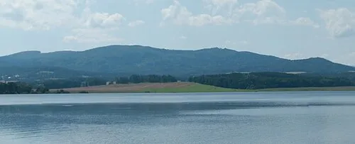 Vysoká Běta Mountain, Brloh17 km S
-
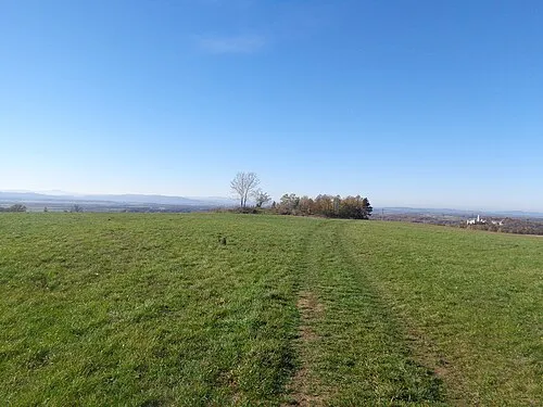 Račicky Mountain, Hosín18 km SE
Other cities and towns in Dříteň


Sources & licences
Data last updated: · 2 independent sources