Heřmaň
Located in Písek District, South Bohemian Region Coordinates: 49°14′10″ N 14°07′54″ E
- Elevation
- 374 m
- above sea level
- Local time
- UTC+01:00
- Europe/Prague · UTC+01:00
- Places inside
- 2
- listed under Heřmaň
- Airports
- JCL České Budějovice South Bohemian Airport39 km
- PRG Václav Havel Airport Prague97 km
About Heřmaň
Heřmaň is a municipality. Location: Písek District, South Bohemian Region. Elevation: 374 m. The best months to visit are May–September. The nearest airport is České Budějovice South Bohemian Airport (39 km). Nearby sights include Hradiště and Jarník.
Climate of Heřmaň
Best months for sightseeingBest months for sightseeing: May–September.
This month · November
A cold month
Day 6° · Night 1° · Rain 53 mm
- Hottest month
- July (day 24°)
- Coldest month
- January (night -4°)
- Wettest month
- July (92 mm)
- Driest month
- February (43 mm)
Bars: average monthly low and high temperature. Below: precipitation. Monthly averages for 1970–2000 at about 18 km resolution, adjusted for elevation. Highlighted months are mild and relatively dry. Source: WorldClim 2.1 (CC BY 4.0).
Show values as a table
| Month | Jan | Feb | Mar | Apr | May | Jun | Jul | Aug | Sep | Oct | Nov | Dec |
|---|---|---|---|---|---|---|---|---|---|---|---|---|
| Average high (°C) | 2° | 4° | 8° | 14° | 19° | 22° | 24° | 24° | 19° | 13° | 6° | 2° |
| Average low (°C) | -4° | -4° | 0° | 3° | 8° | 11° | 13° | 12° | 9° | 4° | 1° | -3° |
| Precipitation (mm) | 51 | 43 | 50 | 44 | 68 | 84 | 92 | 74 | 57 | 50 | 53 | 60 |
Other places to visit in this season: May June July August September
How to get to Heřmaň
The nearest airport is České Budějovice South Bohemian Airport (JCL), 39 km to the southeast as the crow flies. The nearest large city is Prague, 97 km to the north.
Airports
- České Budějovice South Bohemian Airport (JCL) České Budějovice 39 kmsoutheast
- Václav Havel Airport Prague (PRG) Prague 97 kmnorth
- Linz-Hörsching Airport (LNZ) Linz 111 kmsouth
Nearby large cities
- Prague Population: 1.2M 97 kmnorth
- Linz Population: 204.8K 104 kmsouth
- Regensburg Population: 151.4K 150 kmwest
- Salzburg Population: 157.2K 179 kmsouthwest
- Brno Population: 404.3K 180 kmeast
Straight-line distances; road distances are longer. Airport data: OurAirports.
Day trips from Heřmaň
Within 100 km: 71 historic and cultural sites, 821 natural sites, 223 lakes, rivers and coasts.
0–25 km10 places
- Zlatý vrch [Heřmaň] Mountain 1 kmW
- Zdoba Mountain 15 kmE
- Velký Mehelník Mountain 9 kmNE
- Číčenice [Číčenice] Mountain 11 kmSE
25–60 km164 places
- Teufelsschüssel Mountain 58 kmS
- Zwiesel Berg Mountain 59 kmS
- Hochficht Mountain 58 kmS
- Smrčina [Horní Planá] Mountain 58 kmS
60–100 km941 places
- Biber-Revier River 83 kmW
- Unter-Rosenhofer Teich Lake 85 kmSE
- Ober-Rosenhofer Teich Lake 84 kmSE
- Rannasee Lake 82 kmS
Straight-line distances.
Places in Heřmaň
2 placesBar: population relative to the most populous place in this list.
Mountains & nature1
- Zlatý vrch [Heřmaň] · Mountain
Nearby attractions & nature
Everything nearby-
Hradiště Mountain, Písek7.7 km N
-
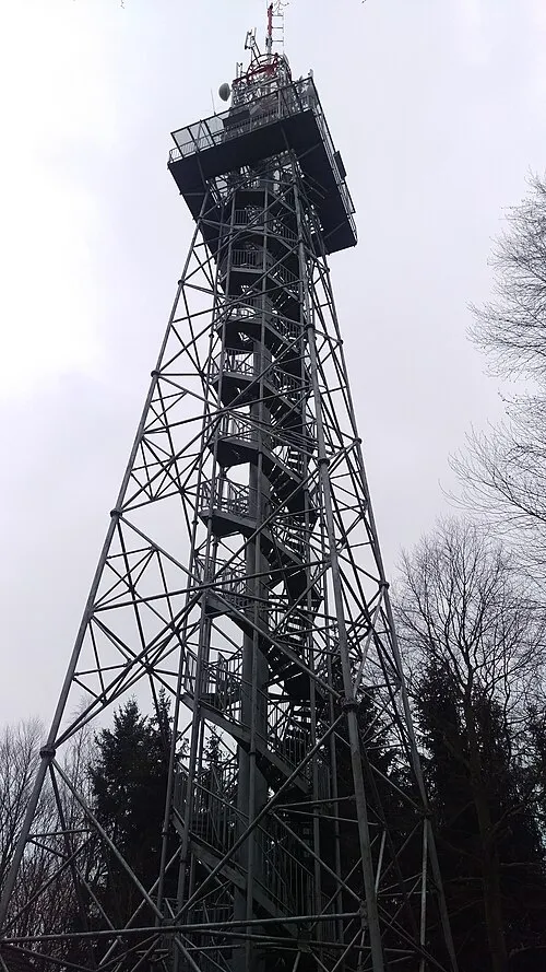 Jarník Mountain, Písek9.2 km NE
-
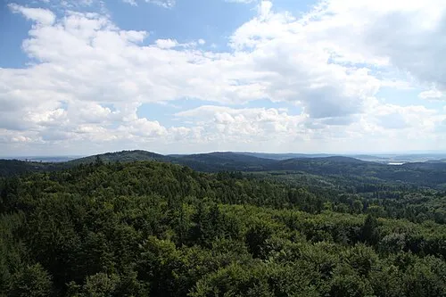 Velký Mehelník Mountain, Písek9.4 km NE
-
Číčenice [Číčenice] Mountain, Číčenice11 km SE
-
Zdoba Mountain, Všemyslice15 km E
-
Černý vrch Mountain, Oslov19 km N
-
Mužský Mountain, Olšovice21 km S
-
Brabčice Mountain, Dub17 km SW
Sources & licences
Data last updated: