- Population
- 2,170
- 2.2K
- Elevation
- 252 m
- above sea level
- Local time
- UTC+01:00
- Europe/Prague · UTC+01:00
- Airports
- BRQ Brno-Tuřany Airport27 km
- OSR Leoš Janáček Airport Ostrava93 km
About Brňany
Brňany is a village. Location: Vyškov, Vyškov District. Population: 2,170. Elevation: 252 m.
Brňany (German: Bründlitz) is a village and municipal part of Vyškov, a town in Vyškov District of the South Moravian Region of the Czech Republic. It has about 1,700 inhabitants. It is located approximately 0.5 kilometres (0.31 mi) southeast of Vyškov and 30 kilometres (19 mi) east of Brno, on the road to Bučovice.
Read more on Wikipedia Text: Wikipedia contributors · CC BY-SA 4.0 · shortened
At a glance
- Area
- 9.7 km²
Source: Wikidata
In comparison
- No. 3 of 12 places in Vyškov by population
- Nearest larger town: Vyškov, 1 km NW
- 6 sights and natural places within 10 km Rozkrámy, Větrník
Climate of Brňany
Best months for sightseeingBest months for sightseeing: May–September.
Bars: average monthly low and high temperature. Below: precipitation. Monthly averages for 1970–2000 at about 18 km resolution, adjusted for elevation. Highlighted months are mild and relatively dry. Source: WorldClim 2.1 (CC BY 4.0).
Show values as a table
| Month | Jan | Feb | Mar | Apr | May | Jun | Jul | Aug | Sep | Oct | Nov | Dec |
|---|---|---|---|---|---|---|---|---|---|---|---|---|
| Average high (°C) | 1° | 3° | 8° | 14° | 20° | 22° | 24° | 24° | 19° | 13° | 6° | 2° |
| Average low (°C) | -4° | -4° | 0° | 3° | 8° | 11° | 13° | 13° | 9° | 5° | 1° | -3° |
| Precipitation (mm) | 28 | 26 | 29 | 37 | 64 | 86 | 81 | 70 | 52 | 38 | 42 | 35 |
Other places to visit in this season: May June July August September
Airports nearest to Brňany
- Brno-Tuřany Airport (BRQ) Brno 27 km
- Leoš Janáček Airport Ostrava (OSR) Mošnov 93 km
- Pardubice Airport (PED) Pardubice 123 km
Straight-line distance; airports with scheduled flights only. Source: OurAirports (public domain).
Nearby attractions & nature
Everything nearby-
Rozkrámy Mountain, Hoštice-Heroltice5.6 km NE
-
Větrník Mountain, Letonice8.6 km S
-
Rakovec Mountain, Račice-Pístovice8.8 km W
-
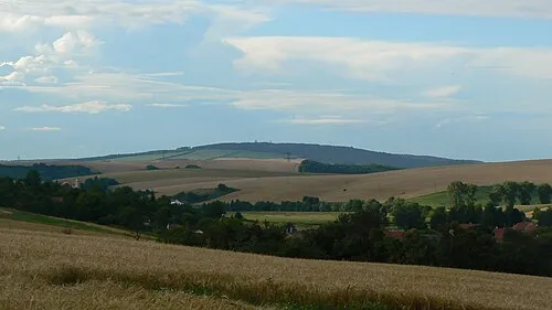 Hradisko Mountain, Chvalkovice11 km SE
-
U Sakra [Švábenice] Mountain, Švábenice9 km E
-
Ostatečná hora Mountain, Nemojany9.1 km W
Sources & licences
Data last updated: · 2 independent sources