Høgebjerg
Located in Langeland Kommune, Region South Denmark Coordinates: 55°04′09″ N 10°53′26″ E
- Elevation
- 20 m
- above sea level
- Local time
- UTC+01:00
- Europe/Copenhagen · UTC+01:00
- Airports
- ODE Odense Hans Christian Andersen Airport58 km
- SGD Sønderborg Airport71 km
About Høgebjerg
Høgebjerg is a mountain. Location: Langeland Kommune, Region South Denmark. Elevation: 20 m. The best months to visit are June–August. The nearest airport is Odense Hans Christian Andersen Airport (58 km). Nearby sights include Grasten and Smørmosen.
Climate of Høgebjerg
Best months for sightseeingBest months for sightseeing: June–August.
This month · November
A cold month
Day 7° · Night 4° · Rain 61 mm
- Hottest month
- August (day 20°)
- Coldest month
- February (night -1°)
- Wettest month
- November (61 mm)
- Driest month
- February (31 mm)
Bars: average monthly low and high temperature. Below: precipitation. Monthly averages for 1970–2000 at about 18 km resolution, adjusted for elevation. Highlighted months are mild and relatively dry. Source: WorldClim 2.1 (CC BY 4.0).
Show values as a table
| Month | Jan | Feb | Mar | Apr | May | Jun | Jul | Aug | Sep | Oct | Nov | Dec |
|---|---|---|---|---|---|---|---|---|---|---|---|---|
| Average high (°C) | 3° | 2° | 5° | 9° | 14° | 18° | 20° | 20° | 16° | 12° | 7° | 4° |
| Average low (°C) | -1° | -1° | 1° | 3° | 8° | 11° | 14° | 14° | 11° | 8° | 4° | 1° |
| Precipitation (mm) | 43 | 31 | 34 | 35 | 43 | 50 | 59 | 54 | 54 | 53 | 61 | 48 |
How to get to Høgebjerg
The nearest airport is Odense Hans Christian Andersen Airport (ODE), 58 km to the northwest as the crow flies. The nearest large city is Odense, 48 km to the northwest.
Airports
- Odense Hans Christian Andersen Airport (ODE) Odense 58 kmnorthwest
- Sønderborg Airport (SGD) Sønderborg 71 kmwest
- Copenhagen Roskilde Airport (RKE) Roskilde 98 kmnortheast
Nearby large cities
- Odense Population: 180.9K 48 kmnorthwest
- Kiel Population: 252.7K 96 kmsouthwest
- Copenhagen Population: 1.2M 126 kmnortheast
- Aarhus Population: 285.3K 128 kmnorth
- Lübeck Population: 212.2K 134 kmsouth
Straight-line distances; road distances are longer. Airport data: OurAirports.
Day trips from Høgebjerg
Within 100 km: 56 historic and cultural sites, 512 natural sites, 288 lakes, rivers and coasts.
0–25 km12 places
- Tåsinge Island 20 kmW
- Smørmosen Beach 12 kmW
- Lindø Island 24 kmSW
- Langesand Island 16 kmN
25–60 km107 places
- Aeroe Island 41 kmSW
- Bay of Kiel Natural site 58 kmS
- Taksensand Beach 60 kmW
- Næsbystrand Beach 42 kmNE
60–100 km737 places
- Sjælland Island 73 kmNE
- Als Island 63 kmW
- Falster Island 75 kmSE
- Fehmarn Island 68 kmS
Straight-line distances.
Nearest towns and villages


Nearby attractions & nature
Everything nearby-
Grasten Natural site, Svendborg Kommune13 km W
-
Smørmosen Beach, Svendborg Kommune12 km W
-
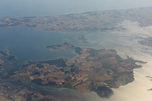 Tåsinge Island, Svendborg Kommune20 km W
-
Oldenbjerg Mountain, Langeland Kommune15 km S
-
Skovbanke Mountain, Slagelse Kommune21 km NE
-
Lindø Island, Langeland Kommune24 km SW
-
Helvedbakke Mountain, Nyborg Kommune22 km N
-
Helleholm Natural site, Slagelse Kommune24 km NE
Sources & licences
Data last updated: · 2 independent sources