Torkilstrup
Located in Guldborgsund Kommune, Region Zealand Coordinates: 54°52′22″ N 11°56′02″ E
- Elevation
- 17 m
- above sea level
- Local time
- UTC+01:00
- Europe/Copenhagen · UTC+01:00
- Airports
- RKE Copenhagen Roskilde Airport80 km
- CPH Copenhagen Kastrup Airport95 km
About Torkilstrup
Torkilstrup is a village. Location: Guldborgsund Kommune, Region Zealand. Elevation: 17 m.
Torkilstrup, also Torkildstrup, is a little village some 7 kilometres (4.3 mi) southeast of Nørre Alslev on the Danish island of Falster. It is best known for Torkilstrup Church, one of the island's oldest churches, built before 1160. The adjacent Torkilstrup Rectory and Torkilstrup Windmill are both on the Danish registry of protected buildings and places.
Source: Wikipedia · CC BY-SA 4.0
Climate of Torkilstrup
Best months for sightseeingBest months for sightseeing: June–August.
This month · November
A cold month
Day 7° · Night 4° · Rain 62 mm
- Hottest month
- July (day 20°)
- Coldest month
- February (night 0°)
- Wettest month
- July (63 mm)
- Driest month
- February (32 mm)
Bars: average monthly low and high temperature. Below: precipitation. Monthly averages for 1970–2000 at about 18 km resolution, adjusted for elevation. Highlighted months are mild and relatively dry. Source: WorldClim 2.1 (CC BY 4.0).
Show values as a table
| Month | Jan | Feb | Mar | Apr | May | Jun | Jul | Aug | Sep | Oct | Nov | Dec |
|---|---|---|---|---|---|---|---|---|---|---|---|---|
| Average high (°C) | 2° | 2° | 5° | 9° | 14° | 18° | 20° | 20° | 16° | 12° | 7° | 4° |
| Average low (°C) | 0° | 0° | 1° | 4° | 8° | 12° | 15° | 15° | 12° | 8° | 4° | 1° |
| Precipitation (mm) | 47 | 32 | 39 | 39 | 42 | 50 | 63 | 57 | 54 | 50 | 62 | 53 |
How to get to Torkilstrup
The nearest airport is Copenhagen Roskilde Airport (RKE), 80 km to the north as the crow flies. For international flights: Copenhagen Kastrup Airport (CPH) (95 km). The nearest large city is Rostock, 88 km to the south.
Airports
- Copenhagen Roskilde Airport (RKE) Roskilde 80 kmnorth
- Copenhagen Kastrup Airport (CPH) Copenhagen 95 kmnortheast
- Rostock-Laage Airport (RLG) Laage 109 kmsouth
Nearby large cities
- Rostock Population: 198.3K 88 kmsouth
- Copenhagen Population: 1.2M 98 kmnortheast
- Malmö Population: 362.1K 106 kmnortheast
- Odense Population: 180.9K 114 kmnorthwest
- Kiel Population: 252.7K 131 kmsouthwest
Straight-line distances; road distances are longer. Airport data: OurAirports.
Day trips from Torkilstrup
Within 100 km: 75 historic and cultural sites, 366 natural sites, 229 lakes, rivers and coasts.
0–25 km16 places
- Falster Island 8 kmS
- Suderø Island 17 kmNW
- Masnedø Kalv Island 12 kmN
- Lindholm Island 24 kmNE
25–60 km56 places
- Mecklenburger Bucht Natural site 58 kmS
- Darßer Ort Natural site 57 kmSE
- Kernzone Natural site 59 kmSE
- Darßer Ort Lighthouse Landmark 58 kmSE
60–100 km598 places
- Sjælland Island 71 kmN
- Amager Island 94 kmNE
- Fehmarn Island 68 kmSW
- Tåsinge Island 87 kmW
Straight-line distances.
Nearby attractions & nature
Everything nearby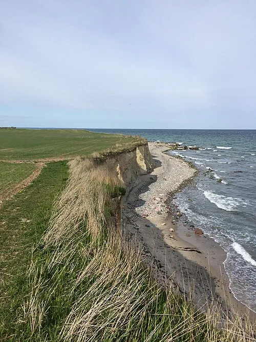
Sources & licences
Data last updated: · 2 independent sources