- Elevation
- 492 m
- above sea level
- Local time
- UTC+01:00
- Europe/Paris · UTC+01:00
- Airports
- CMF Chambéry Aix les Bains airport15 km
- NCY Annecy Meythet airport22 km
About Bassa
Bassa is a village. Location: Auvergne-Rhône-Alpes, France. Elevation: 492 m. The best months to visit are June–September. The nearest airport is Chambéry Aix les Bains airport (15 km). Nearby sights include Montagne de Banges and La Tour de l'Angle Est.
Climate of Bassa
Best months for sightseeingBest months for sightseeing: June–September.
This month · November
A wet month
Day 9° · Night 2° · Rain 103 mm
- Hottest month
- July (day 26°)
- Coldest month
- January (night -2°)
- Wettest month
- October (106 mm)
- Driest month
- August (73 mm)
Bars: average monthly low and high temperature. Below: precipitation. Monthly averages for 1970–2000 at about 18 km resolution, adjusted for elevation. Highlighted months are mild and relatively dry. Source: WorldClim 2.1 (CC BY 4.0).
Show values as a table
| Month | Jan | Feb | Mar | Apr | May | Jun | Jul | Aug | Sep | Oct | Nov | Dec |
|---|---|---|---|---|---|---|---|---|---|---|---|---|
| Average high (°C) | 5° | 7° | 11° | 14° | 19° | 23° | 26° | 25° | 21° | 15° | 9° | 6° |
| Average low (°C) | -2° | -1° | 1° | 4° | 8° | 12° | 14° | 13° | 10° | 6° | 2° | -1° |
| Precipitation (mm) | 84 | 85 | 79 | 76 | 91 | 96 | 74 | 73 | 104 | 106 | 103 | 92 |
Other places to visit in this season: June July August September
How to get to Bassa
The nearest airport is Chambéry Aix les Bains airport (CMF), 15 km to the southwest as the crow flies. For international flights: Geneva International Airport (GVA) (55 km). The nearest large city is Geneva, 52 km to the north.
Airports
- Chambéry Aix les Bains airport (CMF) Chambéry 15 kmsouthwest
- Annecy Meythet airport (NCY) Annecy 22 kmnortheast
- Geneva International Airport (GVA) Geneva 55 kmnorth
Nearby large cities
- Geneva Population: 201.7K 52 kmnorth
- Grenoble Population: 158.6K 67 kmsouth
- Villeurbanne Population: 131.4K 86 kmwest
- Lyon Population: 520.8K 89 kmwest
- Lausanne Population: 139.1K 99 kmnortheast
Straight-line distances; road distances are longer. Airport data: OurAirports.
Day trips from Bassa
Within 100 km: 176 historic and cultural sites, 1,762 natural sites, 347 lakes, rivers and coasts.
0–25 km125 places
- Plage de Menthon Saint Bernard Beach 20 kmNE
- Plage d'Albigny Beach 21 kmNE
- Plage St Jorioz Beach 18 kmNE
- Lacs de Chevelu Lake 14 kmSW
25–60 km555 places
- Etang du Moulin de Vert Lake 48 kmN
- Etang du Moulin de Vert Lake 48 kmN
- Barrage du Rhône Lake 50 kmN
- Parc des Bastions Natural site 52 kmN
60–100 km1,605 places
- Parc de la Tête d'Or Natural site 88 kmW
- Lac Mort Lake 81 kmS
- Lake Leman Lake 85 kmNE
- Lac de Fully Lake 98 kmNE
Straight-line distances.
Nearby attractions & nature
Everything nearby-
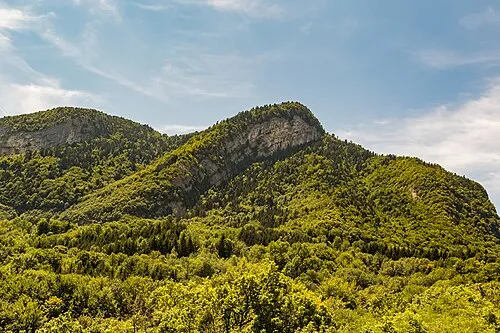 Montagne de Banges Mountain, Arith5.9 km E
-
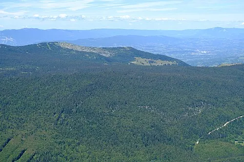 La Tour de l'Angle Est Mountain, Montcel6.6 km S
-
Roche de Prépoulain Mountain, Arith7.1 km SE
-
Deisse River, Savoy6.5 km SW
-
Mont de Corsuet Mountain, Entrelacs7.9 km W
-
Baie de Grésine Natural site, Brison-Saint-Innocent7.9 km W
Sources & licences
Data last updated: