- Elevation
- 597 m
- above sea level
- Local time
- UTC+01:00
- Europe/Paris · UTC+01:00
- Airports
- AUR Aurillac airport97 km
- CFE Clermont-Ferrand Auvergne airport98 km
About Ance
Ance is a river. Location: Haute-Loire, Auvergne-Rhône-Alpes. The best months to visit are June–September. The nearest airport is Aurillac airport (97 km). Nearby sights include Montaure and Roche d'Offre.
Climate of Ance
Best months for sightseeingBest months for sightseeing: June–September.
This month · November
A cold month
Day 10° · Night 3° · Rain 76 mm
- Hottest month
- July (day 25°)
- Coldest month
- January (night 0°)
- Wettest month
- October (103 mm)
- Driest month
- March (55 mm)
Bars: average monthly low and high temperature. Below: precipitation. Monthly averages for 1970–2000 at about 18 km resolution, adjusted for elevation. Highlighted months are mild and relatively dry. Source: WorldClim 2.1 (CC BY 4.0).
Show values as a table
| Month | Jan | Feb | Mar | Apr | May | Jun | Jul | Aug | Sep | Oct | Nov | Dec |
|---|---|---|---|---|---|---|---|---|---|---|---|---|
| Average high (°C) | 7° | 7° | 10° | 13° | 17° | 21° | 25° | 25° | 21° | 16° | 10° | 8° |
| Average low (°C) | 0° | 0° | 2° | 4° | 8° | 11° | 13° | 13° | 10° | 7° | 3° | 1° |
| Precipitation (mm) | 69 | 57 | 55 | 77 | 96 | 71 | 56 | 70 | 84 | 103 | 76 | 71 |
Other places to visit in this season: June July August September
How to get to Ance
The nearest airport is Aurillac airport (AUR), 97 km to the west as the crow flies. For international flights: Clermont-Ferrand Auvergne airport (CFE) (98 km). The nearest large city is Saint-Etienne, 78 km to the northeast.
Airports
- Aurillac airport (AUR) Aurillac 97 kmwest
- Clermont-Ferrand Auvergne airport (CFE) Clermont-Ferrand 98 kmnorth
- Rodez–Aveyron Airport (RDZ) Rodez/Marcillac 111 kmsouthwest
Nearby large cities
- Saint-Etienne Population: 176.3K 78 kmnortheast
- Clermont-Ferrand Population: 147.9K 100 kmnorthwest
- Lyon Population: 520.8K 128 kmnortheast
- Villeurbanne Population: 131.4K 131 kmnortheast
- Nîmes Population: 148.2K 138 kmsoutheast
Straight-line distances; road distances are longer. Airport data: OurAirports.
Day trips from Ance
Within 100 km: 186 historic and cultural sites, 762 natural sites, 223 lakes, rivers and coasts.
0–25 km72 places
- Lac du Bouchet Lake 13 kmSE
- Suc de Miceselle Mountain 17 kmE
- Denise Mountain 20 kmNE
- Mont Chauvet Mountain 18 kmW
25–60 km296 places
- Lac d'Issarlès Lake 38 kmSE
- Lac de Charpal Lake 39 kmS
- Lac du barrage de Naussac Lake 28 kmSE
- Lac de Grandval Lake 45 kmW
60–100 km803 places
- Alba-la-Romaine (Ardèche, France) -- Théâtre gallo-romain Historic site 89 kmSE
- Puy Bien Mountain 86 kmN
- Ancien îlot Gambetta Island 95 kmW
- Lac de Servière Lake 97 kmNW
Straight-line distances.
Nearest towns and villages
-
Monistrol-d'Allier Village, Arrondissement de Brioude0.1 km SE
-
Monistrol-d'Allier Village, Monistrol-d'Allier0.1 km SE
-
Le Vivier Village, Monistrol-d'Allier0.7 km E
-
Saint-Privat-d'Allier Village, Arrondissement du Puy-en-Velay3.7 km NE
-
Pratclaux Village, Saint-Privat-d'Allier1.3 km NE
-
Saint-Privat-d'Allier Village, Saint-Privat-d'Allier3.7 km NE
Nearby attractions & nature
Everything nearby-
Montaure Mountain, Monistrol-d'Allier2.1 km W
-
Roche d'Offre Mountain, Saint-Privat-d'Allier3.3 km N
-
Ruisseau de Virlange River, Haute-Loire4.3 km S
-
Mont Chau Mountain, Saint-Bérain6.8 km N
-
Monts du Velay Mountain, Haute-Loire9.1 km E
-
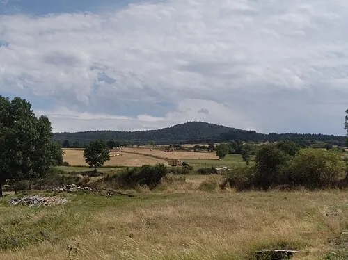 La Durande Mountain, Saint-Bérain8.9 km N
-
Suc de Combret Mountain, Saint-Bérain8 km N
-
Seuge River, Haute-Loire7.7 km NW
Sources & licences
Data last updated: