Forêt Domaniale de Prémol
Located in Isère, Auvergne-Rhône-Alpes Coordinates: 45°06′22″ N 5°51′06″ E
- Elevation
- 1,209 m
- above sea level
- Local time
- UTC+01:00
- Europe/Paris · UTC+01:00
- Airports
- GNB Grenoble Alpes Isère Airport50 km
- CMF Chambéry Aix les Bains airport59 km
About Forêt Domaniale de Prémol
Forêt Domaniale de Prémol is a natural site. Location: Isère, Auvergne-Rhône-Alpes. The best months to visit are July–August. The nearest airport is Grenoble Alpes Isère Airport (50 km). Nearby sights include Pic de l'Oeilly and Rocher de l'Homme.
Photos of Forêt Domaniale de Prémol
-
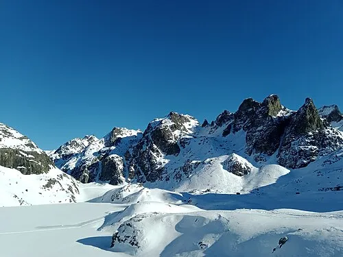
Grand Sorbier Rémih · CC BY-SA 4.0 -
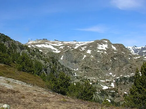
Croix de Chamrousse Patafisik · CC BY-SA 4.0 -
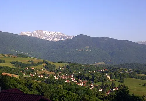
Pic de l'Oeilly Patafisik · CC BY-SA 3.0 -
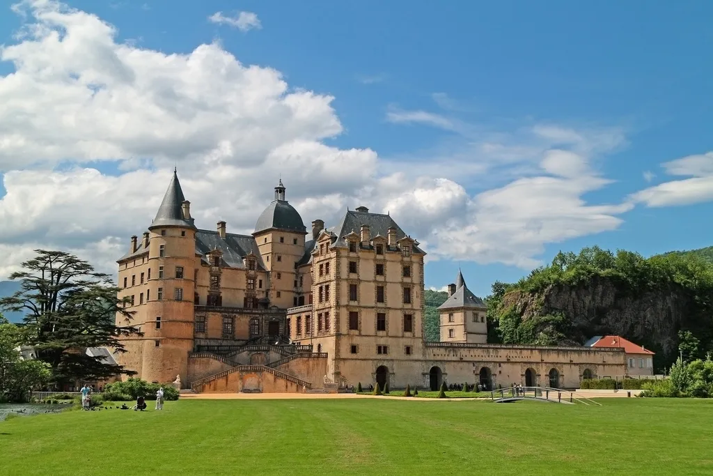
Château de Vizille Bogdanmoisuc · CC BY-SA 3.0


Climate of Forêt Domaniale de Prémol
Best months for sightseeingBest months for sightseeing: July–August.
This month · November
A wet month
Day 7° · Night 1° · Rain 150 mm
- Hottest month
- July (day 22°)
- Coldest month
- January (night -3°)
- Wettest month
- November (150 mm)
- Driest month
- July (72 mm)
Bars: average monthly low and high temperature. Below: precipitation. Monthly averages for 1970–2000 at about 18 km resolution, adjusted for elevation. Highlighted months are mild and relatively dry. Source: WorldClim 2.1 (CC BY 4.0).
Show values as a table
| Month | Jan | Feb | Mar | Apr | May | Jun | Jul | Aug | Sep | Oct | Nov | Dec |
|---|---|---|---|---|---|---|---|---|---|---|---|---|
| Average high (°C) | 3° | 4° | 7° | 9° | 15° | 18° | 22° | 22° | 18° | 13° | 7° | 4° |
| Average low (°C) | -3° | -3° | -1° | 1° | 5° | 8° | 11° | 12° | 9° | 5° | 1° | -2° |
| Precipitation (mm) | 119 | 107 | 106 | 106 | 119 | 105 | 72 | 89 | 109 | 128 | 150 | 129 |
How to get to Forêt Domaniale de Prémol
The nearest airport is Grenoble Alpes Isère Airport (GNB), 50 km to the northwest as the crow flies. For international flights: Lyon Saint-Exupéry Airport (LYS) (91 km). The nearest large city is Grenoble, 13 km to the northwest.
Airports
- Grenoble Alpes Isère Airport (GNB) Grenoble 50 kmnorthwest
- Chambéry Aix les Bains airport (CMF) Chambéry 59 kmnorth
- Lyon Saint-Exupéry Airport (LYS) Colombier-Saugnieu, Rhône 91 kmnorthwest
Nearby large cities
- Grenoble Population: 158.6K 13 kmnorthwest
- Villeurbanne Population: 131.4K 106 kmnorthwest
- Lyon Population: 520.8K 106 kmnorthwest
- Saint-Etienne Population: 176.3K 120 kmwest
- Geneva Population: 201.7K 124 kmnorth
Straight-line distances; road distances are longer. Airport data: OurAirports.
Day trips from Forêt Domaniale de Prémol
Within 100 km: 120 historic and cultural sites, 1,410 natural sites, 362 lakes, rivers and coasts.
0–25 km151 places
- Lac Mort Lake 10 kmSW
- Lac du Vallon Lake 19 kmSE
- Lake Pierre-Châtel Lake 16 kmS
- Lac de Petichet Lake 15 kmS
25–60 km630 places
- St Alban Plage Beach 51 kmN
- Grande Île Island 49 kmN
- Petite Île Island 49 kmN
- Lac du Saulet Lake 33 kmS
60–100 km1,111 places
- Clapes River 91 kmSE
- Plage de Menthon Saint Bernard Beach 88 kmN
- Plage d'Albigny Beach 92 kmN
- Plage St Jorioz Beach 86 kmN
Straight-line distances.
Nearest towns and villages
-
Arrondissement of Grenoble Municipality, Isère4.4 km W
-
Chamrousse Village, Arrondissement of Grenoble1.9 km E
-
Vaulnaveys-le-Bas Village, Vaulnaveys-le-Bas2.2 km W
-
Vaulnaveys-le-Haut Village, Arrondissement of Grenoble3.5 km NW
-
Vaulnaveys-le-Haut Village, Vaulnaveys-le-Haut3.5 km NW
-
Vaulnaveys-le-Bas Village, Arrondissement of Grenoble3.6 km W
Nearby attractions & nature
Everything nearby-
Pic de l'Oeilly Mountain, Séchilienne2.2 km SW
-
Rocher de l'Homme Mountain, Livet-et-Gavet3.5 km E
-
Croix de Chamrousse Mountain, Chamrousse6.8 km NE
-
Grand Sorbier Mountain, Livet-et-Gavet7.3 km NE
-
Grand Vent Mountain, Livet-et-Gavet7.1 km NE
-
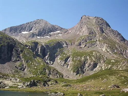 Le Taillefer Mountain, Lavaldens9.4 km SE
-
Cime Chalvine Mountain, Livet-et-Gavet8.1 km E
-
Site Natura 2000 - Cembraie, pelouses, lacs et tourbières de Belledonne, de Chamrousse au Grand Colon Natural site, Revel6.6 km NE
More nature in France
-
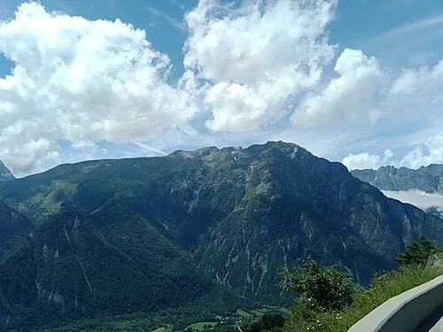 Cime de Cornillon Mountain, Oulles9.5 km E
-
Serre Montgaudi Mountain, Ornon8.9 km SE
-
Petit Voudène Mountain, Livet-et-Gavet7.1 km NE
-
Fau Cuchet Mountain, Saint-Jean-de-Vaulx11 km SW
-
La Grande Lance Mountain, La Combe-de-Lancey11 km NE
-
Cime des Mayes Mountain, Lavaldens11 km SE
Sources & licences
Data last updated: