Les Chaprais
Located in Besançon, Arrondissement of Besançon Coordinates: 47°14′45″ N 6°01′54″ E
- Elevation
- 253 m
- above sea level
- Local time
- UTC+01:00
- Europe/Paris · UTC+01:00
- Airports
- DLE Dole Tavaux Airport51 km
- GVA Geneva International Airport112 km
About Les Chaprais
Les Chaprais is a village. Location: Besançon, Arrondissement of Besançon. Elevation: 253 m. The best months to visit are May–September. The nearest airport is Dole Tavaux Airport (51 km). Nearby sights include Citadel of Besançon and Battant Bastion.
Photos of Les Chaprais
-
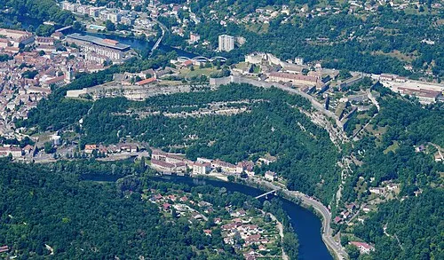
Citadel of Besançon Carsten Steger · CC BY-SA 4.0

Climate of Les Chaprais
Best months for sightseeingBest months for sightseeing: May–September.
This month · November
A wet month
Day 9° · Night 3° · Rain 108 mm
- Hottest month
- July (day 25°)
- Coldest month
- January (night -1°)
- Wettest month
- May (108 mm)
- Driest month
- March (80 mm)
Bars: average monthly low and high temperature. Below: precipitation. Monthly averages for 1970–2000 at about 18 km resolution, adjusted for elevation. Highlighted months are mild and relatively dry. Source: WorldClim 2.1 (CC BY 4.0).
Show values as a table
| Month | Jan | Feb | Mar | Apr | May | Jun | Jul | Aug | Sep | Oct | Nov | Dec |
|---|---|---|---|---|---|---|---|---|---|---|---|---|
| Average high (°C) | 5° | 7° | 11° | 14° | 19° | 22° | 25° | 25° | 21° | 15° | 9° | 6° |
| Average low (°C) | -1° | 0° | 3° | 5° | 9° | 12° | 14° | 14° | 11° | 7° | 3° | 1° |
| Precipitation (mm) | 92 | 89 | 80 | 93 | 108 | 104 | 87 | 81 | 103 | 106 | 108 | 105 |
Other places to visit in this season: May June July August September
How to get to Les Chaprais
The nearest airport is Dole Tavaux Airport (DLE), 51 km to the southwest as the crow flies. For international flights: Geneva International Airport (GVA) (112 km). The nearest large city is Besançon, 1 km to the west.
Airports
- Dole Tavaux Airport (DLE) Dole 51 kmsouthwest
- Geneva International Airport (GVA) Geneva 112 kmsouth
- Bern Airport (BRN) Bern 117 kmeast
Nearby large cities
- Besançon Population: 128.4K 1 kmwest
- Dijon Population: 159.9K 77 kmwest
- Lausanne Population: 139.1K 93 kmsoutheast
- Bern Population: 121.6K 112 kmeast
- Mulhouse Population: 111.4K 113 kmnortheast
Straight-line distances; road distances are longer. Airport data: OurAirports.
Day trips from Les Chaprais
Within 100 km: 177 historic and cultural sites, 545 natural sites, 199 lakes, rivers and coasts.
0–25 km55 places
- Mont des Buis Mountain 3 kmS
- Forêt de Vaite Natural site 15 kmE
- Bois d'Ully Natural site 21 kmS
- Bois sur Roche Natural site 20 kmSE
25–60 km158 places
- Lac des Taillères Lake 52 kmSE
- Lac de Moron Lake 57 kmE
- Lac des Brenets Lake 54 kmE
- Crêt du Cervelet Mountain 56 kmSE
60–100 km708 places
- Sankt Petersinsel Island 86 kmE
- Lake Neuchâtel Lake 73 kmSE
- Lake Murten Lake 87 kmSE
- Lac de Joux Lake 70 kmS
Straight-line distances.
Nearby attractions & nature
Everything nearby-
Citadel of Besançon Historic site, Besançon1.7 km S
-
Battant Bastion Historic site, Besançon0.7 km W
-
Ball Tower Historic site, Besançon0.7 km SW
-
Montmart Tower Historic site, Besançon0.7 km W
-
Abbaye Saint-Paul Attraction, Besançon0.8 km S
-
Quai Vauban Bastion Historic site, Besançon0.8 km SW
Sources & licences
Data last updated: