Arrondissement of Saint-Brieuc
Located in Côtes-d'Armor, Brittany Region Coordinates: 48°20′48″ N 2°38′50″ W
- Population
- 275,606
- 275.6K
- Elevation
- 203 m
- above sea level
- Local time
- UTC+01:00
- Europe/Paris · UTC+01:00
- Places inside
- 110
- listed under Arrondissement of Saint-Brieuc
- Airports
- RNS Rennes-Saint-Jacques Airport74 km
- JER Jersey Airport101 km
About Arrondissement of Saint-Brieuc
Arrondissement of Saint-Brieuc is a municipality. Location: Côtes-d'Armor, Brittany Region. Population: 275,606. Elevation: 203 m. The best months to visit are June–September. The nearest airport is Rennes-Saint-Jacques Airport (74 km). Nearby sights include Forêt de Bosquen and Forêt de Lorge.
Climate of Arrondissement of Saint-Brieuc
Best months for sightseeingBest months for sightseeing: June–September.
This month · November
A wet month
Day 11° · Night 6° · Rain 105 mm
- Hottest month
- August (day 21°)
- Coldest month
- February (night 3°)
- Wettest month
- November (105 mm)
- Driest month
- July (45 mm)
Bars: average monthly low and high temperature. Below: precipitation. Monthly averages for 1970–2000 at about 18 km resolution, adjusted for elevation. Highlighted months are mild and relatively dry. Source: WorldClim 2.1 (CC BY 4.0).
Show values as a table
| Month | Jan | Feb | Mar | Apr | May | Jun | Jul | Aug | Sep | Oct | Nov | Dec |
|---|---|---|---|---|---|---|---|---|---|---|---|---|
| Average high (°C) | 8° | 9° | 11° | 12° | 16° | 19° | 21° | 21° | 19° | 15° | 11° | 9° |
| Average low (°C) | 3° | 3° | 4° | 5° | 8° | 11° | 13° | 13° | 11° | 9° | 6° | 4° |
| Precipitation (mm) | 99 | 78 | 73 | 61 | 64 | 50 | 45 | 50 | 69 | 89 | 105 | 100 |
Other places to visit in this season: June July August September
How to get to Arrondissement of Saint-Brieuc
The nearest airport is Rennes-Saint-Jacques Airport (RNS), 74 km to the southeast as the crow flies. The nearest large city is Rennes, 77 km to the east.
Airports
- Rennes-Saint-Jacques Airport (RNS) Saint-Jacques-de-la-Lande, Ille-et-Vilaine 74 kmsoutheast
- Jersey Airport (JER) St. Peter 101 kmnorth
- Guernsey Airport (GCI) Saint Peter Port 121 kmnorth
Nearby large cities
- Rennes Population: 227.8K 77 kmeast
- Brest Population: 144.9K 136 kmwest
- Nantes Population: 325.1K 150 kmsoutheast
- Angers Population: 168.3K 184 kmsoutheast
- Caen Population: 110.6K 192 kmnortheast
Straight-line distances; road distances are longer. Airport data: OurAirports.
Day trips from Arrondissement of Saint-Brieuc
Within 100 km: 231 historic and cultural sites, 145 natural sites, 294 lakes, rivers and coasts.
0–25 km25 places
- Bel Air Mountain 6 kmSE
- Anse d'Yffiniac Natural site 20 kmN
- Forêt de Saint-Aubin Natural site 25 kmNE
- Forêt de Loudéac Natural site 15 kmS
25–60 km162 places
- Plage des Rosaires Beach 25 kmN
- Plage du Mole Beach 57 kmNE
- Plage de l'Éventail Beach 58 kmNE
- Le Taurel Island 53 kmNW
60–100 km483 places
- Île de Groix Island 100 kmSW
- Île Grande Island 85 kmNW
- Kastell Koad Freg Historic site 70 kmNW
- Kastell Tonkedeg Historic site 67 kmNW
Straight-line distances.
Arrondissement of Saint-Brieuc and similar cities
Side by side with cities of similar size in the same country: population, elevation and climate.
| Measure | Arrondissement of Saint-Brieuc | Strasbourg | Bordeaux | Montpellier |
|---|---|---|---|---|
| Population | 275.6K | 274.8K | 265.3K | 248.3K |
| Elevation | 203 m | 147 m | 20 m | 55 m |
| Summer day (hottest month) | 21° | 25° | 26° | 29° |
| Winter night (coldest month) | 3° | -1° | 2° | 3° |
| Annual rainfall | 883 mm | 735 mm | 921 mm | 645 mm |
| Best months | Jun–Sep | May–Sep | May–Sep | May–Oct |
| Distance | — | 768 km | 421 km | 729 km |
Climate values are 1970–2000 monthly averages; straight-line distance.
Places in Arrondissement of Saint-Brieuc
110 places- 1 Saint-Brieuc 45K
- 2 Lamballe-Armor 16.6K
- 3 Plérin 13.8K
- 4 Ploufragan 11.4K
- 5 Loudéac 9.6K
- 6 Trégueux 8.4K
- 7 Langueux 7.6K
- 8 Pordic 7.1K
- 9 Binic-Étables-sur-Mer 7K
- 10 Plédran 6.6K
- 11 Le Mené 6.4K
- 12 Yffiniac 5K
- 13 Plaintel 4.3K
- 14 Hillion 4.1K
- 15 Pléneuf-Val-André 4.1K
- 16 Plœuc-L'Hermitage 4.1K
- 17 Erquy 3.9K
- 18 Quessoy 3.8K
- 19 Plémet 3.6K
- 20 Merdrignac 2.9K
- 21 Saint-Quay-Portrieux 2.9K
- 22 Quintin 2.8K
- 23 Plouguenast-Langast 2.5K
- 24 Jugon-les-Lacs 2.5K
- 25 Guerlédan 2.4K
- 26 Plénée-Jugon 2.4K
- 27 Saint-Brandan 2.4K
- 28 Hénon 2.2K
- 29 Saint-Alban 2.2K
- 30 La Motte 2.1K
- 31 Pommeret 2.1K
- 32 Saint-Julien 2.1K
- 33 Trémuson 2.1K
- 34 Plourhan 2K
- 35 Coëtmieux 1.8K
- 36 Lantic 1.7K
- 37 Trévé 1.6K
- 38 Bréhand 1.6K
- 39 Plaine-Haute 1.6K
- 40 Plestan 1.6K
- 41 Plémy 1.6K
- 42 Plurien 1.5K
- 43 Saint-Carreuc 1.5K
- 44 Saint-Donan 1.4K
- 45 Le Fœil 1.4K
- 46 Plédéliac 1.4K
- 47 Landéhen 1.4K
- 48 Hénanbihen 1.3K
- 49 La Méaugon 1.3K
- 50 Saint-Barnabé 1.3K
- 51 Hénansal 1.2K
- 52 Trémorel 1.2K
- 53 Andel 1.1K
- 54 Saint-Caradec 1.1K
- 55 Sévignac 1.1K
- 56 Lanfains 1.1K
- 57 Uzel 1K
- 58 Plumieux 1K
- 59 Corlay 957
- 60 Trédaniel 944
Bar: population relative to the most populous place in this list.
Nearby attractions & nature
Everything nearby-
Forêt de Bosquen Natural site, Côtes-d'Armor14 km E
-
Forêt de Lorge Natural site, Côtes-d'Armor13 km W
-
Urne River, Côtes-d'Armor16 km N
-
Ruisseau la Truite River, Côtes-d'Armor16 km N
-
Chifrouet River, Côtes-d'Armor17 km NE
-
Forêt de Loudéac Natural site, Côtes-d'Armor15 km S
-
Ruisseau d'Évran River, Côtes-d'Armor18 km N
-
Forêt de Saint-Aubin Natural site, Côtes-d'Armor25 km NE
Other cities and towns in Côtes-d'Armor
-
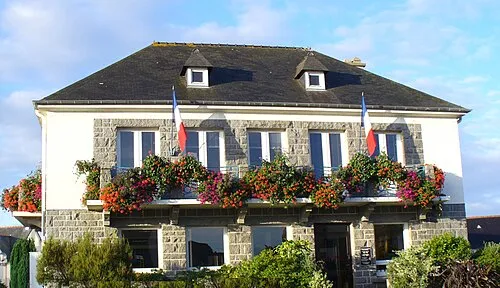 Langueux Town, Langueux17 km N
-
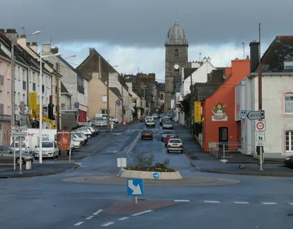 Loudéac Town, Loudéac20 km SW
-
Lamballe Town, Lamballe-Armor17 km NE
-
Plédran Town, Plédran13 km NW
-
Arrondissement of Dinan Municipality, Côtes-d'Armor39 km E
-
Saint-Brieuc City, Saint-Brieuc21 km NW
Sources & licences
Data last updated: