Botmeur
Located in Arrondissement of Châteaulin, Finistère Coordinates: 48°23′01″ N 3°54′55″ W
- Population
- 212
- 212
- Elevation
- 261 m
- above sea level
- Local time
- UTC+01:00
- Europe/Paris · UTC+01:00
- Places inside
- 7
- listed under Botmeur
- Airports
- BES Brest Bretagne airport38 km
- GCI Guernsey Airport151 km
About Botmeur
Botmeur is a village. Location: Arrondissement of Châteaulin, Finistère. Population: 212. Elevation: 261 m. The best months to visit are June–September. The nearest airport is Brest Bretagne airport (38 km). Nearby sights include Mont de Saint-Michel and Roc'h Trédudon TV Tower.
Photos of Botmeur
-
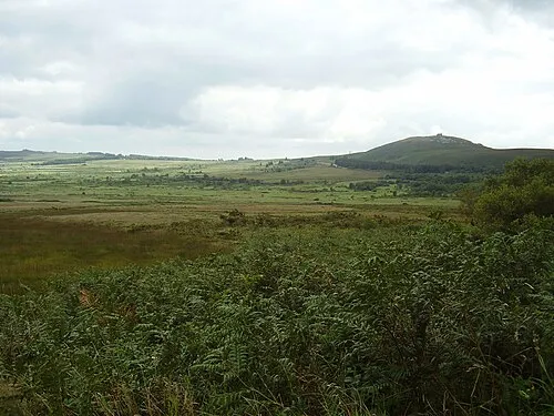
Mont de Saint-Michel Kamel15 · CC BY-SA 3.0

Climate of Botmeur
Best months for sightseeingBest months for sightseeing: June–September.
This month · November
A wet month
Day 11° · Night 6° · Rain 136 mm
- Hottest month
- August (day 20°)
- Coldest month
- February (night 3°)
- Wettest month
- January (140 mm)
- Driest month
- July (52 mm)
Bars: average monthly low and high temperature. Below: precipitation. Monthly averages for 1970–2000 at about 18 km resolution, adjusted for elevation. Highlighted months are mild and relatively dry. Source: WorldClim 2.1 (CC BY 4.0).
Show values as a table
| Month | Jan | Feb | Mar | Apr | May | Jun | Jul | Aug | Sep | Oct | Nov | Dec |
|---|---|---|---|---|---|---|---|---|---|---|---|---|
| Average high (°C) | 8° | 8° | 10° | 12° | 15° | 17° | 20° | 20° | 18° | 14° | 11° | 9° |
| Average low (°C) | 3° | 3° | 4° | 5° | 8° | 10° | 12° | 12° | 11° | 8° | 6° | 4° |
| Precipitation (mm) | 140 | 113 | 100 | 77 | 77 | 60 | 52 | 63 | 88 | 110 | 136 | 139 |
Other places to visit in this season: June July August September
How to get to Botmeur
The nearest airport is Brest Bretagne airport (BES), 38 km to the west as the crow flies. The nearest large city is Brest, 42 km to the west.
Airports
- Brest Bretagne airport (BES) Brest 38 kmwest
- Guernsey Airport (GCI) Saint Peter Port 151 kmnortheast
- Jersey Airport (JER) St. Peter 156 kmnortheast
Nearby large cities
- Brest Population: 144.9K 42 kmwest
- Rennes Population: 227.8K 169 kmeast
- Nantes Population: 325.1K 219 kmsoutheast
- Plymouth Population: 260.2K 222 kmnorth
- Exeter Population: 130.7K 262 kmnorth
Straight-line distances; road distances are longer. Airport data: OurAirports.
Day trips from Botmeur
Within 100 km: 237 historic and cultural sites, 136 natural sites, 258 lakes, rivers and coasts.
0–25 km55 places
- Ménez Keryéven Mountain 7 kmSE
- Roc Trévezel Mountain 3 kmN
- Ménez Toul al Lann Mountain 18 kmNE
- Roche Saint-Barnabé Mountain 10 kmNE
25–60 km319 places
- Île Grande Island 53 kmNE
- Kastell Koad Freg Historic site 51 kmNE
- Kastell Tonkedeg Historic site 49 kmNE
- Plage du Trez-Hir Beach 59 kmW
60–100 km257 places
- Île de Groix Island 90 kmS
- Île de Quéménès Island 73 kmW
- Île aux Rats Island 62 kmS
- Trieux River 78 kmNE
Straight-line distances.
Places in Botmeur
7 placesBar: population relative to the most populous place in this list.
Cities & villages4
Mountains & nature2
- Ménez Kador · Mountain
- Roc Trévezel · Mountain
Nearby attractions & nature
Everything nearby-
Mont de Saint-Michel Mountain, Saint-Rivoal4.3 km SW
-
Roc'h Trédudon TV Tower Landmark, Plounéour-Ménez3.8 km NE
-
Roc'h Cléguer Mountain, Brasparts4.4 km S
-
Roc'h Trédudon Mountain, La Feuillée4.5 km NE
-
Chapelle Saint-Houardon Attraction, La Feuillée4.5 km E
-
Roc ar Feunteun Mountain, La Feuillée5.5 km NE
Other cities and towns in Arrondissement of Châteaulin
-
Saint-Rivoal Village, Arrondissement of Châteaulin7.1 km SW
-
Loqueffret Village, Arrondissement of Châteaulin8.3 km SE
-
 Loqueffret Village, Loqueffret8.3 km SE
-
Brennilis Village, Brennilis5.6 km SE
-
Saint-Rivoal Village, Saint-Rivoal7.1 km SW
-
Litiez Village, La Feuillée3.2 km NE
Sources & licences
Data last updated: