Bois de Pleuven
Located in Finistère, Brittany Region Coordinates: 47°57′00″ N 3°58′00″ W
- Elevation
- 106 m
- above sea level
- Local time
- UTC+01:00
- Europe/Paris · UTC+01:00
- Airports
- BES Brest Bretagne airport65 km
- RNS Rennes-Saint-Jacques Airport167 km
About Bois de Pleuven
Bois de Pleuven is a natural site. Location: Finistère, Brittany Region. The best months to visit are June–September. The nearest airport is Brest Bretagne airport (65 km). Nearby sights include Bois du Mur and Jet.
Climate of Bois de Pleuven
Best months for sightseeingBest months for sightseeing: June–September.
This month · November
A wet month
Day 12° · Night 6° · Rain 133 mm
- Hottest month
- August (day 22°)
- Coldest month
- February (night 4°)
- Wettest month
- November (133 mm)
- Driest month
- July (45 mm)
Bars: average monthly low and high temperature. Below: precipitation. Monthly averages for 1970–2000 at about 18 km resolution, adjusted for elevation. Highlighted months are mild and relatively dry. Source: WorldClim 2.1 (CC BY 4.0).
Show values as a table
| Month | Jan | Feb | Mar | Apr | May | Jun | Jul | Aug | Sep | Oct | Nov | Dec |
|---|---|---|---|---|---|---|---|---|---|---|---|---|
| Average high (°C) | 9° | 9° | 11° | 13° | 16° | 19° | 21° | 22° | 19° | 16° | 12° | 10° |
| Average low (°C) | 4° | 4° | 5° | 6° | 9° | 12° | 14° | 14° | 12° | 9° | 6° | 5° |
| Precipitation (mm) | 126 | 98 | 86 | 67 | 72 | 53 | 45 | 59 | 79 | 94 | 133 | 123 |
Other places to visit in this season: June July August September
How to get to Bois de Pleuven
The nearest airport is Brest Bretagne airport (BES), 65 km to the northwest as the crow flies. The nearest large city is Brest, 62 km to the northwest.
Airports
- Brest Bretagne airport (BES) Brest 65 kmnorthwest
- Rennes-Saint-Jacques Airport (RNS) Saint-Jacques-de-la-Lande, Ille-et-Vilaine 167 kmeast
- Jersey Airport (JER) St. Peter 191 kmnortheast
Nearby large cities
- Brest Population: 144.9K 62 kmnorthwest
- Rennes Population: 227.8K 172 kmeast
- Nantes Population: 325.1K 199 kmsoutheast
- Angers Population: 168.3K 262 kmeast
- Plymouth Population: 260.2K 270 kmnorth
Straight-line distances; road distances are longer. Airport data: OurAirports.
Day trips from Bois de Pleuven
Within 100 km: 281 historic and cultural sites, 138 natural sites, 287 lakes, rivers and coasts.
0–25 km66 places
- Île aux Rats Island 20 kmSW
- Moros River 9 kmSE
- Plages de Trévignon Beach 16 kmSE
- Raguenes Beach 22 kmSE
25–60 km204 places
- Île de Groix Island 51 kmSE
- Plage de Kerguélen Beach 50 kmSE
- Plage de Toulhars Beach 52 kmSE
- Plage de Larmor Beach 52 kmSE
60–100 km436 places
- Belle Île Island 90 kmSE
- Île Grande Island 99 kmN
- Kastell Koad Freg Historic site 94 kmNE
- Kastell Tonkedeg Historic site 91 kmNE
Straight-line distances.
Nearest towns and villages
-
Arrondissement of Quimper Municipality, Finistère3.2 km NW
-
Saint-Yvi Village, Arrondissement of Quimper3.1 km NE
-
Saint-Yvi Village, Saint-Yvi3.1 km NE
-
La Forêt-Fouesnant Village, Arrondissement of Quimper4.6 km S
-
Lotissement du Bois de Pleuven Village, Saint-Yvi0.9 km NE
-
Saint-Évarzec Village, Arrondissement of Quimper4.3 km W
Nearby attractions & nature
Everything nearby-
Bois du Mur Natural site, Finistère2.9 km W
-
Jet River, Finistère5.2 km NE
-
Baie de la Forêt Natural site, Brittany Region8.8 km S
-
Anse du Trez Natural site, France14 km SW
-
Bois de Goarlot Natural site, Finistère15 km E
-
Roch Veur Mountain, Briec20 km N
-
Île Chevalier Island, Brittany Region19 km SW
-
Forêt de Coatloc'h Natural site, Finistère18 km E
More nature in France
-
Menez-Kerque Mountain, Cast25 km N
-
Ménez Gos Mountain, Edern22 km N
-
Karreg an Tan Mountain, Gouézec23 km N
-
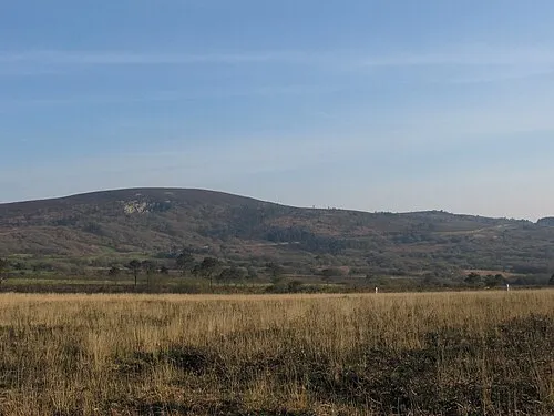 Ménez Hom Mountain, Dinéault36 km NW
-
Forêt du Duc Natural site, Finistère23 km NW
-
Montagne de Laz Mountain, Laz24 km NE
Sources & licences
Data last updated: