Arrondissement of Lorient
Located in Morbihan, Brittany Region Coordinates: 47°47′51″ N 3°11′37″ W
- Population
- 323,308
- 323.3K
- Elevation
- 54 m
- above sea level
- Local time
- UTC+01:00
- Europe/Paris · UTC+01:00
- Places inside
- 58
- listed under Arrondissement of Lorient
- Airports
- RNS Rennes-Saint-Jacques Airport113 km
- BES Brest Bretagne airport116 km
About Arrondissement of Lorient
Arrondissement of Lorient is a municipality. Location: Morbihan, Brittany Region. Population: 323,308. Elevation: 54 m. The best months to visit are June–September. The nearest airport is Rennes-Saint-Jacques Airport (113 km). Nearby sights include Ruisseau du Pont du Roch and Ruisseau de Kergrois.
Climate of Arrondissement of Lorient
Best months for sightseeingBest months for sightseeing: June–September.
This month · November
A wet month
Day 12° · Night 7° · Rain 116 mm
- Hottest month
- August (day 22°)
- Coldest month
- February (night 4°)
- Wettest month
- November (116 mm)
- Driest month
- July (43 mm)
Bars: average monthly low and high temperature. Below: precipitation. Monthly averages for 1970–2000 at about 18 km resolution, adjusted for elevation. Highlighted months are mild and relatively dry. Source: WorldClim 2.1 (CC BY 4.0).
Show values as a table
| Month | Jan | Feb | Mar | Apr | May | Jun | Jul | Aug | Sep | Oct | Nov | Dec |
|---|---|---|---|---|---|---|---|---|---|---|---|---|
| Average high (°C) | 9° | 10° | 12° | 14° | 17° | 20° | 22° | 22° | 20° | 16° | 12° | 10° |
| Average low (°C) | 4° | 4° | 5° | 6° | 9° | 12° | 14° | 14° | 12° | 10° | 7° | 5° |
| Precipitation (mm) | 108 | 86 | 74 | 62 | 66 | 48 | 43 | 51 | 72 | 89 | 116 | 108 |
Other places to visit in this season: June July August September
How to get to Arrondissement of Lorient
The nearest airport is Rennes-Saint-Jacques Airport (RNS), 113 km to the east as the crow flies. For international flights: Brest Bretagne airport (BES) (116 km). The nearest large city is Brest, 117 km to the northwest.
Airports
- Rennes-Saint-Jacques Airport (RNS) Saint-Jacques-de-la-Lande, Ille-et-Vilaine 113 kmeast
- Brest Bretagne airport (BES) Brest 116 kmnorthwest
- Nantes Atlantique Airport (NTE) Nantes 139 kmsoutheast
Nearby large cities
- Brest Population: 144.9K 117 kmnorthwest
- Rennes Population: 227.8K 119 kmeast
- Nantes Population: 325.1K 139 kmsoutheast
- Angers Population: 168.3K 202 kmeast
- Le Mans Population: 144.5K 255 kmeast
Straight-line distances; road distances are longer. Airport data: OurAirports.
Day trips from Arrondissement of Lorient
Within 100 km: 222 historic and cultural sites, 153 natural sites, 266 lakes, rivers and coasts.
0–25 km64 places
- Plage de Kerguélen Beach 19 kmSW
- Plage de Toulhars Beach 17 kmSW
- Plage de Larmor Beach 17 kmSW
- Plage de Sainte-Barbe Beach 22 kmS
25–60 km294 places
- Belle Île Island 52 kmS
- Île de Groix Island 27 kmSW
- Plage de Carnac Beach 27 kmS
- Moros River 54 kmW
60–100 km283 places
- Kastell Tonkedeg Historic site 99 kmN
- Île aux Rats Island 74 kmW
- Plage de la Courance Beach 93 kmSE
- Plage Sainte-Marguerite Beach 91 kmSE
Straight-line distances.
Arrondissement of Lorient and similar cities
Side by side with cities of similar size in the same country: population, elevation and climate.
| Measure | Arrondissement of Lorient | Nantes | Marne La Vallée | Nice |
|---|---|---|---|---|
| Population | 323.3K | 325.1K | 318.3K | 342.7K |
| Elevation | 54 m | 19 m | 96 m | 25 m |
| Summer day (hottest month) | 22° | 25° | 24° | 28° |
| Winter night (coldest month) | 4° | 3° | 1° | 5° |
| Annual rainfall | 923 mm | 794 mm | 635 mm | 807 mm |
| Best months | Jun–Sep | Jun–Sep | Jun–Sep | May–Sep |
| Distance | — | 139 km | 448 km | 931 km |
Climate values are 1970–2000 monthly averages; straight-line distance.
Places in Arrondissement of Lorient
58 places- 1 Lorient 57.3K
- 2 Lanester 22.4K
- 3 Ploemeur 17.9K
- 4 Hennebont 15.6K
- 5 Auray 13.7K
- 6 Guidel 11.4K
- 7 Quéven 8.6K
- 8 Larmor-Plage 8.2K
- 9 Languidic 7.9K
- 10 Pluvigner 7.5K
- 11 Caudan 6.8K
- 12 Brech 6.6K
- 13 Kervignac 6.6K
- 14 Inzinzac-Lochrist 6.5K
- 15 Plouay 5.6K
- 16 Pluneret 5.6K
- 17 Riantec 5.5K
- 18 Plouhinec 5.3K
- 19 Quiberon 4.8K
- 20 Carnac 4.3K
- 21 Plumergat 4.1K
- 22 Locmiquélic 4.1K
- 23 Belz 3.7K
- 24 Landévant 3.7K
- 25 Pont-Scorff 3.7K
- 26 Erdeven 3.6K
- 27 Locoal-Mendon 3.4K
- 28 Cléguer 3.3K
- 29 Crach 3.3K
- 30 Merlevenez 3.2K
- 31 Camors 3K
- 32 Ploemel 2.8K
- 33 Gestel 2.8K
- 34 Sainte-Anne-d'Auray 2.7K
- 35 Port-Louis 2.6K
- 36 Le Palais 2.6K
- 37 Bubry 2.4K
- 38 Landaul 2.3K
- 39 Groix 2.3K
- 40 Plouharnel 2.1K
- 41 Inguiniel 2.1K
- 42 Saint-Pierre-Quiberon 2.1K
- 43 Étel 1.9K
- 44 La Trinité-sur-Mer 1.6K
- 45 Locmariaquer 1.6K
- 46 Nostang 1.5K
- 47 Saint-Philibert 1.5K
- 48 Quistinic 1.4K
- 49 Brandérion 1.4K
- 50 Sainte-Hélène 1.2K
- 51 Calan 1.2K
- 52 Bangor 990
- 53 Sauzon 981
- 54 Locmaria 870
- 55 Lanvaudan 803
- 56 Gâvres 673
- 57 Île-d'Houat 243
- 58 Hœdic 101
Bar: population relative to the most populous place in this list.
Nearby attractions & nature
Everything nearby-
Ruisseau du Pont du Roch River, Morbihan5.4 km S
-
Ruisseau de Kergrois River, Morbihan6.9 km SE
-
Bois de Trémelin Natural site, Morbihan7.9 km NW
-
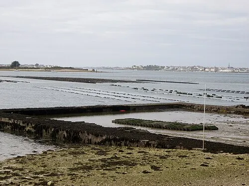 Île de Kerner Island, Morbihan14 km SW
-
Étang de Berringue Lake, Morbihan10 km S
-
Le Loc'h Lake, Morbihan10 km S
-
Rivière du Plessis River, Morbihan11 km SW
-
Ével River, Morbihan11 km NE
Other cities and towns in Morbihan
Sources & licences
Data last updated: