Bois de Trémelin
Located in Morbihan, Brittany Region Coordinates: 47°51′20″ N 3°15′17″ W
- Elevation
- 100 m
- above sea level
- Local time
- UTC+01:00
- Europe/Paris · UTC+01:00
- Airports
- BES Brest Bretagne airport109 km
- RNS Rennes-Saint-Jacques Airport116 km
About Bois de Trémelin
Bois de Trémelin is a natural site. Location: Morbihan, Brittany Region. The best months to visit are June–September. The nearest airport is Brest Bretagne airport (109 km). Nearby sights include Bois d'Organ and Abbaye de la Joie-Notre-Dame.
Climate of Bois de Trémelin
Best months for sightseeingBest months for sightseeing: June–September.
This month · November
A wet month
Day 12° · Night 6° · Rain 121 mm
- Hottest month
- August (day 22°)
- Coldest month
- January (night 4°)
- Wettest month
- November (121 mm)
- Driest month
- July (46 mm)
Bars: average monthly low and high temperature. Below: precipitation. Monthly averages for 1970–2000 at about 18 km resolution, adjusted for elevation. Highlighted months are mild and relatively dry. Source: WorldClim 2.1 (CC BY 4.0).
Show values as a table
| Month | Jan | Feb | Mar | Apr | May | Jun | Jul | Aug | Sep | Oct | Nov | Dec |
|---|---|---|---|---|---|---|---|---|---|---|---|---|
| Average high (°C) | 9° | 9° | 11° | 13° | 17° | 19° | 22° | 22° | 19° | 16° | 12° | 10° |
| Average low (°C) | 4° | 4° | 5° | 6° | 9° | 11° | 13° | 13° | 12° | 9° | 6° | 5° |
| Precipitation (mm) | 115 | 91 | 81 | 66 | 71 | 52 | 46 | 54 | 76 | 94 | 121 | 114 |
Other places to visit in this season: June July August September
How to get to Bois de Trémelin
The nearest airport is Brest Bretagne airport (BES), 109 km to the northwest as the crow flies. The nearest large city is Brest, 109 km to the northwest.
Airports
- Brest Bretagne airport (BES) Brest 109 kmnorthwest
- Rennes-Saint-Jacques Airport (RNS) Saint-Jacques-de-la-Lande, Ille-et-Vilaine 116 kmeast
- Nantes Atlantique Airport (NTE) Nantes 146 kmsoutheast
Nearby large cities
- Brest Population: 144.9K 109 kmnorthwest
- Rennes Population: 227.8K 121 kmeast
- Nantes Population: 325.1K 146 kmsoutheast
- Angers Population: 168.3K 207 kmeast
- Le Mans Population: 144.5K 259 kmeast
Straight-line distances; road distances are longer. Airport data: OurAirports.
Day trips from Bois de Trémelin
Within 100 km: 247 historic and cultural sites, 162 natural sites, 272 lakes, rivers and coasts.
0–25 km55 places
- Plage de Kerguélen Beach 20 kmSW
- Plage de Toulhars Beach 19 kmSW
- Plage de Larmor Beach 19 kmSW
- Plage du Magouëro Beach 21 kmS
25–60 km292 places
- Belle Île Island 58 kmS
- Île de Groix Island 29 kmSW
- Plage de Carnac Beach 35 kmSE
- Moros River 49 kmW
60–100 km334 places
- Kastell Koad Freg Historic site 96 kmN
- Kastell Tonkedeg Historic site 92 kmN
- Île aux Rats Island 70 kmW
- Les Grands Sables Beach 61 kmS
Straight-line distances.
Nearest towns and villages
-
Inzinzac-Lochrist Village, Arrondissement of Lorient1.5 km SW
-
Arrondissement of Lorient Municipality, Morbihan7.9 km SE
-
Inzinzac-Lochrist Village, Inzinzac-Lochrist1.1 km SW
-
Hennebont Village, Arrondissement of Lorient6 km S
-
Lanvaudan Village, Arrondissement of Lorient4.9 km N
-
Penquesten Village, Inzinzac-Lochrist2 km NE
Nearby attractions & nature
Everything nearby-
Bois d'Organ Natural site, Morbihan6.3 km N
-
Abbaye de la Joie-Notre-Dame Attraction, Hennebont5 km SW
-
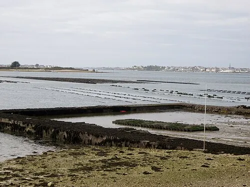 Île de Kerner Island, Morbihan17 km S
-
Artothèque Galerie Pierre Tal-Coat d'Hennebont Museum, Hennebont5.5 km S
-
Ével River, Morbihan11 km E
-
Château du Bot Historic site, Hennebont5.9 km SW
-
Forêt du Pont Calleck Natural site, Morbihan14 km NW
-
La Roche du Diable Mountain, Guilligomarc'h18 km NW
Sources & licences
Data last updated: