Évisa
Located in Arrondissement of Ajaccio, South Corsica Coordinates: 42°15′12″ N 8°48′07″ E
- Population
- 213
- 213
- Elevation
- 838 m
- above sea level
- Local time
- UTC+01:00
- Europe/Paris · UTC+01:00
- Places inside
- 8
- listed under Évisa
- Airports
- CLY Calvi Sainte Catherine Airport31 km
- AJA Ajaccio Napoléon Bonaparte airport37 km
About Évisa
Évisa is a village. Location: Arrondissement of Ajaccio, South Corsica. Population: 213. Elevation: 838 m. The best months to visit are June–August. The nearest airport is Calvi Sainte Catherine Airport (31 km). Nearby sights include Ruisseau d'Aitone and Ruisseau de Tavulella.
Photos of Évisa
-
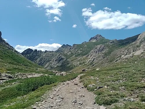
Le Forcelle Rémih · CC BY-SA 4.0 -
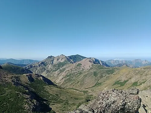
Capu di Guagnarola Rémih · CC BY-SA 4.0 -
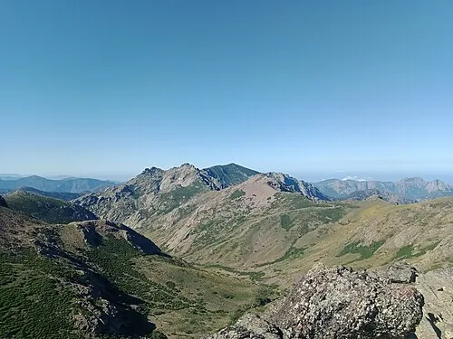
Ponte de Cricche Rémih · CC BY-SA 4.0


Climate of Évisa
Best months for sightseeingBest months for sightseeing: June–August.
This month · November
A wet month
Day 12° · Night 6° · Rain 119 mm
- Hottest month
- July (day 24°)
- Coldest month
- February (night 2°)
- Wettest month
- November (119 mm)
- Driest month
- July (14 mm)
Bars: average monthly low and high temperature. Below: precipitation. Monthly averages for 1970–2000 at about 18 km resolution, adjusted for elevation. Highlighted months are mild and relatively dry. Source: WorldClim 2.1 (CC BY 4.0).
Show values as a table
| Month | Jan | Feb | Mar | Apr | May | Jun | Jul | Aug | Sep | Oct | Nov | Dec |
|---|---|---|---|---|---|---|---|---|---|---|---|---|
| Average high (°C) | 8° | 8° | 10° | 12° | 16° | 20° | 24° | 24° | 20° | 16° | 12° | 9° |
| Average low (°C) | 2° | 2° | 3° | 5° | 9° | 12° | 15° | 16° | 13° | 10° | 6° | 3° |
| Precipitation (mm) | 90 | 80 | 78 | 74 | 51 | 35 | 14 | 26 | 69 | 113 | 119 | 99 |
How to get to Évisa
The nearest airport is Calvi Sainte Catherine Airport (CLY), 31 km to the north as the crow flies. For international flights: Bastia-Poretta International airport (BIA) (65 km). The nearest large city is Nice, 204 km to the northwest.
Airports
- Calvi Sainte Catherine Airport (CLY) Calvi 31 kmnorth
- Ajaccio Napoléon Bonaparte airport (AJA) Ajaccio 37 kmsouth
- Bastia-Poretta International airport (BIA) Bastia 65 kmnortheast
Nearby large cities
- Nice Population: 342.7K 204 kmnorthwest
- Toulon Population: 168.7K 255 kmnorthwest
- Marseille Population: 877.2K 303 kmnorthwest
- Aix-en-Provence Population: 146.8K 308 kmnorthwest
Straight-line distances; road distances are longer. Airport data: OurAirports.
Day trips from Évisa
Within 100 km: 138 historic and cultural sites, 575 natural sites, 314 lakes, rivers and coasts.
0–25 km208 places
- Plage Bussaglia Beach 10 kmW
- Capu di a Borba Mountain 22 kmE
- Punta di a Vita Mountain 19 kmS
- Capu di Bagliu Mountain 16 kmSW
25–60 km487 places
- Corsica Island 27 kmSE
- Plage du Ruppione Beach 47 kmS
- Plage d'Albitreccia Beach 44 kmS
- Plage de Cupabia Beach 57 kmS
60–100 km332 places
- Banda Bianca Beach 69 kmNE
- Plage de Carataggio Beach 88 kmSE
- Plage de Capu Laurosu Beach 65 kmS
- Plage de Purraja Beach 65 kmS
Straight-line distances.
Places in Évisa
8 placesBar: population relative to the most populous place in this list.
Mountains & nature7
- Capo alla Penna · Mountain
- Capu â Cuccula · Mountain
- Capu â Rughia · Mountain
- Capu a Scale · Mountain
- Capu di Guagnarola · Mountain
- Capu di Melu · Mountain
- Ponte de Cricche · Mountain
Nearby attractions & nature
Everything nearby-
Ruisseau d'Aitone River, South Corsica2.2 km W
-
Ruisseau de Tavulella River, Corsica2.3 km SW
-
Gorges de Spelunca Natural site, Corsica2.9 km W
-
Ruisseau de Lonca River, South Corsica3.1 km W
-
Capu di a Pulmunaccia Mountain, Marignana4.3 km SW
-
Capu Sant'Anghiulu Mountain, Cristinacce3.8 km SE
Sources & licences
Data last updated: