Arrondissement of Ajaccio
Located in South Corsica, Corsica Coordinates: 42°00′00″ N 8°55′00″ E
- Population
- 123,120
- 123.1K
- Elevation
- 469 m
- above sea level
- Local time
- UTC+01:00
- Europe/Paris · UTC+01:00
- Places inside
- 81
- listed under Arrondissement of Ajaccio
- Airports
- AJA Ajaccio Napoléon Bonaparte airport13 km
- FSC Figari Sud-Corse Airport57 km
About Arrondissement of Ajaccio
Arrondissement of Ajaccio is a municipality. Location: South Corsica, Corsica. Population: 123,120. Elevation: 469 m. The best months to visit are June–September. The nearest airport is Ajaccio Napoléon Bonaparte airport (13 km). Nearby sights include Église San-Giovanni and Torrent de Monticchi.
Photos of Arrondissement of Ajaccio
-
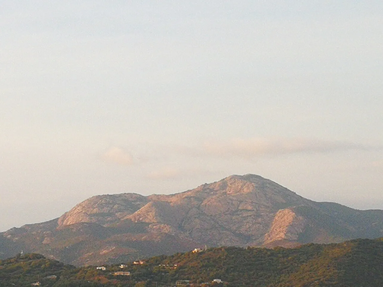
Monte Ravu Rotavdrag · CC BY-SA 4.0 -
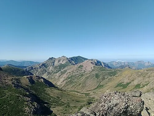
Capu di Guagnarola Rémih · CC BY-SA 4.0 -
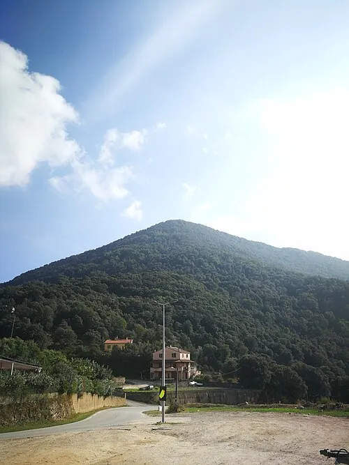
Punta di a Cuma Rotavdrag · CC BY-SA 4.0 -
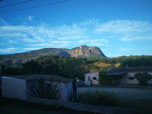
Punta Mora Rotavdrag · CC BY-SA 4.0 -
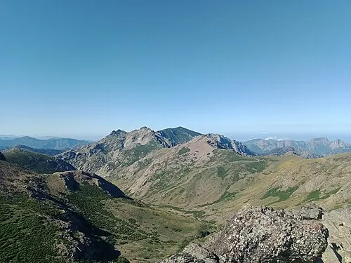
Ponte de Cricche Rémih · CC BY-SA 4.0


Climate of Arrondissement of Ajaccio
Best months for sightseeingBest months for sightseeing: June–September.
This month · November
A wet month
Day 15° · Night 8° · Rain 105 mm
- Hottest month
- August (day 26°)
- Coldest month
- February (night 4°)
- Wettest month
- November (105 mm)
- Driest month
- July (12 mm)
Bars: average monthly low and high temperature. Below: precipitation. Monthly averages for 1970–2000 at about 18 km resolution, adjusted for elevation. Highlighted months are mild and relatively dry. Source: WorldClim 2.1 (CC BY 4.0).
Show values as a table
| Month | Jan | Feb | Mar | Apr | May | Jun | Jul | Aug | Sep | Oct | Nov | Dec |
|---|---|---|---|---|---|---|---|---|---|---|---|---|
| Average high (°C) | 11° | 11° | 12° | 15° | 19° | 23° | 26° | 26° | 23° | 19° | 15° | 12° |
| Average low (°C) | 4° | 4° | 5° | 7° | 11° | 14° | 17° | 17° | 15° | 12° | 8° | 5° |
| Precipitation (mm) | 75 | 69 | 69 | 64 | 45 | 28 | 12 | 22 | 56 | 96 | 105 | 87 |
Other places to visit in this season: June July August September
How to get to Arrondissement of Ajaccio
The nearest airport is Ajaccio Napoléon Bonaparte airport (AJA), 13 km to the southwest as the crow flies. For international flights: Figari Sud-Corse Airport (FSC) (57 km). The nearest large city is Nice, 232 km to the northwest.
Airports
- Ajaccio Napoléon Bonaparte airport (AJA) Ajaccio 13 kmsouthwest
- Figari Sud-Corse Airport (FSC) Figari 57 kmsouth
- Calvi Sainte Catherine Airport (CLY) Calvi 60 kmnorth
Nearby large cities
- Nice Population: 342.7K 232 kmnorthwest
- Toulon Population: 168.7K 275 kmnorthwest
- Marseille Population: 877.2K 324 kmnorthwest
- Aix-en-Provence Population: 146.8K 331 kmnorthwest
Straight-line distances; road distances are longer. Airport data: OurAirports.
Day trips from Arrondissement of Ajaccio
Within 100 km: 134 historic and cultural sites, 564 natural sites, 353 lakes, rivers and coasts.
0–25 km174 places
- Corsica Island 23 kmNE
- Plage du Ruppione Beach 22 kmSW
- Plage d'Albitreccia Beach 19 kmSW
- Plage Saint-François Beach 18 kmSW
25–60 km603 places
- Plage de Cupabia Beach 31 kmS
- Plage de Carataggio Beach 59 kmSE
- Plage de Capu Laurosu Beach 37 kmS
- Plage de Purraja Beach 36 kmS
60–100 km274 places
- Banda Bianca Beach 85 kmNE
- Saleccia Beach 84 kmN
- Moriani-Plage Beach 66 kmNE
- Plage de Figari Beach 60 kmS
Straight-line distances.
Arrondissement of Ajaccio and similar cities
Side by side with cities of similar size in the same country: population, elevation and climate.
| Measure | Arrondissement of Ajaccio | Metz | Besançon | Orléans |
|---|---|---|---|---|
| Population | 123.1K | 123.9K | 128.4K | 116.3K |
| Elevation | 469 m | 182 m | 300 m | 115 m |
| Summer day (hottest month) | 26° | 25° | 24° | 25° |
| Winter night (coldest month) | 4° | -1° | -1° | 1° |
| Annual rainfall | 728 mm | 776 mm | 1,156 mm | 641 mm |
| Best months | Jun–Sep | May–Sep | Jun–Sep | Jun–Sep |
| Distance | — | 820 km | 627 km | 857 km |
Climate values are 1970–2000 monthly averages; straight-line distance.
Places in Arrondissement of Ajaccio
81 places- 1 Ajaccio 69.1K
- 2 Bastelicaccia 3.9K
- 3 Alata 3.2K
- 4 Afa 3.1K
- 5 Grosseto-Prugna 3K
- 6 Sarrola-Carcopino 2.8K
- 7 Cuttoli-Corticchiato 2K
- 8 Peri 1.9K
- 9 Appietto 1.8K
- 10 Albitreccia 1.7K
- 11 Pietrosella 1.6K
- 12 Cauro 1.4K
- 13 Cargèse 1.3K
- 14 Eccica-Suarella 1.2K
- 15 Vico 917
- 16 Coti-Chiavari 748
- 17 Coggia 704
- 18 Ocana 581
- 19 Vero 559
- 20 Bastelica 541
- 21 Calcatoggio 532
- 22 Ota 529
- 23 Ucciani 492
- 24 Piana 482
- 25 Serra-di-Ferro 476
- 26 Santa-Maria-Siché 441
- 27 Bocognano 416
- 28 Valle-di-Mezzana 414
- 29 Tavera 399
- 30 Carbuccia 389
- 31 Casaglione 389
- 32 Villanova 357
- 33 Tavaco 352
- 34 Sari-d'Orcino 331
- 35 Pila-Canale 286
- 36 Cozzano 270
- 37 Olivese 228
- 38 Zicavo 228
- 39 Évisa 213
- 40 Azilone-Ampaza 179
- 41 Cognocoli-Monticchi 168
- 42 Palneca 162
- 43 Guagno 157
- 44 Guitera-les-Bains 147
- 45 Soccia 145
- 46 Guargualé 140
- 47 Ciamannacce 133
- 48 Balogna 130
- 49 Zigliara 130
- 50 Tolla 127
- 51 Serriera 124
- 52 Letia 117
- 53 Frasseto 115
- 54 Marignana 109
- 55 Tasso 109
- 56 Sant'Andréa-d'Orcino 108
- 57 Campo 106
- 58 Poggiolo 106
- 59 Lopigna 102
- 60 Partinello 102
Bar: population relative to the most populous place in this list.
Nearby attractions & nature
Everything nearby-
Église San-Giovanni Historic site, Corsica5.8 km N
-
Torrent de Monticchi River, South Corsica7.2 km S
-
Rivière d'Ese River, South Corsica7.3 km SE
-
Gorges du Prunelli Natural site, Corsica7.4 km SE
-
Ruisseau de Mondone River, South Corsica8.9 km NE
-
Pont de Zipitoli Landmark, Corsica8.3 km SE
-
Prunelli Natural site, Corsica8.3 km SE
-
Ajara River, South Corsica9.6 km E
Sources & licences
Data last updated: