South Corsica
Located in Corsica, France Coordinates: 41°55′00″ N 9°10′00″ E
- Population
- 166,045
- 166K
- Elevation
- 1,392 m
- above sea level
- Local time
- UTC+01:00
- Europe/Paris · UTC+01:00
- Places inside
- 105
- listed under South Corsica
About South Corsica
South Corsica is a district. Location: Corsica, France. Population: 166,045.
Corse-du-Sud (French pronunciation: [kɔʁs dy syd] ; Corsican: Corsica suttana [ˈkorsiga zutˈtana], Pumonte [puˈmɔntɛ] or Pumonti [puˈmɔnti]; English: Southern Corsica) is an administrative department of France, consisting of the southern part of the island of Corsica. The corresponding departmental territorial collectivity merged with that of Haute-Corse on 1 January 2018, forming the single territorial collectivity of Corsica, with territorial elections coinciding with the dissolution of the separate council.
Read more on Wikipedia Text: Wikipedia contributors · CC BY-SA 4.0 · shortened
At a glance
- Built
- 1976
- Area
- 4,014 km²
Source: Wikidata
In comparison
- 22 sights and natural places within 10 km Monte Occhjatu, Ruisseau de Casamintellu
- Listed here: River: 68, Natural site: 25, Lake: 6, Island: 2
Airports nearest to South Corsica
- Ajaccio Napoléon Bonaparte airport (AJA) Ajaccio 30 km
- Figari Sud-Corse Airport (FSC) Figari 46 km
- Calvi Sainte Catherine Airport (CLY) Calvi 75 km
Straight-line distance; airports with scheduled flights only. Source: OurAirports (public domain).
Places in South Corsica
105 places-
Arrondissement of Ajaccio Municipality123.1K
-
Arrondissement of Sartène Municipality42.9K
-
Ajara River
-
Albelli River
-
A Liscia River
-
Baie d'Elbo Natural site
-
Baraci River
-
Capu di Acciaju Natural site
-
Capu Laurosu Natural site
-
Chiuni River
-
Chiuvone River
-
Étang de Balistra Lake
-
Étang de Canettu Lake
-
Étang de Sperono Lake
-
Étang de Tanchiccia Lake
-
Étangs d'Arasu Lake
-
Favone River
-
Forêt Communale de Piana Natural site
-
Forêt de Barocaggio Marghese Natural site
-
Forêt de Botaro Natural site
-
Forêt de Gattica Natural site
-
Forêt de l'Ospedale Natural site
-
Forêt de Pastricciola Natural site
-
Forêt d'Esigna Natural site
-
Forêt de Stragonato Natural site
-
Forêt de Tacca Natural site
-
Forêt de Vittoli Natural site
-
Forêt d'Olivese Natural site
-
Forêt Territoriale de Libio Natural site
-
Forêt Territoriale de Lonca Natural site
-
Forêt Territoriale de l'Ospedale Massif d'Albarellu Natural site
-
Forêt Territoriale de Punta Niella Natural site
-
Forêt Territoriale de Sambucu Natural site
-
Forêt Territoriale de Valle Mala Natural site
-
Forêt Territoriale de Zonza Natural site
-
Forêt Territoriale du Cusciunu Natural site
-
Golfe de Topiti Natural site
-
Île de Farina Island
-
Île de Farina Island
-
La Gravona River
-
Le Prunelli River
-
Montagne de Cagna Mountain
-
Padulatu Lake
-
Plage d'Agliu Beach
-
Porto River
-
Presqu'île de Rondinara Natural site
-
Richiusa River
-
Rivière de Conca River
-
Rivière de Guagno River
-
Rivière de Porto River
-
Rivière de Sagone River
-
Rivière d'Ese River
-
Rivière de Tarcu River
-
Rizzanèse River
-
Ruisseau d'Agosta River
-
Ruisseau d'Aitone River
-
Ruisseau de Bubia River
-
Ruisseau de Calzatoghiu River
-
Ruisseau de Canali River
-
Ruisseau de Canella River
Nature and heritage in South Corsica
-
Capo dello Vitullo Mountain, Marignana
-
Capu d'Ota Mountain, Ota
-
Punta di Stavulinca Mountain, Figari
-
Monte Senino Mountain, Osani
-
Monte Scupetu Mountain, Figari
-
Sapara Mountain, Bastelica
Nearby attractions & nature
Everything nearby-
Forêt Territoriale de Sant'Antone Natural site, Corsica5.9 km N
-
Monte Formicula Mountain, San-Gavino-di-Fiumorbo5.4 km NE
-
Forêt de Val Chiara Natural site, Upper Corsica5.7 km E
-
Punta Castellucciu Mountain, Chisa7.3 km E
-
Monte Malo Mountain, Solaro7.4 km SE
-
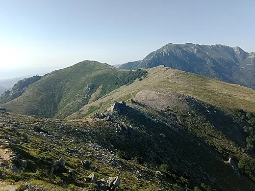 Punta di Campolongo Mountain, San-Gavino-di-Fiumorbo7.9 km NE
Sources & licences
Data last updated: · 2 independent sources