- Elevation
- 123 m
- above sea level
- Local time
- UTC+01:00
- Europe/Paris · UTC+01:00
- Airports
- AJA Ajaccio Napoléon Bonaparte airport23 km
- CLY Calvi Sainte Catherine Airport44 km
About Ruisseau de Calzatoghiu
Ruisseau de Calzatoghiu is a river. Location: South Corsica, Corsica. The best months to visit are May–October. The nearest airport is Ajaccio Napoléon Bonaparte airport (23 km). Nearby sights include Capu a u Lucu and U Cruzzini.
Photos of Ruisseau de Calzatoghiu
-
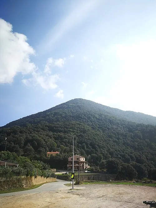
Punta di a Cuma Rotavdrag · CC BY-SA 4.0

Climate of Ruisseau de Calzatoghiu
Best months for sightseeingBest months for sightseeing: May–October.
This month · November
A wet month
Day 17° · Night 10° · Rain 112 mm
- Hottest month
- July (day 28°)
- Coldest month
- February (night 6°)
- Wettest month
- November (112 mm)
- Driest month
- July (14 mm)
Bars: average monthly low and high temperature. Below: precipitation. Monthly averages for 1970–2000 at about 18 km resolution, adjusted for elevation. Highlighted months are mild and relatively dry. Source: WorldClim 2.1 (CC BY 4.0).
Show values as a table
| Month | Jan | Feb | Mar | Apr | May | Jun | Jul | Aug | Sep | Oct | Nov | Dec |
|---|---|---|---|---|---|---|---|---|---|---|---|---|
| Average high (°C) | 13° | 13° | 14° | 17° | 21° | 25° | 28° | 28° | 25° | 21° | 17° | 14° |
| Average low (°C) | 6° | 6° | 8° | 10° | 13° | 17° | 20° | 20° | 17° | 14° | 10° | 7° |
| Precipitation (mm) | 83 | 76 | 74 | 69 | 49 | 32 | 14 | 25 | 63 | 104 | 112 | 93 |
Other places to visit in this season: May June July August September October
How to get to Ruisseau de Calzatoghiu
The nearest airport is Ajaccio Napoléon Bonaparte airport (AJA), 23 km to the south as the crow flies. For international flights: Bastia-Poretta International airport (BIA) (71 km). The nearest large city is Nice, 217 km to the northwest.
Airports
- Ajaccio Napoléon Bonaparte airport (AJA) Ajaccio 23 kmsouth
- Calvi Sainte Catherine Airport (CLY) Calvi 44 kmnorth
- Bastia-Poretta International airport (BIA) Bastia 71 kmnortheast
Nearby large cities
- Nice Population: 342.7K 217 kmnorthwest
- Toulon Population: 168.7K 263 kmnorthwest
- Marseille Population: 877.2K 311 kmnorthwest
- Aix-en-Provence Population: 146.8K 317 kmnorthwest
Straight-line distances; road distances are longer. Airport data: OurAirports.
Day trips from Ruisseau de Calzatoghiu
Within 100 km: 138 historic and cultural sites, 571 natural sites, 317 lakes, rivers and coasts.
0–25 km199 places
- Corsica Island 22 kmE
- Plage du Ricanto Beach 23 kmS
- Plage Bussaglia Beach 21 kmNW
- Punta di a Vita Mountain 6 kmS
25–60 km542 places
- Plage du Ruppione Beach 33 kmS
- Plage d'Albitreccia Beach 30 kmS
- Plage de Cupabia Beach 44 kmS
- Plage Saint-François Beach 25 kmS
60–100 km285 places
- Banda Bianca Beach 77 kmNE
- Plage de Carataggio Beach 75 kmSE
- Saleccia Beach 73 kmNE
- Moriani-Plage Beach 63 kmNE
Straight-line distances.
Nearest towns and villages
Nearby attractions & nature
Everything nearby-
Capu a u Lucu Mountain, Murzo2.2 km N
-
U Cruzzini River, South Corsica2 km SW
-
Punta di a Spusata Mountain, Corsica2.7 km NE
-
Punta di Curiccia Mountain, Corsica3.5 km NE
-
Punta di a Cuma Mountain, Vico4.6 km NW
-
Punta di Purcilellu Mountain, Murzo4.4 km NE
-
Ruisseau de Catena River, South Corsica4 km NW
-
Punta Riccinosa Mountain, Poggiolo5 km E
Sources & licences
Data last updated: