Forêt de l'Ospedale
Located in South Corsica, Corsica Coordinates: 41°40′00″ N 9°14′30″ E
- Elevation
- 653 m
- above sea level
- Local time
- UTC+01:00
- Europe/Paris · UTC+01:00
- Airports
- FSC Figari Sud-Corse Airport22 km
- AJA Ajaccio Napoléon Bonaparte airport46 km
About Forêt de l'Ospedale
Forêt de l'Ospedale is a natural site. Location: South Corsica, Corsica. The best months to visit are June–September. The nearest airport is Figari Sud-Corse Airport (22 km). Nearby sights include Punta di Finaggia and Pointe de Finaggia.
Climate of Forêt de l'Ospedale
Best months for sightseeingBest months for sightseeing: June–September.
This month · November
Outside the best season
Day 13° · Night 8° · Rain 98 mm
- Hottest month
- July (day 25°)
- Coldest month
- February (night 4°)
- Wettest month
- November (98 mm)
- Driest month
- July (14 mm)
Bars: average monthly low and high temperature. Below: precipitation. Monthly averages for 1970–2000 at about 18 km resolution, adjusted for elevation. Highlighted months are mild and relatively dry. Source: WorldClim 2.1 (CC BY 4.0).
Show values as a table
| Month | Jan | Feb | Mar | Apr | May | Jun | Jul | Aug | Sep | Oct | Nov | Dec |
|---|---|---|---|---|---|---|---|---|---|---|---|---|
| Average high (°C) | 9° | 9° | 11° | 13° | 18° | 22° | 25° | 25° | 22° | 18° | 13° | 10° |
| Average low (°C) | 4° | 4° | 5° | 7° | 11° | 15° | 18° | 18° | 15° | 12° | 8° | 5° |
| Precipitation (mm) | 74 | 71 | 69 | 59 | 45 | 28 | 14 | 23 | 53 | 89 | 98 | 90 |
Other places to visit in this season: June July August September
How to get to Forêt de l'Ospedale
The nearest airport is Figari Sud-Corse Airport (FSC), 22 km to the southwest as the crow flies. The nearest large city is Nice, 278 km to the northwest.
Airports
- Figari Sud-Corse Airport (FSC) Figari 22 kmsouthwest
- Ajaccio Napoléon Bonaparte airport (AJA) Ajaccio 46 kmnorthwest
- Olbia Costa Smeralda Airport (OLB) Olbia (SS) 88 kmsouth
Nearby large cities
- Nice Population: 342.7K 278 kmnorthwest
- Toulon Population: 168.7K 317 kmnorthwest
- Marseille Population: 877.2K 365 kmnorthwest
- Aix-en-Provence Population: 146.8K 374 kmnorthwest
Straight-line distances; road distances are longer. Airport data: OurAirports.
Day trips from Forêt de l'Ospedale
Within 100 km: 108 historic and cultural sites, 508 natural sites, 340 lakes, rivers and coasts.
0–25 km134 places
- Plage de Carataggio Beach 13 kmSE
- Plage de Santa Giulia Beach 15 kmS
- Plage de Palombaggia Beach 14 kmSE
- Plage Casadelmar Beach 9 kmSE
25–60 km392 places
- Corsica Island 56 kmN
- Plage du Ruppione Beach 42 kmNW
- Plage d'Albitreccia Beach 43 kmNW
- Plage de Cupabia Beach 39 kmW
60–100 km430 places
- Plage Bussaglia Beach 82 kmNW
- Moriani-Plage Beach 82 kmN
- Île de Gargali Island 97 kmNW
- Étang de Terrenzana Lake 60 kmNE
Straight-line distances.
Nearest towns and villages
-
Arrondissement of Sartène Municipality, South Corsica6.3 km W
-
Lecci Village, Arrondissement of Sartène6.5 km E
-
Arraggio Village, San-Gavino-di-Carbini3.1 km SE
-
Arraggio Village, San-Gavino-di-Carbini3.2 km SE
-
Rinajolu de Palavese Village, Porto-Vecchio3.3 km SE
-
Gialla Village, San-Gavino-di-Carbini3.5 km E
Nearby attractions & nature
Everything nearby-
Punta di Finaggia Mountain, San-Gavino-di-Carbini2.1 km W
-
Pointe de Finaggia Mountain, Porto-Vecchio2.4 km W
-
Punta di Pineta Piana Mountain, Corsica2 km W
-
Forêt de Barocaggio Marghese Natural site, South Corsica2.7 km NW
-
Punta di u Diamante Mountain, San-Gavino-di-Carbini4.7 km NW
-
Forêt Territoriale de l'Ospedale Natural site, Zonza4.6 km N
-
Castellu d'Arraggio Historic site, Corsica2.7 km SE
-
Massif de Zonza Mountain, Corsica6.3 km N
More nature in France
-
Monte Calva Mountain, Zonza6.4 km N
-
Punta di a Vaca Morta Mountain, Levie6.6 km W
-
Punta di Quercitella Mountain, Zonza9.6 km N
-
Punta di a Varra Mountain, Porto-Vecchio9.8 km SE
-
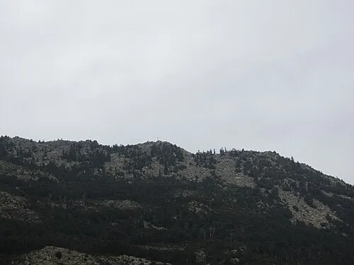 Montagne de Cagna Mountain, South Corsica16 km SW
-
Punta di u Cerchiu Mountain, Porto-Vecchio12 km SE
Sources & licences
Data last updated: