- Population
- 160,566
- 160.6K
- Elevation
- 297 m
- above sea level
- Local time
- UTC+01:00
- Europe/Paris · UTC+01:00
- Places inside
- 101
- listed under Arrondissement of Sélestat-Erstein
- Airports
- SXB Strasbourg Airport28 km
- FKB Karlsruhe Baden-Baden Airport70 km
About Arrondissement of Sélestat-Erstein
Arrondissement of Sélestat-Erstein is a municipality. Location: Bas-Rhin, Grand Est. Population: 160,566. Elevation: 297 m. The best months to visit are June–September. The nearest airport is Strasbourg Airport (28 km). Nearby sights include Chapelle Saint-Sébastien and Château du Bernstein.
Photos of Arrondissement of Sélestat-Erstein
-
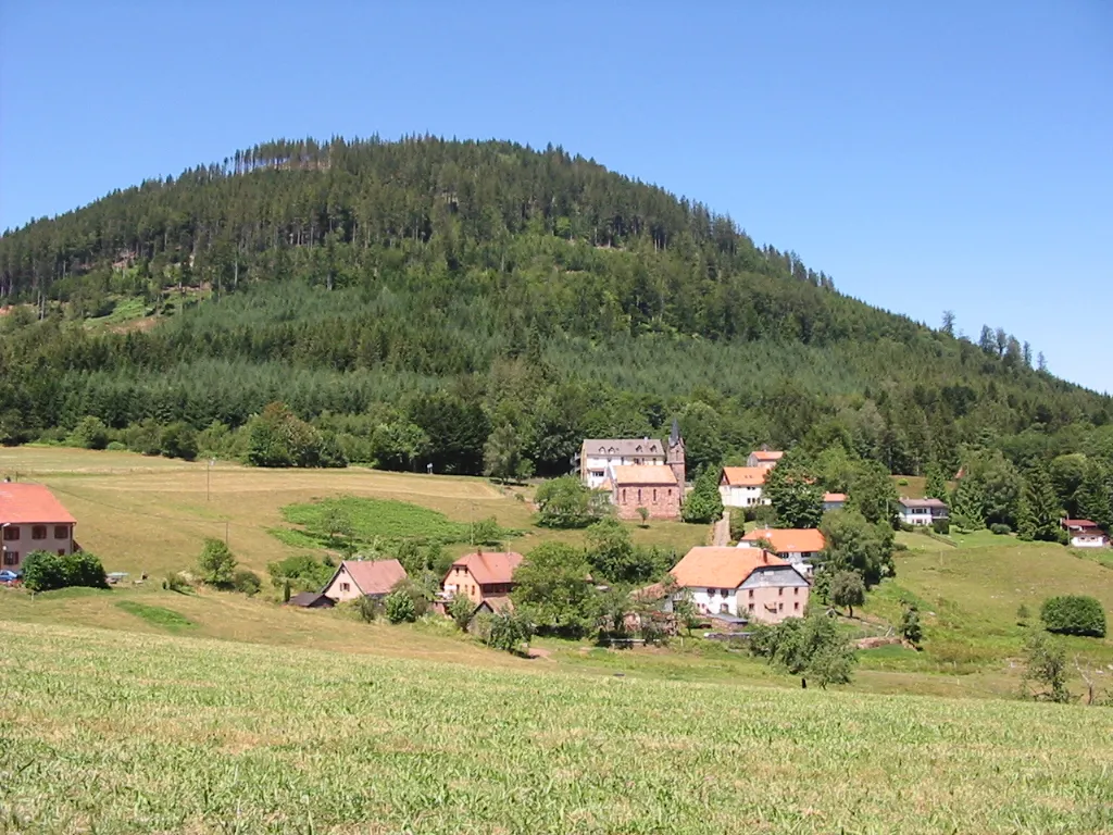
Climont No machine-readable author provided. Cham assumed · CC BY 2.5 -
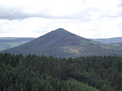
Ungersberg Jmp48 · CC BY-SA 3.0 -
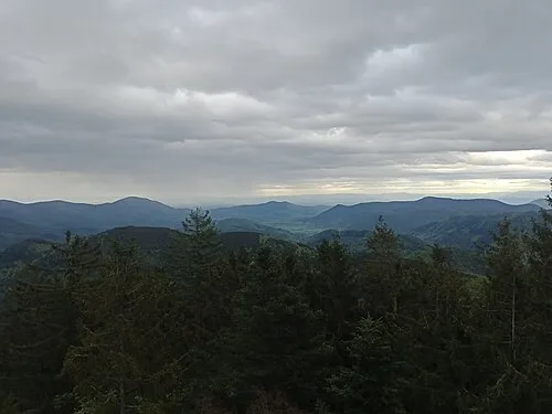
Le Dachfirst Rémih · CC BY-SA 4.0 -
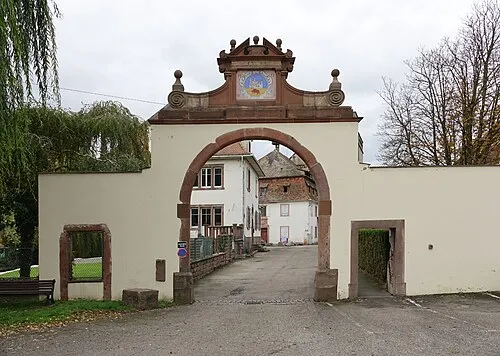
Ebersmunster Abbey Gzen92 · CC BY-SA 4.0


Climate of Arrondissement of Sélestat-Erstein
Best months for sightseeingBest months for sightseeing: June–September.
This month · November
A cold month
Day 8° · Night 2° · Rain 62 mm
- Hottest month
- July (day 24°)
- Coldest month
- January (night -2°)
- Wettest month
- May (78 mm)
- Driest month
- March (46 mm)
Bars: average monthly low and high temperature. Below: precipitation. Monthly averages for 1970–2000 at about 18 km resolution, adjusted for elevation. Highlighted months are mild and relatively dry. Source: WorldClim 2.1 (CC BY 4.0).
Show values as a table
| Month | Jan | Feb | Mar | Apr | May | Jun | Jul | Aug | Sep | Oct | Nov | Dec |
|---|---|---|---|---|---|---|---|---|---|---|---|---|
| Average high (°C) | 4° | 5° | 10° | 14° | 19° | 22° | 24° | 24° | 20° | 14° | 8° | 5° |
| Average low (°C) | -2° | -1° | 2° | 4° | 8° | 12° | 13° | 13° | 9° | 6° | 2° | 0° |
| Precipitation (mm) | 50 | 51 | 46 | 49 | 78 | 75 | 71 | 62 | 61 | 61 | 62 | 65 |
Other places to visit in this season: June July August September
How to get to Arrondissement of Sélestat-Erstein
The nearest airport is Strasbourg Airport (SXB), 28 km to the northeast as the crow flies. The nearest large city is Strasbourg, 37 km to the northeast.
Airports
- Strasbourg Airport (SXB) Strasbourg 28 kmnortheast
- Karlsruhe Baden-Baden Airport (FKB) Rheinmünster 70 kmnortheast
- EuroAirport Basel–Mulhouse–Freiburg (BSL) Bâle / Mulhouse 82 kmsouth
Nearby large cities
- Strasbourg Population: 274.8K 37 kmnortheast
- Freiburg im Breisgau Population: 237.5K 50 kmsoutheast
- Mulhouse Population: 111.4K 65 kmsouth
- Basel Population: 177.6K 87 kmsouth
- Nancy Population: 105.1K 99 kmnorthwest
Straight-line distances; road distances are longer. Airport data: OurAirports.
Day trips from Arrondissement of Sélestat-Erstein
Within 100 km: 460 historic and cultural sites, 2,000 natural sites, 458 lakes, rivers and coasts.
0–25 km158 places
- Limberg Mountain 24 kmSE
- Mühlbach River 24 kmSE
- Ettenbach River 25 kmE
- Elz River 24 kmE
25–60 km827 places
- Unditz River 34 kmE
- Rench River 57 kmNE
- Matschelsee Lake 31 kmE
- Tunisee Lake 42 kmSE
60–100 km1,933 places
- Etangs Rougeat Lake 99 kmS
- Pisciculture Lake 98 kmS
- Rheinhafen Kleinhüningen Lake 84 kmS
- Etang du Milieu Lake 98 kmS
Straight-line distances.
Arrondissement of Sélestat-Erstein and similar cities
Side by side with cities of similar size in the same country: population, elevation and climate.
| Measure | Arrondissement of Sélestat-Erstein | Dijon | Paris 16 Passy | Paris 17 Batignolles-Monceau |
|---|---|---|---|---|
| Population | 160.6K | 159.9K | 159.4K | 159.2K |
| Elevation | 297 m | 240 m | 67 m | 61 m |
| Summer day (hottest month) | 24° | 25° | 25° | 25° |
| Winter night (coldest month) | -2° | -1° | 2° | 2° |
| Annual rainfall | 731 mm | 767 mm | 632 mm | 632 mm |
| Best months | Jun–Sep | Jun–Sep | May–Sep | May–Sep |
| Distance | — | 213 km | 384 km | 381 km |
Climate values are 1970–2000 monthly averages; straight-line distance.
Places in Arrondissement of Sélestat-Erstein
101 places- 1 Sélestat 19.1K
- 2 Obernai 11K
- 3 Erstein 10.7K
- 4 Barr 7.2K
- 5 Benfeld 5.7K
- 6 Châtenois 4.2K
- 7 Marckolsheim 4.1K
- 8 Gerstheim 3.4K
- 9 Scherwiller 3.2K
- 10 Rhinau 2.7K
- 11 Huttenheim 2.7K
- 12 Hilsenheim 2.7K
- 13 Epfig 2.3K
- 14 Ebersheim 2.2K
- 15 Dambach-la-Ville 2.2K
- 16 Wittisheim 2.1K
- 17 Muttersholtz 2K
- 18 Villé 1.8K
- 19 Sundhouse 1.8K
- 20 Andlau 1.7K
- 21 Nordhouse 1.7K
- 22 Krautergersheim 1.7K
- 23 Kintzheim 1.6K
- 24 Westhouse 1.5K
- 25 Meistratzheim 1.5K
- 26 Hindisheim 1.5K
- 27 Bernardswiller 1.5K
- 28 Matzenheim 1.4K
- 29 Obenheim 1.4K
- 30 Boofzheim 1.4K
- 31 Valff 1.3K
- 32 Gertwiller 1.3K
- 33 Niedernai 1.2K
- 34 Kogenheim 1.2K
- 35 Kertzfeld 1.2K
- 36 Sand 1.2K
- 37 Innenheim 1.2K
- 38 Baldenheim 1.2K
- 39 Mussig 1.1K
- 40 Stotzheim 1K
- 41 Bindernheim 1K
- 42 Hipsheim 1K
- 43 Ohnenheim 1K
- 44 Artolsheim 995
- 45 Rossfeld 991
- 46 Heiligenstein 957
- 47 Osthouse 923
- 48 Sermersheim 921
- 49 Herbsheim 916
- 50 Goxwiller 848
- 51 Schaeffersheim 846
- 52 Elsenheim 823
- 53 Maisonsgoutte 804
- 54 Saint-Pierre-Bois 773
- 55 Zellwiller 772
- 56 Mackenheim 761
- 57 Bootzheim 724
- 58 Diebolsheim 704
- 59 Neubois 695
- 60 Breitenbach 674
Bar: population relative to the most populous place in this list.
Nearby attractions & nature
Everything nearby-
Chapelle Saint-Sébastien Attraction, Grand Est0.7 km S
-
Château du Bernstein Historic site, Grand Est1.8 km SW
-
Château de l'Ortenbourg Historic site, Grand Est4.5 km SW
-
Château de Ramstein Historic site, Grand Est4.8 km SW
-
Lièpvrette River, Bas-Rhin5.5 km SW
-
Sainte-Marguerite Attraction, Grand Est5.1 km NE
-
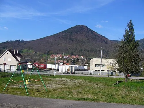 Chalmont Mountain, Lièpvre11 km SW
-
Château d'Andlau Historic site, Grand Est7.6 km N
Sources & licences
Data last updated: