- Elevation
- 247 m
- above sea level
- Local time
- UTC+01:00
- Europe/Paris · UTC+01:00
- Airports
- BSL EuroAirport Basel–Mulhouse–Freiburg28 km
- SXB Strasbourg Airport87 km
About Bois de Nonnenbruch
Bois de Nonnenbruch is a natural site. Location: Haut-Rhin, Grand Est. The best months to visit are May–September. The nearest airport is EuroAirport Basel–Mulhouse–Freiburg (28 km). Nearby sights include Forêt communale de Pulversheim and Forêt communale d'Ensisheim.
Photos of Bois de Nonnenbruch
-
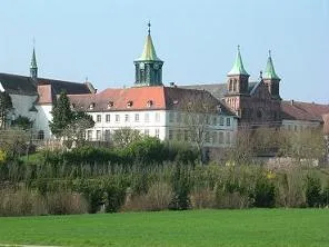
Abbaye Notre-Dame d'Oelenberg Frere Theophane · CC BY-SA 3.0 -
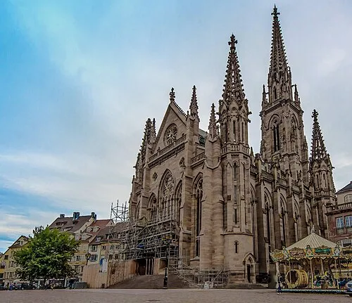
Temple Saint-Étienne Mahé Petit Garçon Curieux · CC BY-SA 3.0


Climate of Bois de Nonnenbruch
Best months for sightseeingBest months for sightseeing: May–September.
This month · November
A cold month
Day 9° · Night 2° · Rain 61 mm
- Hottest month
- July (day 25°)
- Coldest month
- January (night -1°)
- Wettest month
- May (75 mm)
- Driest month
- March (45 mm)
Bars: average monthly low and high temperature. Below: precipitation. Monthly averages for 1970–2000 at about 18 km resolution, adjusted for elevation. Highlighted months are mild and relatively dry. Source: WorldClim 2.1 (CC BY 4.0).
Show values as a table
| Month | Jan | Feb | Mar | Apr | May | Jun | Jul | Aug | Sep | Oct | Nov | Dec |
|---|---|---|---|---|---|---|---|---|---|---|---|---|
| Average high (°C) | 5° | 6° | 11° | 15° | 19° | 23° | 25° | 25° | 21° | 15° | 9° | 6° |
| Average low (°C) | -1° | -1° | 2° | 4° | 9° | 12° | 14° | 13° | 10° | 6° | 2° | 0° |
| Precipitation (mm) | 52 | 52 | 45 | 53 | 75 | 73 | 68 | 62 | 60 | 60 | 61 | 64 |
Other places to visit in this season: May June July August September
How to get to Bois de Nonnenbruch
The nearest airport is EuroAirport Basel–Mulhouse–Freiburg (BSL), 28 km to the southeast as the crow flies. The nearest large city is Mulhouse, 6 km to the southeast.
Airports
- EuroAirport Basel–Mulhouse–Freiburg (BSL) Bâle / Mulhouse 28 kmsoutheast
- Strasbourg Airport (SXB) Strasbourg 87 kmnorth
- Bern Airport (BRN) Bern 99 kmsouth
Nearby large cities
- Mulhouse Population: 111.4K 6 kmsoutheast
- Basel Population: 177.6K 34 kmsoutheast
- Freiburg im Breisgau Population: 237.5K 49 kmnortheast
- Strasbourg Population: 274.8K 95 kmnorth
- Bern Population: 121.6K 95 kmsouth
Straight-line distances; road distances are longer. Airport data: OurAirports.
Day trips from Bois de Nonnenbruch
Within 100 km: 414 historic and cultural sites, 1,361 natural sites, 397 lakes, rivers and coasts.
0–25 km139 places
- Klemmbach River 21 kmE
- Haselbach River 24 kmSE
- Ruine Gutenau Historic site 22 kmE
- Burg Istein Historic site 24 kmSE
25–60 km790 places
- Etangs Rougeat Lake 38 kmS
- Basler Weiher Lake 50 kmSE
- Pisciculture Lake 38 kmS
- Lac Tabeillon Lake 56 kmS
60–100 km1,243 places
- Kleiner Bremgartenwald Mountain 92 kmS
- Fahr Abbey Attraction 97 kmSE
- Arbeiterstrandbad Tennwil Beach 89 kmSE
- Sankt Petersinsel Island 81 kmS
Straight-line distances.
Nearest towns and villages
-
Richwiller Village, Arrondissement of Mulhouse1.5 km S
-
Richwiller Village, Richwiller1.4 km S
-
Wittelsheim Village, Arrondissement of Mulhouse3.2 km NW
-
Pfastatt Village, Arrondissement of Mulhouse3.2 km SE
-
Lutterbach Village, Arrondissement of Mulhouse3.6 km S
-
Wittenheim Village, Arrondissement of Mulhouse4.9 km E
Nearby attractions & nature
Everything nearby-
Forêt communale de Pulversheim Natural site, Pulversheim6.4 km NE
-
Forêt communale d'Ensisheim Natural site, Ensisheim7.3 km NE
-
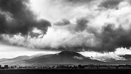 Hartmannswillerkopf Mountain, Wattwiller11 km NW
-
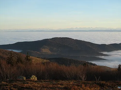 Le Molkenrain Mountain, Wattwiller13 km NW
-
Doller River, Haut-Rhin5.1 km SE
-
Parc Alfred Wallach Natural site, Grand Est8.8 km SE
-
Couvent cistercien de Schoenensteinbach Historic site, Wittenheim4.1 km NE
-
Amselkopf Mountain, Steinbach11 km W
Sources & licences
Data last updated: