- Elevation
- 147 m
- above sea level
- Local time
- UTC+01:00
- Europe/Paris · UTC+01:00
- Airports
- SXB Strasbourg Airport13 km
- FKB Karlsruhe Baden-Baden Airport36 km
About Réserve Naturelle de l'Île du Rohrschollen
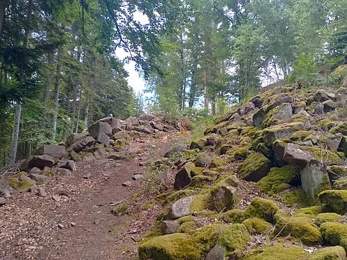
Réserve Naturelle de l'Île du Rohrschollen is a natural site. Location: Grand Est, France. The best months to visit are May–September. The nearest airport is Strasbourg Airport (13 km). Nearby sights include Unterer Wald and Schütterle.
Climate of Réserve Naturelle de l'Île du Rohrschollen
Best months for sightseeingBest months for sightseeing: May–September.
This month · November
A cold month
Day 8° · Night 3° · Rain 60 mm
- Hottest month
- July (day 25°)
- Coldest month
- January (night -1°)
- Wettest month
- June (90 mm)
- Driest month
- January (40 mm)
Bars: average monthly low and high temperature. Below: precipitation. Monthly averages for 1970–2000 at about 18 km resolution, adjusted for elevation. Highlighted months are mild and relatively dry. Source: WorldClim 2.1 (CC BY 4.0).
Show values as a table
| Month | Jan | Feb | Mar | Apr | May | Jun | Jul | Aug | Sep | Oct | Nov | Dec |
|---|---|---|---|---|---|---|---|---|---|---|---|---|
| Average high (°C) | 5° | 6° | 11° | 15° | 20° | 23° | 25° | 25° | 21° | 14° | 8° | 6° |
| Average low (°C) | -1° | 0° | 2° | 5° | 9° | 13° | 14° | 14° | 10° | 7° | 3° | 1° |
| Precipitation (mm) | 40 | 43 | 43 | 52 | 88 | 90 | 74 | 63 | 67 | 61 | 60 | 54 |
Other places to visit in this season: May June July August September
How to get to Réserve Naturelle de l'Île du Rohrschollen
The nearest airport is Strasbourg Airport (SXB), 13 km to the west as the crow flies. The nearest large city is Strasbourg, 9 km to the northwest.
Airports
- Strasbourg Airport (SXB) Strasbourg 13 kmwest
- Karlsruhe Baden-Baden Airport (FKB) Rheinmünster 36 kmnortheast
- Saarbrücken Airport (SCN) Saarbrücken 93 kmnorthwest
Nearby large cities
- Strasbourg Population: 274.8K 9 kmnorthwest
- Freiburg im Breisgau Population: 237.5K 58 kmsouth
- Karlsruhe Population: 283.8K 71 kmnortheast
- Pforzheim Population: 119.3K 78 kmnortheast
- Mulhouse Population: 111.4K 91 kmsouthwest
Straight-line distances; road distances are longer. Airport data: OurAirports.
Day trips from Réserve Naturelle de l'Île du Rohrschollen
Within 100 km: 524 historic and cultural sites, 3,098 natural sites, 634 lakes, rivers and coasts.
0–25 km142 places
- Unditz River 9 kmSE
- Rench River 23 kmNE
- Matschelsee Lake 12 kmS
- Eselskopf (I) Mountain 23 kmE
25–60 km1,224 places
- Mummelsee Lake 31 kmE
- Huzenbacher See Lake 41 kmE
- Glaswaldsee Lake 36 kmE
- Tunisee Lake 50 kmS
60–100 km2,890 places
- Hoher Randen (Südliche Höhe) Mountain 99 kmSE
- Hagen Mountain 100 kmSE
- Insel Flotzgrün Island 98 kmNE
- Titisee Lake 73 kmS
Straight-line distances.
Nearest towns and villages
-
Goldscheuer Village, Kehl1.8 km E
-
Illkirch-Graffenstaden Village, Arrondissement de Strasbourg6.3 km W
-
Altenheim Village, Neuried5.4 km S
-
Willstätt Village, Ortenaukreis6.7 km E
-
Marlen Village, Kehl2.3 km NE
-
Neuried Village, Ortenaukreis6.7 km S
Nearby attractions & nature
Everything nearby-
Unterer Wald Natural site, Baden-Wurttemberg2.7 km SE
-
Schütterle River, Baden-Wurttemberg2.2 km SE
-
Réserve Naturelle du Massif Forestier du Neuhof-Illkirch-Graffenstaden Natural site, Grand Est3 km W
-
Mühlbach River, Baden-Wurttemberg2 km S
-
Willstätter Wald Natural site, Baden-Wurttemberg4.7 km E
-
Endinger Wald Natural site, Baden-Wurttemberg5.3 km E
-
Gottswald Natural site, Baden-Wurttemberg7.3 km E
-
Tieflachgraben River, Baden-Wurttemberg4.1 km SE
More nature in France
-
Parc de l'Orangerie Natural site, Grand Est9 km N
-
Réserve Naturelle de la Forêt d'Erstein Natural site, Grand Est10 km SW
-
Fort Kléber Natural site, Wolfisheim13 km NW
-
Bischenberg Mountain, Bischoffsheim24 km W
-
Herrenwald Natural site, Bas-Rhin21 km N
-
 Purpurkopf Mountain, Rosheim33 km W
Sources & licences
Data last updated: