Arrondissement of La Rochelle
Located in Charente-Maritime, New Aquitaine Coordinates: 46°13′03″ N 1°01′48″ W
- Population
- 231,319
- 231.3K
- Elevation
- 12 m
- above sea level
- Local time
- UTC+01:00
- Europe/Paris · UTC+01:00
- Places inside
- 59
- listed under Arrondissement of La Rochelle
- Airports
- LRH La Rochelle Île de Ré Airport13 km
- PIS Poitiers-Biard Airport111 km
About Arrondissement of La Rochelle
Arrondissement of La Rochelle is a municipality. Location: Charente-Maritime, New Aquitaine. Population: 231,319. Elevation: 12 m. The best months to visit are June–September. The nearest airport is La Rochelle Île de Ré Airport (13 km). Nearby sights include Ruisseau le Curé and Phare du bout du monde.
Climate of Arrondissement of La Rochelle
Best months for sightseeingBest months for sightseeing: June–September.
This month · November
Outside the best season
Day 13° · Night 6° · Rain 91 mm
- Hottest month
- August (day 25°)
- Coldest month
- January (night 3°)
- Wettest month
- November (91 mm)
- Driest month
- July (35 mm)
Bars: average monthly low and high temperature. Below: precipitation. Monthly averages for 1970–2000 at about 18 km resolution, adjusted for elevation. Highlighted months are mild and relatively dry. Source: WorldClim 2.1 (CC BY 4.0).
Show values as a table
| Month | Jan | Feb | Mar | Apr | May | Jun | Jul | Aug | Sep | Oct | Nov | Dec |
|---|---|---|---|---|---|---|---|---|---|---|---|---|
| Average high (°C) | 9° | 10° | 13° | 15° | 19° | 22° | 25° | 25° | 23° | 18° | 13° | 10° |
| Average low (°C) | 3° | 3° | 5° | 7° | 10° | 13° | 15° | 15° | 13° | 10° | 6° | 4° |
| Precipitation (mm) | 80 | 69 | 53 | 59 | 56 | 39 | 35 | 41 | 64 | 84 | 91 | 84 |
Other places to visit in this season: June July August September
How to get to Arrondissement of La Rochelle
The nearest airport is La Rochelle Île de Ré Airport (LRH), 13 km to the west as the crow flies. For international flights: Nantes Atlantique Airport (NTE) (113 km). The nearest large city is Nantes, 118 km to the north.
Airports
- La Rochelle Île de Ré Airport (LRH) La Rochelle 13 kmwest
- Poitiers-Biard Airport (PIS) Poitiers/Biard 111 kmeast
- Nantes Atlantique Airport (NTE) Nantes 113 kmnorthwest
Nearby large cities
- Nantes Population: 325.1K 118 kmnorth
- Angers Population: 168.3K 144 kmnorth
- Bordeaux Population: 265.3K 157 kmsouth
- Limoges Population: 141.2K 181 kmeast
- Tours Population: 141.6K 186 kmnortheast
Straight-line distances; road distances are longer. Airport data: OurAirports.
Day trips from Arrondissement of La Rochelle
Within 100 km: 118 historic and cultural sites, 74 natural sites, 114 lakes, rivers and coasts.
0–25 km49 places
- Plage Nord Beach 19 kmW
- Plage Sud Beach 20 kmW
- La Plage d'Aytré Beach 13 kmSW
- Plage de l'Arénault Beach 23 kmW
25–60 km112 places
- Oléron Island 38 kmSW
- Île de Ré Island 30 kmW
- Plage des Sables Vigniers Beach 40 kmSW
- Plage du Rocher Beach 42 kmNW
60–100 km145 places
- Plage des Nonnes Beach 73 kmS
- Né River 81 kmSE
- Barzan-Plage Beach 77 kmS
- Plage des Vergnes Beach 73 kmS
Straight-line distances.
Arrondissement of La Rochelle and similar cities
Side by side with cities of similar size in the same country: population, elevation and climate.
| Measure | Arrondissement of La Rochelle | Paris 15 Vaugirard | Rennes | Lille |
|---|---|---|---|---|
| Population | 231.3K | 229.7K | 227.8K | 238.7K |
| Elevation | 12 m | 47 m | 39 m | 20 m |
| Summer day (hottest month) | 25° | 25° | 24° | 23° |
| Winter night (coldest month) | 3° | 2° | 3° | 1° |
| Annual rainfall | 755 mm | 632 mm | 738 mm | 716 mm |
| Best months | Jun–Sep | May–Sep | Jun–Sep | Jun–Aug |
| Distance | — | 385 km | 216 km | 576 km |
Climate values are 1970–2000 monthly averages; straight-line distance.
Places in Arrondissement of La Rochelle
59 places- 1 La Rochelle 75.7K
- 2 Île de Ré 18.1K
- 3 Aytré 8.7K
- 4 Périgny 8.3K
- 5 Lagord 7.1K
- 6 Puilboreau 6K
- 7 Châtelaillon-Plage 5.9K
- 8 Nieul-sur-Mer 5.8K
- 9 Dompierre-sur-Mer 5.4K
- 10 Saint-Xandre 4.7K
- 11 Marans 4.5K
- 12 Sainte-Soulle 4.4K
- 13 Angoulins 3.9K
- 14 Sainte-Marie-de-Ré 3.4K
- 15 La Jarrie 3.2K
- 16 Marsilly 3K
- 17 L'Houmeau 2.8K
- 18 Saint-Jean-de-Liversay 2.8K
- 19 La Flotte 2.8K
- 20 La Jarne 2.5K
- 21 Saint-Martin-de-Ré 2.3K
- 22 Rivedoux-Plage 2.3K
- 23 Le Bois-Plage-en-Ré 2.3K
- 24 Villedoux 2.2K
- 25 Saint-Médard-d'Aunis 2.2K
- 26 Vérines 2.2K
- 27 Andilly 2.2K
- 28 Saint-Rogatien 2.2K
- 29 Salles-sur-Mer 2.1K
- 30 Esnandes 2.1K
- 31 Charron 2K
- 32 Courçon 1.8K
- 33 Saint-Sauveur-d'Aunis 1.7K
- 34 Thairé 1.7K
- 35 Saint-Ouen-d'Aunis 1.6K
- 36 Benon 1.6K
- 37 Yves 1.5K
- 38 Saint-Christophe 1.4K
- 39 Clavette 1.4K
- 40 Ars-en-Ré 1.3K
- 41 Saint-Vivien 1.3K
- 42 Croix-Chapeau 1.2K
- 43 Bourgneuf 1.2K
- 44 La Couarde-sur-Mer 1.2K
- 45 Nuaillé-d'Aunis 1.1K
- 46 La Ronde 1.1K
- 47 Angliers 1K
- 48 Longèves 955
- 49 Le Gué-d'Alleré 910
- 50 Montroy 881
- 51 Ferrières 877
- 52 Taugon 795
- 53 Loix 715
- 54 Cram-Chaban 654
- 55 Saint-Cyr-du-Doret 637
- 56 Saint-Clément-des-Baleines 628
- 57 Les Portes-en-Ré 612
- 58 La Grève-sur-Mignon 556
- 59 La Laigne 477
Bar: population relative to the most populous place in this list.
Nearby attractions & nature
Everything nearby-
Ruisseau le Curé River, Charente-Maritime7.7 km E
-
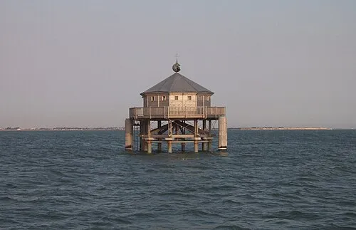 Phare du bout du monde Landmark, New Aquitaine15 km SW
-
Vendée River, Charente-Maritime13 km NE
-
Sablanceaux Natural site, Charente-Maritime19 km W
-
Forêt de Benon Natural site, Charente-Maritime20 km E
-
Bois de Benon Natural site, Charente-Maritime18 km E
-
Le Chay Natural site, New Aquitaine15 km SW
-
Sèvre-Niortaise River, New Aquitaine13 km NW
Sources & licences
Data last updated: