Fort de Royan
Located in Charente-Maritime, New Aquitaine Coordinates: 45°37′00″ N 1°02′00″ W
- Local time
- UTC+01:00
- Europe/Paris · UTC+01:00
- Elevation
- 1 m
- above sea level
- Airports
- LRH La Rochelle Île de Ré Airport64 km
- BOD Bordeaux–Mérignac Airport91 km
About Fort de Royan
Fort de Royan is a historic site. Location: Charente-Maritime, New Aquitaine. The best months to visit are May–September. The nearest airport is La Rochelle Île de Ré Airport (64 km). Nearby sights include Plage du Chay and Îles aux Mouettes.
Climate of Fort de Royan
Best months for sightseeingBest months for sightseeing: May–September.
This month · November
A wet month
Day 13° · Night 6° · Rain 102 mm
- Hottest month
- August (day 25°)
- Coldest month
- January (night 4°)
- Wettest month
- November (102 mm)
- Driest month
- July (39 mm)
Bars: average monthly low and high temperature. Below: precipitation. Monthly averages for 1970–2000 at about 18 km resolution, adjusted for elevation. Highlighted months are mild and relatively dry. Source: WorldClim 2.1 (CC BY 4.0).
Show values as a table
| Month | Jan | Feb | Mar | Apr | May | Jun | Jul | Aug | Sep | Oct | Nov | Dec |
|---|---|---|---|---|---|---|---|---|---|---|---|---|
| Average high (°C) | 10° | 11° | 14° | 16° | 19° | 22° | 25° | 25° | 23° | 18° | 13° | 11° |
| Average low (°C) | 4° | 4° | 5° | 7° | 11° | 13° | 15° | 15° | 13° | 10° | 6° | 5° |
| Precipitation (mm) | 88 | 76 | 60 | 66 | 63 | 45 | 39 | 47 | 73 | 90 | 102 | 95 |
Other places to visit in this season: May June July August September
How to get to Fort de Royan
The nearest airport is La Rochelle Île de Ré Airport (LRH), 64 km to the north as the crow flies. For international flights: Bordeaux–Mérignac Airport (BOD) (91 km). The nearest large city is Bordeaux, 93 km to the southeast.
Airports
- La Rochelle Île de Ré Airport (LRH) La Rochelle 64 kmnorth
- Bordeaux–Mérignac Airport (BOD) Bordeaux 91 kmsouth
- Poitiers-Biard Airport (PIS) Poitiers/Biard 150 kmnortheast
Nearby large cities
- Bordeaux Population: 265.3K 93 kmsoutheast
- Limoges Population: 141.2K 179 kmeast
- Nantes Population: 325.1K 182 kmnorth
- Angers Population: 168.3K 209 kmnorth
- Tours Population: 141.6K 238 kmnortheast
Straight-line distances; road distances are longer. Airport data: OurAirports.
Day trips from Fort de Royan
Within 100 km: 98 historic and cultural sites, 66 natural sites, 158 lakes, rivers and coasts.
0–25 km29 places
- Plage des Nonnes Beach 8 kmSE
- Barzan-Plage Beach 15 kmSE
- Plage des Vergnes Beach 7 kmSE
- Plage de l'Arnèche Beach 7 kmSE
25–60 km81 places
- Oléron Island 41 kmNW
- Né River 51 kmE
- La Plage d'Aytré Beach 56 kmN
- Plage des Sables Vigniers Beach 47 kmNW
60–100 km212 places
- Île de Ré Island 71 kmNW
- Plage Nord Beach 63 kmN
- Plage Sud Beach 63 kmN
- Plage de l'Arénault Beach 67 kmN
Straight-line distances.
Nearby attractions & nature
Everything nearby-
Plage du Chay Beach, Royan0.8 km NW
-
Îles aux Mouettes Island, Charente-Maritime2.1 km SE
-
Le Rivaud Ruisseau River, Charente-Maritime1.9 km NW
-
Forêt de Suzac Natural site, New Aquitaine5.7 km SE
-
Plage de Suzac Beach, Meschers-sur-Gironde6.1 km SE
-
Plage naturiste Saint-Nicolas-le-Verdon-sur-Mer Beach, Le Verdon-sur-Mer6.7 km SW
-
Phare de Cordouan Landmark, France11 km W
-
Plage de l'Arnèche Beach, Meschers-sur-Gironde6.9 km SE
Nearest towns and villages
-
Royan Village, Arrondissement of Rochefort1.4 km NE
-
Royan Town, Royan1.3 km N
-
Saint-Georges-de-Didonne Village, Arrondissement of Rochefort3 km SE
-
Vaux-sur-Mer Village, Arrondissement of Rochefort3.8 km NW
More sights in Charente-Maritime
-
Église Sainte-Radegonde Attraction, Talmont-sur-Gironde13 km SE
-
Novioregum Historic site, Barzan15 km SE
-
Phare de la Coubre Landmark, La Tremblade18 km NW
-
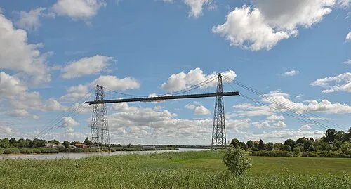 Rochefort-Martrou Transporter Bridge Landmark, Rochefort34 km N
-
Pigeonnier et vestiges de l'abbaye de Montierneuf Historic site, Saint-Agnant30 km N
-
Fort de Lupin Historic site, Saint-Nazaire-sur-Charente38 km N
Sources & licences
Data last updated: