- Population
- 73,936
- 73.9K
- Elevation
- 43 m
- above sea level
- Local time
- UTC+01:00
- Europe/Paris · UTC+01:00
- Places inside
- 123
- listed under Arrondissement of Bayeux
- Airports
- CFR Caen Carpiquet airport27 km
- DOL Deauville Normandie airport70 km
About Arrondissement of Bayeux
Arrondissement of Bayeux is a municipality. Location: Calvados, Normandy. Population: 73,936. Elevation: 43 m. The best months to visit are June–September. The nearest airport is Caen Carpiquet airport (27 km). Nearby sights include Siette and Drôme.
Climate of Arrondissement of Bayeux
Best months for sightseeingBest months for sightseeing: June–September.
This month · November
A cold month
Day 12° · Night 5° · Rain 89 mm
- Hottest month
- August (day 22°)
- Coldest month
- February (night 3°)
- Wettest month
- November (89 mm)
- Driest month
- August (45 mm)
Bars: average monthly low and high temperature. Below: precipitation. Monthly averages for 1970–2000 at about 18 km resolution, adjusted for elevation. Highlighted months are mild and relatively dry. Source: WorldClim 2.1 (CC BY 4.0).
Show values as a table
| Month | Jan | Feb | Mar | Apr | May | Jun | Jul | Aug | Sep | Oct | Nov | Dec |
|---|---|---|---|---|---|---|---|---|---|---|---|---|
| Average high (°C) | 8° | 9° | 11° | 13° | 17° | 19° | 22° | 22° | 20° | 16° | 12° | 9° |
| Average low (°C) | 3° | 3° | 4° | 5° | 8° | 11° | 13° | 13° | 11° | 9° | 5° | 4° |
| Precipitation (mm) | 81 | 65 | 62 | 53 | 60 | 50 | 46 | 45 | 69 | 83 | 89 | 88 |
Other places to visit in this season: June July August September
How to get to Arrondissement of Bayeux
The nearest airport is Caen Carpiquet airport (CFR), 27 km to the east as the crow flies. The nearest large city is Caen, 33 km to the east.
Airports
- Caen Carpiquet airport (CFR) Caen 27 kmeast
- Deauville Normandie airport (DOL) Deauville 70 kmeast
- Jersey Airport (JER) St. Peter 102 kmwest
Nearby large cities
- Caen Population: 110.6K 33 kmeast
- Le Havre Population: 186K 71 kmeast
- Rouen Population: 116.3K 139 kmeast
- Rennes Population: 227.8K 144 kmsouthwest
- Le Mans Population: 144.5K 159 kmsoutheast
Straight-line distances; road distances are longer. Airport data: OurAirports.
Day trips from Arrondissement of Bayeux
Within 100 km: 169 historic and cultural sites, 82 natural sites, 124 lakes, rivers and coasts.
0–25 km40 places
- Gold Beach Beach 21 kmE
- Omaha Beach Beach 12 kmNW
- Bois du Molay Natural site 9 kmW
- Forêt de Cerisy Natural site 12 kmSW
25–60 km152 places
- Juno Beach Beach 28 kmE
- Sword Beach Beach 34 kmE
- Utah Beach Beach 32 kmNW
- Plage de Riva Bella Beach 40 kmE
60–100 km183 places
- Ollonde River 65 kmW
- Plage Collignon Beach 71 kmNW
- Plage Napoléon Beach 73 kmNW
- Plage de Collignon Beach 70 kmNW
Straight-line distances.
Arrondissement of Bayeux and similar cities
Side by side with cities of similar size in the same country: population, elevation and climate.
| Measure | Arrondissement of Bayeux | La Rochelle | Bourges | Pau |
|---|---|---|---|---|
| Population | 73.9K | 76.8K | 68K | 82.7K |
| Elevation | 43 m | 13 m | 144 m | 219 m |
| Summer day (hottest month) | 22° | 25° | 26° | 25° |
| Winter night (coldest month) | 3° | 3° | 1° | 4° |
| Annual rainfall | 791 mm | 769 mm | 717 mm | 1,304 mm |
| Best months | Jun–Sep | Jun–Sep | Jun–Sep | Jun–Sep |
| Distance | — | 346 km | 340 km | 663 km |
Climate values are 1970–2000 monthly averages; straight-line distance.
Places in Arrondissement of Bayeux
123 places- 1 Bayeux 13.5K
- 2 Isigny-sur-Mer 3.7K
- 3 Le Molay-Littry 3K
- 4 Saint-Vigor-le-Grand 2.4K
- 5 Creully sur Seulles 2.3K
- 6 Port-en-Bessin-Huppain 1.9K
- 7 Tilly-sur-Seulles 1.7K
- 8 Ver-sur-Mer 1.6K
- 9 Grandcamp-Maisy 1.6K
- 10 Balleroy-sur-Drôme 1.4K
- 11 Fontenay-le-Pesnel 1.2K
- 12 Ponts sur Seulles 1.2K
- 13 Moulins-en-Bessin 1.2K
- 14 Audrieu 1K
- 15 Sommervieu 1K
- 16 Trévières 926
- 17 Saint-Paul-du-Vernay 811
- 18 Banville 776
- 19 Le Tronquay 773
- 20 Sainte-Marguerite-d'Elle 769
- 21 Aure sur Mer 743
- 22 Formigny La Bataille 726
- 23 Saint-Martin-des-Entrées 698
- 24 Subles 675
- 25 Juaye-Mondaye 668
- 26 Graye-sur-Mer 656
- 27 Tour-en-Bessin 653
- 28 Longues-sur-Mer 610
- 29 Asnelles 602
- 30 La Cambe 569
- 31 Monceaux-en-Bessin 558
- 32 Osmanville 540
- 33 Crouay 538
- 34 Ryes 511
- 35 Arromanches-les-Bains 503
- 36 Nonant 495
- 37 Saint-Loup-Hors 481
- 38 Hottot-les-Bagues 477
- 39 Fontaine-Henry 469
- 40 Lingèvres 466
- 41 Ellon 463
- 42 Lison 448
- 43 Bény-sur-Mer 445
- 44 Cormolain 415
- 45 Le Breuil-en-Bessin 412
- 46 Vaucelles 401
- 47 Commes 400
- 48 Noron-la-Poterie 395
- 49 Maisons 390
- 50 Bucéels 385
- 51 Blay 384
- 52 Mosles 359
- 53 Vaux-sur-Aure 350
- 54 Castillon 342
- 55 Étréham 342
- 56 Tracy-sur-Mer 338
- 57 Mandeville-en-Bessin 336
- 58 Vendes 313
- 59 Vaux-sur-Seulles 302
- 60 Cartigny-l'Épinay 301
Bar: population relative to the most populous place in this list.
Nearby attractions & nature
Everything nearby-
Siette River, Calvados4.9 km W
-
Drôme River, Calvados6.8 km NE
-
Bois du Molay Natural site, Calvados8.8 km W
-
Forêt de Cerisy Natural site, Calvados12 km SW
-
Tortonne River, Calvados11 km NW
-
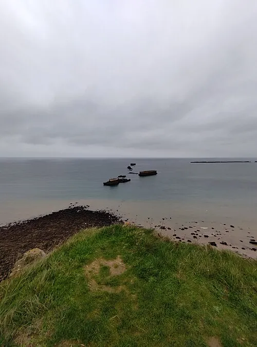 Cap Manvieux Natural site, Normandy14 km NE
-
Esque River, Calvados15 km W
-
Abbaye Saint-Vigor de Cerisy Historic site, Cerisy-la-Forêt12 km SW
Sources & licences
Data last updated: